Routes
The Washington, D.C. area is an underrated running gem, offering an exceptional mix of urban routes, historic landmarks, and expansive trails that span D.C., Maryland, and Virginia. Within the city, Rock Creek Park provides a vast, wooded escape with miles of paved and dirt trails winding through forests, creeks, and quiet parkways, perfect for long, shaded runs. The National Mall offers a uniquely scenic experience, where runners can cruise past monuments, museums, and the Capitol on flat, open paths that showcase the city’s grandeur. Across the border in Maryland, the Capital Crescent Trail (CCT) connects Georgetown to Bethesda with a smooth, shaded route, while the C&O Canal Towpath offers endless gravel miles along the Potomac. On the Virginia side, the Mount Vernon Trail parallels the river from Roslyn to George Washington’s Mount Vernon, offering stunning skyline and water views, while the W&OD Trail stretches over 45 miles through Northern Virginia’s suburbs. Woven into the region’s dense urban fabric and transit network, these routes make running in the D.C. area both accessible and endlessly varied, combining convenience with natural beauty and history at every turn.

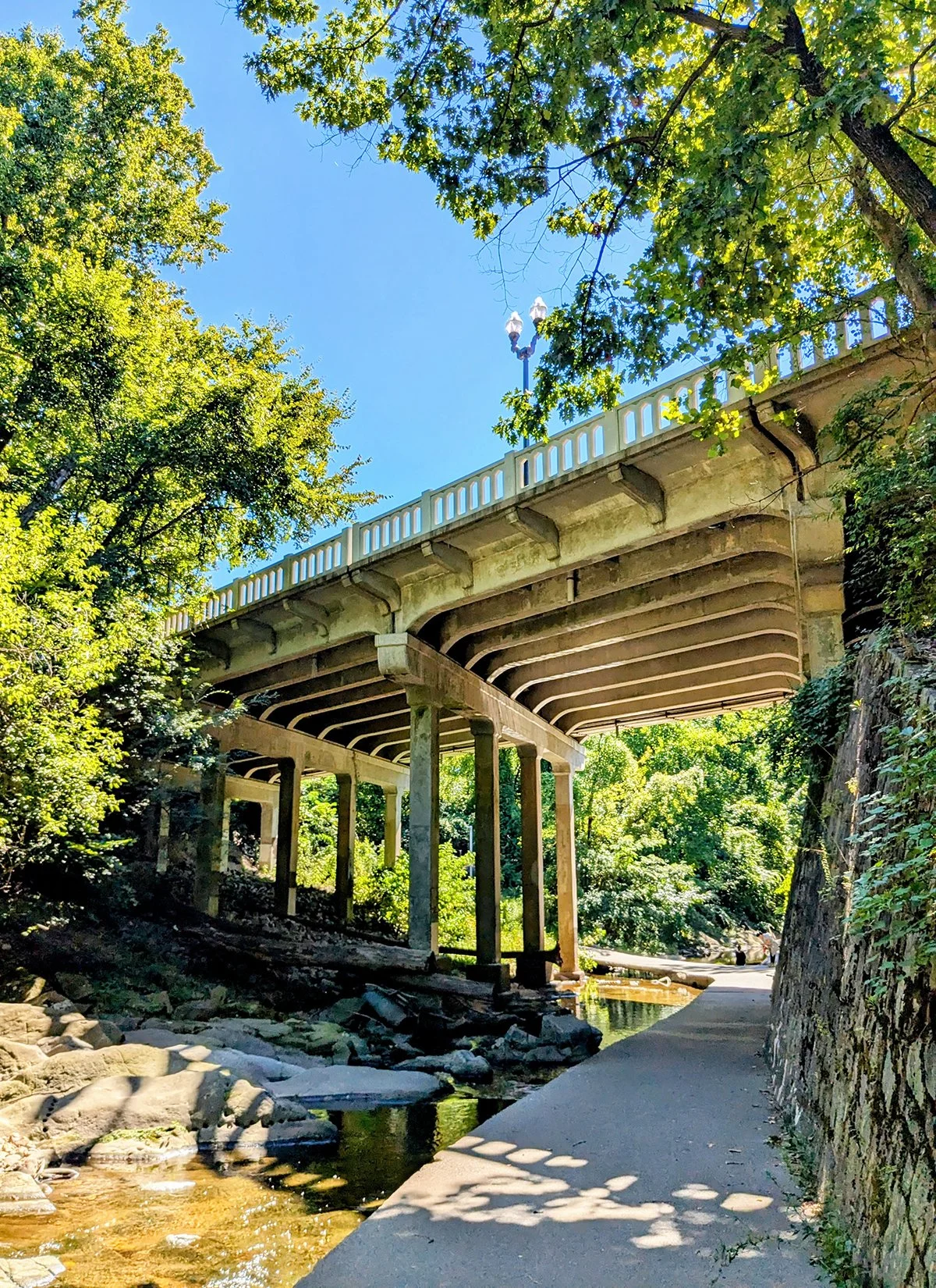
1. Rock Creek Park & Trail
Rock Creek Park is one of D.C.’s largest and most beloved urban green spaces—a natural oasis in the heart of the city. The park stretches from the Potomac River all the way north into Maryland, offering a mix of wooded trails, paved paths, and historic sites. A key component of the park is the Rock Creek Trail, a popular multi-use path that winds through the park with many access points along the way.
• Start: under Whitehurst Fwy in Georgetown
• Course: up to 22.7 miles (750 ft+) north to Lake Needwood / Rock Creak Regional Park
This route begins at the trailhead beneath Whitehurst Freeway and K Street, which marks Mile 0 of the Capital Crescent Trail (Route 7) and sits just a mile north from the National Mall (Route 3). From here, the Rock Creek Trail winds more than 20 miles north through lush, wooded terrain. The first four miles—up to Peirce Mill—follow paved paths alongside Rock Creek, with easy access to a few other trails like the Dumbarton Oaks Trail, Piney Branch Trail, and Klingle Valley Trail.
North of Peirce Mill, the trail merges with Beach Drive, where the next four miles—just before reaching the Maryland border—are largely closed to vehicle traffic. This stretch transforms into a wide, shared roadway for pedestrians, runners, and cyclists, and is considered the most popular section of Rock Creek Park for outdoor recreation. Within this area, a network of dirt trails offers a quieter, more secluded alternative to the wide and often crowded Beach Drive.
Farther north, the Rock Creek Trail returns to a dedicated paved path and continues roughly parallel to Beach Drive for several additional miles as it winds into Maryland.
Cafes / Many of D.C.’s most vibrant neighborhoods—Dupont Circle, Adams Morgan, and Woodley Park—are just a short walk from Rock Creek Park and Trail, offering a wealth of cafes and restaurants for trail users to enjoy.
Transit / Woodley Park-Zoo/Adams Morgan on the Red Line is the closest Metro Station to Rock Creek Park and Trail. A few other stations are also within walking / running distance.


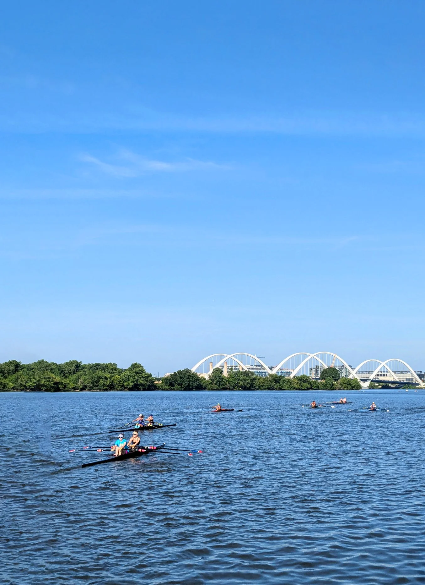
2. Hains Point
Hains Point is a scenic island (not a peninsula!) located at the southern tip of East Potomac Park in Washington, D.C. Surrounded by the Potomac River and the Washington Channel, it is a popular destination for runners, cyclists, and walkers thanks to its flat, open roads and waterfront views.
• Start & Finish: Ohio Dr at East Basin Drive
• Course: 4.1 miles, flat, mostly car-free road, minimal traffic
Ohio Drive follows the waterfront of Hains Point, linking it to West Potomac Park and The National Mall (detour in effect currently on Ohio Drive through West Potomac Park). The 4.1-mile loop encircles the island, primarily following Ohio Drive before turning onto East Basin Drive. While the island has generally low vehicle traffic, cars on the road aren't uncommon in the northern section. The lighter traffic in the southern section makes the shorter 3.2-mile loop via Buckeye Drive a popular alternative. Both loops are perfect for long runs, tempo workouts, and cycling laps, offering minimal interruptions, much less tourists than the Mall, and scenic river views.
The Jefferson Memorial stands along the northern waterfront of Hains Point, with a scenic view of the Tidal Basin. Each spring, the area transforms into a top tourist destination as thousands of cherry blossom trees burst into full bloom, attracting visitors from near and far. Hains Point is also a key part of the iconic Cherry Blossom 10 Miler.
From Hains Point, the National Mall (Route 3) is just a few blocks north, while the Rock Creek Trail (Route 1) is easily accessible by following Ohio Drive northwest. The Mount Vernon Trail (Route 11) also lies just across the Potomac River.
Cafes / Hains Point itself has very few businesses, including cafes, so visitors looking for dining options may need to head toward the National Mall, or nearby neighborhoods like the Wharf and Maine Avenue for more choices.
Transit / The closest station to this route is Smithsonian Station on the National Mall.

3. National Mall
• Start & Finish: Anywhere along the loop
• Course: 5.2 miles, 138+ ft gain, multi-use path, many street crossings
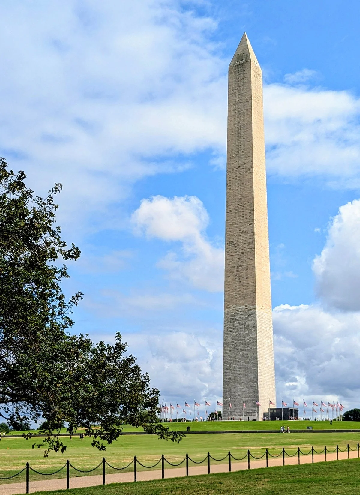
The National Mall is the heart of Washington, D.C., and one of the most iconic landmarks in the country. Spanning from the Lincoln Memorial to the U.S. Capitol, the Mall features wide, scenic walking paths that stretch its entire length , offering a stunning backdrop of historic monuments, and museums.
- Lincoln Memorial: the grand monument stands at the western end of the mall
- Washington Monument: the towering obelisk at the Mall’s center honors the first U.S. president- Thomas Jefferson Memorial: the stunning neoclassical structure is on the Tidal Basin south of the Washington Monument.
- The White House: located north of the Washington Monument
- US Capitol: located at the eastern end, this is the home of the U.S. Congress.
The eastern side of the Mall is lined with a collection of prestigious museums, including
- Smithsonian Museums: Natural History , Air and Space, American History, American Indian, National Gallery of Art, African Art, Asian Art
- Hirshhorn Museum and Sculpture Garden
The National Mall is well connected to many of D.C.’s major running routes, making it a central hub for runners: to the west, behind the Lincoln Memorial is Rock Creek Trail, which leads north to Rock Creek Park (Route 1) and connects to the Capital Crescent Trail (Route 7). South of the Mall is Hains Point (Route 2), a scenic island loop perfect for running and cycling; to the east, Metropolitan Branch Trail (Route 4), Anacostia River Trail (Route 5), Lincoln Park are all a mile or so away.
Cafes / The Mall is surrounded by institutions and museums, so finding quality cafés beyond the typical fast food spots requires a short walk. DUA DC Coffee (P17) and Nino's Bakery (P18) are my top picks for coffee and pastries in the city.
Transit / The Mall is well-served by WMATA Metro. The closest station to this route is Smithsonian Station with major transit hubs like L’Enfant Plaza, Metro Center, and Gallery Place also within walking distance.

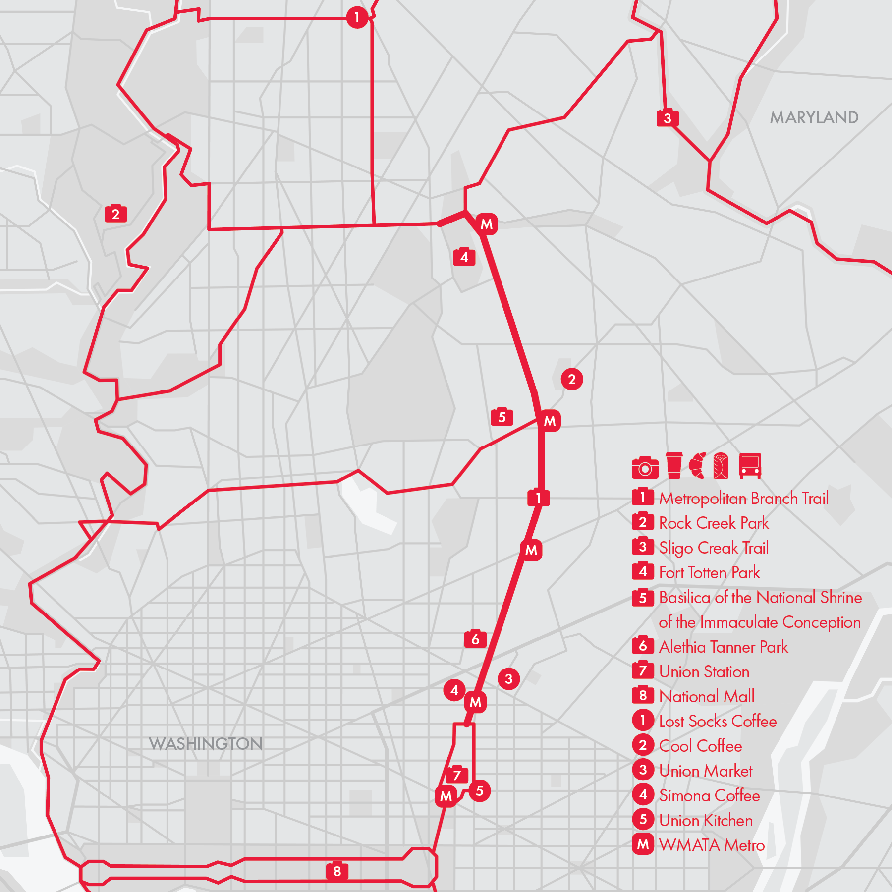
4. Metropolitan Branch Trail

The Metropolitan Branch Trail (MBT) is a partially completed multi-use path that will span 8 miles, connecting Union Station in Washington, DC to Silver Spring, MD. Currently, the 4-mile section between Union Station and Fort Totten is complete, with the remainder still under construction. The trail runs parallel to WMATA’s Red Line, which follows the historic Baltimore and Ohio Railroad (B&O) Metropolitan Branch—the origin of the trail’s name.
• Start & Finish: NoMa, Fort Totten
• Course: 3.9 miles, 234+ ft gain, paved, multi-use path
Though relatively short, MBT serves as a vital commuter and recreational route, currently connecting five WMATA Red Line stations.
- The trail begins at Union Station, though its markings are loose on the sidewalk. Union Station, a Beaux-Arts architectural masterpiece, is both a historic landmark and a bustling multimodal transit hub.
- The MBT becomes a clearly defined multi-use path in NoMa, one station north. NoMa is a rapidly growing neighborhood known for modern development and a vibrant urban scene.
- Continuing north, the next station is Rhode Island Ave, where District Collective Running hosts Saturday morning long runs at Bryant St Market.
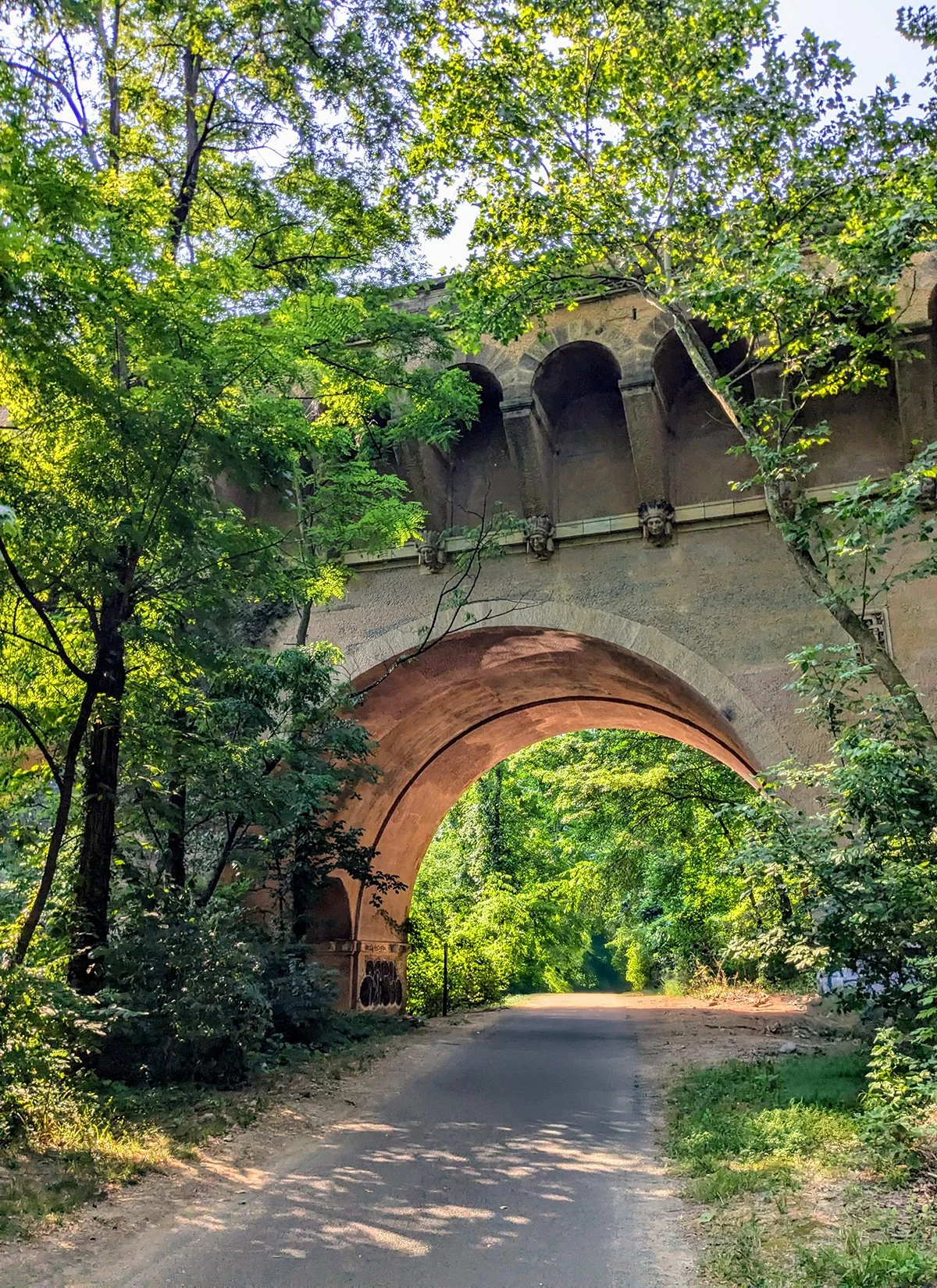
- Further along, the trail reaches Brookland, home to The Catholic University of America and the Basilica of the National Shrine of the Immaculate Conception (P12), the largest Catholic church in North America.
- The MBT currently ends at Fort Totten, a transit station adjacent to the expansive Fort Totten Park. To continue north, the current detour route follows Gallatin St NW and 3rd St NW to Takoma.
For longer runs, the MBT connects to other major trails in D.C., including Rock Creek Trail, the National Mall, and the Sligo Trail (Routes 1, 3, and 9).
Cafe / Cafes are scattered throughout the neighborhoods along the MBT, with Union Market in NoMa standing out as a popular dining and shopping destination.
Transit / MBT is fully served by WMATA Metro Red Line.
5. Anacostia River Trail
The Anacostia River Trail is a scenic multi-use path that runs along the Anacostia River, in the eastern side of Washington D.C. and extends north into Maryland.
• Start & Finish: Frederick Douglass Memorial Bridge to Hyattsville
• Course: 10 miles, 189+ ft gain, mostly paved multi-use path
Between Frederick Douglass Memorial Bridge and Benning Road, the trail runs along both sides of the Anacostia River. On the east side (P3-4), it passes through Anacostia Park and it's easy to follow; On the west side, the trail weaves through a more urban environment with a few turns to navigate, but it also features several attractions worth exploring along the way.
- Nationals Park: home to the Washington Nationals, D.C.'s Major League Baseball team.
- The Yards: a vibrant waterfront neighborhood known for its mix of parks, dining, shopping, and entertainment.
- RFK Stadium: the now defunct stadium was home to many D.C. sports teams, and the area around it is still used as a public recreational space.
- Kingman Island: a man-made island in the river, serving as a natural retreat within the city with hiking trails.
Beyond Benning Rd, the trail follows the east side of the Anacostia River, winding through peaceful green spaces and wooded areas and passes Kenilworth Aquatic Gardens and Bladensburg Waterfront Park. The route concludes in Hyattsville, where it splits into two, following the two branches of the river (see Routes 9 and 10).
The Anacostia River Trail is a key running route in southeast D.C. often part of a loop that's connected with National Mall or Lincoln Park.
Cafe / While there are no cafés directly along the trail, Southeast D.C. offers plenty of dining options, particularly around The Yards, Eastern Market, and along 7th and 8th Street SE.
Transit / WMATA's Metro has several stations near the trail, particularly in Southeast D.C. and Minnesota Ave Station. Further north, public transit access is limited until the trail reaches its endpoint in Bladensburg/Hyattsville.

6. Westside Trails

The west side of Washington, D.C., is home to several scenic and tranquil trails, many of which meander through wooded ravines adorned with lush greenery, ample shade, and the soothing sounds of nature.
The longest and most popular trail in the area is the Glover Archbold Trail, which can be easily connected to several other trails in the area (see below), though it does not link directly to the Capital Crescent Trail.
• Start & Finish: Foxhall Road to Van Ness Street
• Course: 3 miles, 400+ ft gain, dirt surface
Another notable north-south trail in the area is the Battery Kemble Trail:
• Start & Finish: MacArthur Boulevard to Nebraska Avenue
• Course: 1 mile, 230+ ft gain, dirt surface
Two east-west trails connect the Glover Archbold and Battery Kemble Trails:
Palisades Valley Trail:
• Start & Finish: Foxhall Road to Arizona Avenue
• Course: 2.2 miles, 90+ ft gain, dirt surface, often unshaded
Wesley Heights Trail:
• Start & Finish: Glover Archbold Trail to Battery Kemble Trail
• Course: 0.75 miles, 140+ ft gain, dirt surface
Additionally, the Whitehaven Trail connects the Glover Archbold Trail to Wisconsin Avenue and further links to the Rock Creek Trail via Dumbarton Oaks Park:
• Start & Finish: Rock Creek Trail west to Glover Archbold Trail
• Course: 2 miles, 290+ ft gain, dirt surface
Lastly, Piney Branch Parkway and Klingle Valley Trail are popular paved paths that together create a runner-friendly east-west connection across Rock Creek Park:
• Start & Finish: Arkansas Ave to Klinger Rd
• Course: 1.8 miles, 230+ ft gain, paved surface
Cafe / Check out Georgetown, Tenleytown, and along Wisconsin Avenue and Connecticut Avenue. These areas are dotted with cozy spots perfect for a coffee break or a light bite while exploring the neighborhood.
Transit / WMATA's Red Line can be a convenient option for accessing some trails, particularly the Glover Archbold Trail and the shorter trails near Rock Creek Park. For other areas, bus services provide helpful connections, allowing runners to travel from a trailhead to one of the metro stations.

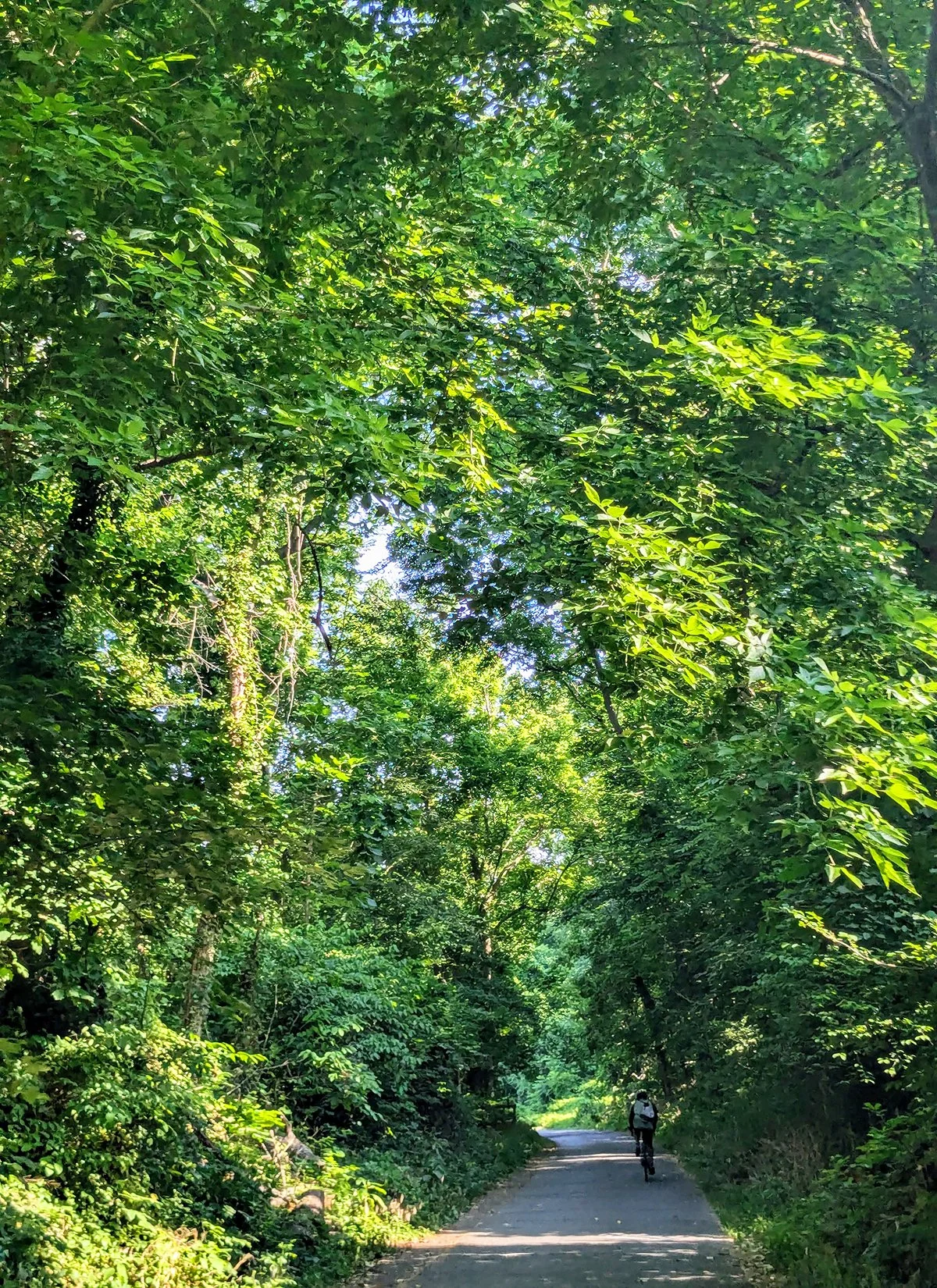
7. Capital Crescent Trail and Chesapeake & Ohio Canal Towpath
Capital Crescent Trail
• Start: Rock Creek and Potomac Pkwy
• Finish: Bethesda Ave
• Course: 7.75 miles, 331 ft+, mostly paved, multi-use path
The Capital Crescent Trail (CCT) is a beloved multi-use trail that stretches from Georgetown to Bethesda. Spanning about 8 miles, the trail is primarily paved. The unpaved Georgetown Branch Trail section beyond Bethesda, which previously extended to Silver Spring, is currently closed due to the ongoing Purple Line construction.
The trail begins near the Rock Creek Trail and runs alongside the Whitehurst Fwy, offering great views of the Georgetown Waterfront Park and the Rosslyn skyline (P3-4). Once past Francis Scott Key Bridge, the trail transitions into a quieter, more serene environment, with lush tree-lined sections that continue almost uninterrupted to Bethesda (P6-11), with a gradual incline. There is only one at-grade street crossing just before reaching the trail's end in Bethesda. It is one of the most popular routes for runners and cyclists in the region.
Chesapeake & Ohio Canal Towpath
• Start: Rock Creek Trail and C&O Canal
• End: Canal Lock 5
• Course: 4.65 miles, 38 ft+, crushed stone
The Chesapeake & Ohio Canal Towpath (C&O) is a scenic trail that traces the historic C&O Canal (P12-15), extending well beyond DC into Maryland, Pennsylvania, and Ohio. While primarily a cycling route, the sections in and around DC are also favored by runners due to their soft surface and proximity to urban amenities. The CCT and C&O run parallel for the first few miles, with several access points connecting the two between Rock Creek Trail and C&O Canal Lock 5.
Cafe / There are no food stops along the CCT, aside from a McDonald's, but both Georgetown and Bethesda are filled with fantastic cafes and restaurants.
Transit / Bethesda is served by WMATA's Red Line, offering direct metro access to Downtown DC. While Georgetown isn't served by rail, it is well-connected to Central DC via several bus routes.
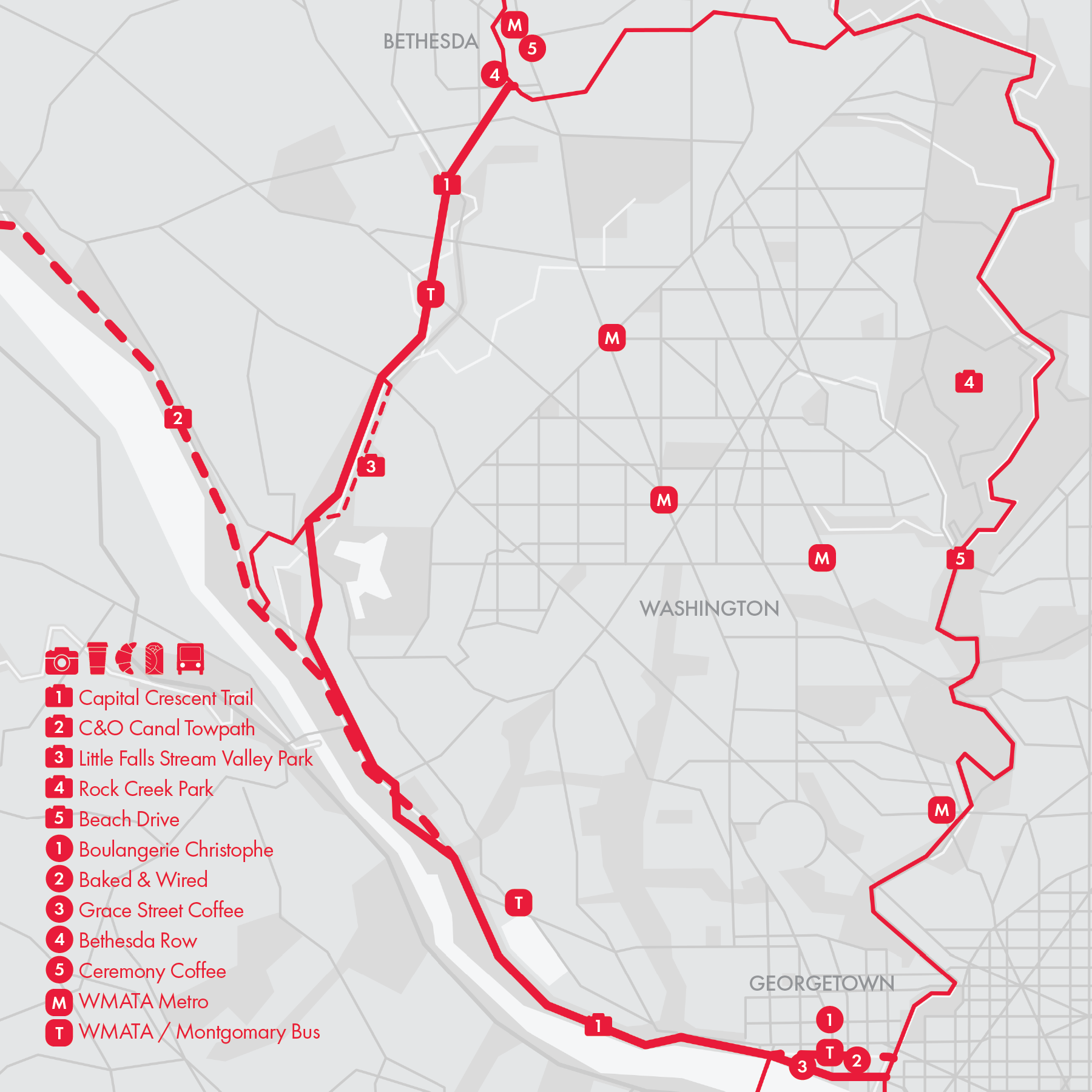
8. Bethesda

Bethesda is a thriving urban community in Montgomery County, Maryland, located just northwest of Washington, D.C. Known for its upscale neighborhoods, vibrant downtown, and proximity to the nation’s capital, Bethesda is a hub of culture, commerce, and outdoor recreation.
Bethesda serves as the northern endpoint of the Capital Crescent Trail (Route 7), a beloved multi-use path that connects the community to Georgetown in Washington, D.C., to the south. To the north, the most notable running route is the Bethesda Trolley Trail, a rail-to-trail path that winds through a mix of urban and suburban landscapes, culminating in North Bethesda near shopping malls and a Metro station. These trails make Bethesda a hub for outdoor enthusiasts and commuters alike.
Bethesda Trolley Trail
• Start: Battery Lane Urban Park near Downtown Bethesda
• Finish: North Bethesda Whole Foods
• Course: 4.3 miles, 297 ft+, paved multi-use path, some street crossings
In addition to the Bethesda Trolley Trail, Old Georgetown Road and section of Rockville Pike near the Medical Center are also popular streets for running. Further more, Bethesda isn't far from the scenic Rock Creek Trail, and several popular connecting streets in the area provide access to this winding, nature-filled path.
Cafe / Downtown Bethesda boasts an abundance of café and dining options, with two vibrant shopping areas located near the start of the Bethesda Trolley Trail. Coffee enthusiasts can enjoy standout spots like Ceremony Coffee and Grace Street Coffee. Meanwhile, North Bethesda features its own shopping area near the end of the Bethesda Trolley Trail.
Transit / This area is well served by public transit. The Metro Red Line directly connects Bethesda (and North Bethesda) to Washington, D.C.

9. Sligo Creek Trail

• Start: Northwest Branch Trail and Rhode Island Ave
• Finish: Wheaton Regional Park
• Course: 12 miles, 532 ft+, paved, multi-use path, some street crossings
This route is located in Montgomery County, Maryland, just north of Washington, D.C. It begins at the intersection of the Northwest Branch Trail and Rhode Island Avenue, initially following the Anacostia River's Northwest Branch and its accompanying trail to the northwest).
At mile 2, the Northwest Branch splits into two, and the trail diverges as well. One branch remains the Northwest Branch, continuing for several more miles toward the Northwest Branch Stream Valley Park. However, this route follows the newly formed Sligo Creek and its accompanying Sligo Creek Trail from the split. Sligo Creek is the branch that stays closer to Washington, D.C.
Between miles 2 and 4, the Sligo Creek Trail is a narrow multi-use path that winds through a mix of natural landscapes and residential areas, offering a peaceful and shaded route. After mile 4 (at the intersection of New Hampshire Avenue), the trail runs closely alongside Sligo Creek Parkway, large sections of which become car-free on weekends. Runners can choose to stay on the narrow trail or switch to the wider parkway, which is shared with cyclists, providing flexibility and a more open running experience.
In addition to connecting seamlessly with the Anacostia River Trail to the south, the Sligo Creek Trail also links to other regional trails and parks, such as the Metropolitan Branch Trail and Rock Creek Park, although these connections typically take 1 to 2 miles.
Cafe / This route primarily winds through green spaces, so for food options, explore nearby town centers and shopping malls.
Transit / The Sligo Creek Trail is located about a mile from several WMATA Metro Red Line stations, including Fort Totten, Takoma, and Silver Spring. Additionally, bus services are available at major intersections along the trail.

10. College Park

College Park is a vibrant city in Maryland, located just northeast of Washington, D.C., with excellent connectivity to the capital through scenic running trails and efficient public transit. Running routes in and around College Park are centered on the Anacostia River Tributary System, where each river branch is lined with multi-use paths. These trails provide runners with a variety of picturesque and accessible routes to explore.
• Start: Anacostia River Trail Trailhead at the confluence of the Northeast and Northwest Branches
• Finish: Paint Branch Trailhead at Cherry Hill Rd
• Course: 7.2 miles, 111 ft+, paved, multi-use path, some street crossings
This route begins by following the Northeast Branch Trail, winding through expansive open fields until it reaches the scenic Lake Artemesia Natural Area, where the river splits. At this point, Indian Creek and its accompanying trail continue northeast, while the Paint Branch veers slightly westward, heading toward the University of Maryland (UMD) campus. The route follows the Paint Branch, meandering through lush green spaces like the Paint Branch Stream Valley Park and the serene Paint Branch Golf Complex.
Running somewhat parallel to this route is the Rhode Island Ave Trolley Trail, a multi-use path that passes through a mix of urban and natural landscapes, including residential neighborhoods, wooded areas, and small parks.
Also nearby is Greenbelt Park, a serene 1,100-acre park known for its lush forests, open meadows, and diverse plant and animal life. It is particularly popular among cyclists.
Cafe / There are plenty of café options both on and near the University of Maryland (UMD) campus, as well as along Baltimore Avenue, the main artery connecting College Park to D.C.
Transit / The WMATA Metro and MARC Commuter Rail College Park Station is conveniently located near the UMD campus and this route. These rail services and WMATA buses serve additional stations close by this route.

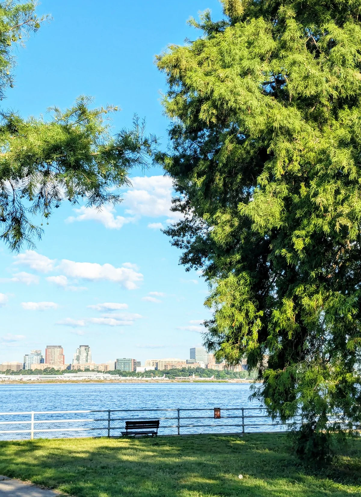
11. Mount Vernon Trail

Spanning approximately 18 miles along the Potomac River, the Mount Vernon Trail (MVT) is one of the most beloved multi-use trails in the DC area. MVT is part of the 16-mile "Arlington Loop", which is made up of segments from the Mount Vernon, Custis, W&OD, and Four Mile Run trails (Routes 11-14).
• Start: South end of Francis Scott Key Bridge
• Finish: George Washington's Mount Vernon
• Course: 18 miles, 574 ft+, paved, multi-use path, some street crossings
Heading south from Rosslyn along the Potomac River, MVT treats runners to stunning views of the D.C. skyline. The trail winds through Lady Bird Johnson Park (Mile 2), where additional paths provide access to running routes around Arlington Cemetery or Crystal City. As you continue, you’ll reach Gravelly Point (near Mile 3), a popular spot for plane spotting just north of Reagan Airport.
Further south, the trail passes the Four Mile Run Trail trailhead (Mile 5) and enters Old Town Alexandria (Mile 8). Here, you’ll encounter charming cobblestone streets and colonial architecture. Runners are briefly directed onto city streets (Union Street) before rejoining the trail.
After passing under the I-495 (Mile 9), the second half of the trail becomes quieter and more serene. This section meanders through wooded areas and open spaces, and runs parallel to the George Washington Memorial Parkway, leading all the way to the Mount Vernon Estate, the historic home of George Washington.
Cafe / The northern half of the MVT has a more urban vibe, with easy access to cafes and amenities in nearby shopping centers located in Rosslyn, Crystal City, Potomac Yard, and Old Town Alexandria. However, once you pass the I-495 overpass, the trail becomes more secluded.
Transit / MVT is accessible via several Metro stations located nearby, including Rosslyn, Crystal City, Potomac Yard, and King St-Old Town (Alexandria). Beyond Alexandria, WMATA Bus Route 11 runs along the George Washington Memorial Parkway. There are more bus options at the Mount Vernon Estate, at the end of this route.


12. Custis Trail

The Custis Trail is a popular multi-use trail located in Arlington, VA. It runs approximately 4.4 miles from Rosslyn to the Washington & Old Dominion Railroad Trail (W&OD Trail). The trail takes its name from the Custis family, influential landowners in the region during the 18th and 19th centuries. Custis Trail is part of the 16-mile "Arlington Loop", which is made up of segments from the Mount Vernon, Custis, W&OD, and Four Mile Run trails (Routes 11-14).
• Start: South end of Francis Scott Key Bridge
• Finish: Washington and Old Dominion Trail
• Course: 4.4 miles, 398 ft+, paved, multi-use path, some street crossings
The trail largely parallels Interstate 66, offering a blend of urban and natural landscapes for cyclists, runners, and walkers. It features a series of gentle rolling hills, with a gradual incline as it moves westward. Along the way, you’ll encounter amenities such as benches, water fountains, and rest areas. Multiple access points and parking areas are available, making it convenient for both commuters and recreational users, who frequent the trail regularly.
Near the western end of the Custis Trail, just beyond Ballston, the Bluemont Junction Trail acts as an alternative link, connecting the W&OD Trail to the Custis Trail as it winds through Arlington's Bluemont neighborhood.
Cafe / Running somewhat parallel to the Custis Trail is Arlington's primary business corridor, stretching between Rosslyn and Ballston, both of which feature significant commercial districts. Along this corridor, you’ll find an array of excellent cafes, such as Simona Cafe and Northside Social, adding to the vibrant atmosphere of the area.
Transit / The Rosslyn-Ballston corridor is well-served by five WMATA Metro stations, all accessible via the Orange and Silver Lines. Additionally, several WMATA and Arlington Transit bus routes operate in this area, providing convenient connections.

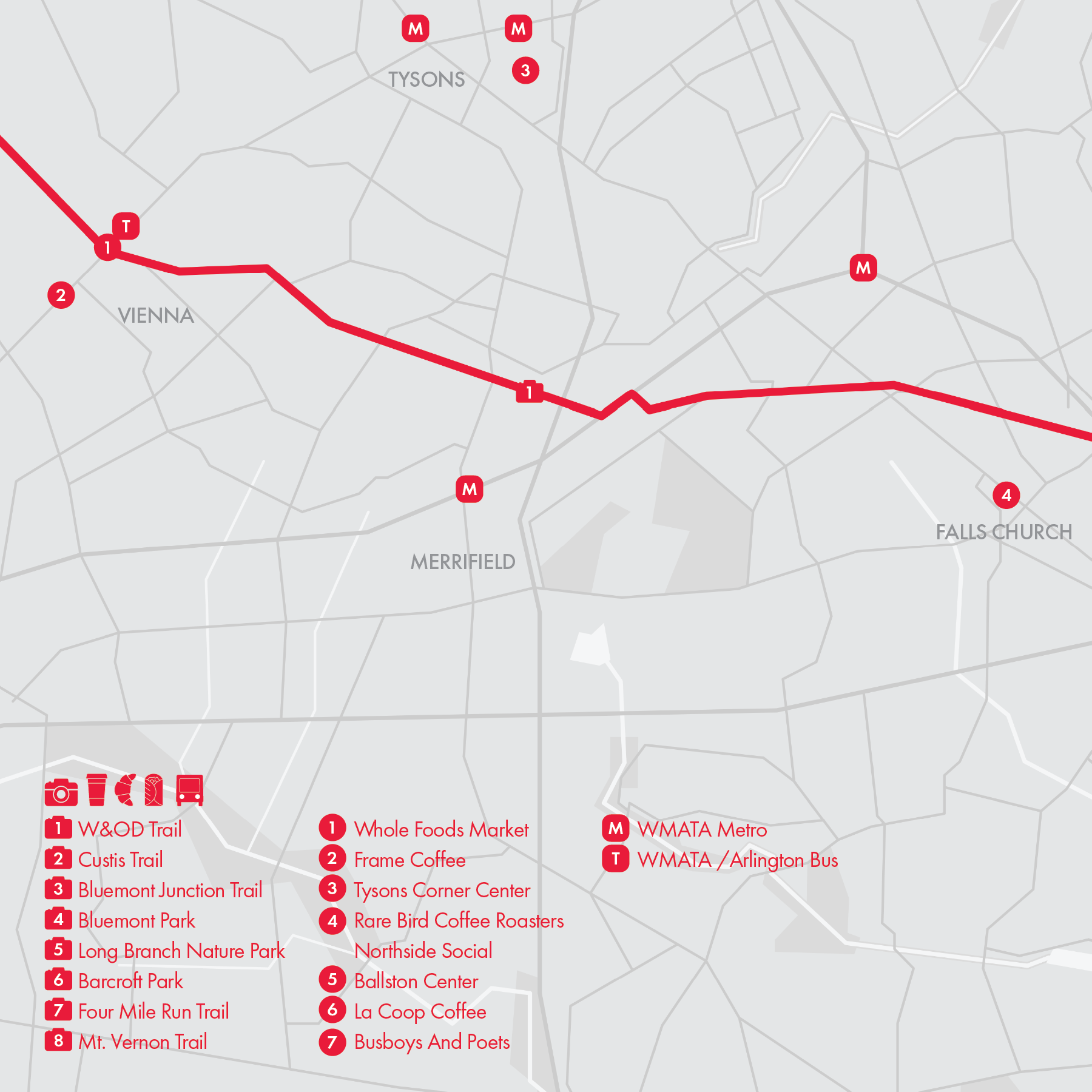
13. Washington and Old Dominion Trail

The Washington & Old Dominion (W&OD) Trail is a popular multi-use trail that stretches 45 miles from Arlington to Purcellville, following the route of the former Washington & Old Dominion Railroad. The east most section of the trail is part of the 16-mile "Arlington Loop", which is made up of segments from the Mount Vernon, Custis, W&OD, and Four Mile Run trails (Routes 11-14).
• Start: Trailhead off Shirlington Road
• Finish: as far as Purcellville, VA; this route ends at Downtown Vienna or Reston Town Center Metro Station
• Course: 11.3 miles, 526 ft+ (Vienna) or 18 miles, 753 ft+ (Reston), paved, multi-use path, some street crossings
The W&OD Trail passes through multiple towns in Northern Virginia, transitioning gradually from urban zones to suburban communities and finally to rural scenery as you head westward. The trail is predominantly flat, with a slight incline as it progresses toward Purcellville. It is clearly marked with mileposts every half-mile, beginning at mile 0 in Arlington and concluding at mile 44.5 in Purcellville. The trail is very popular among cyclists, particularly in the urban stretches between Arlington and Vienna.
The W&OD Trail connects with other trails, such as the Four Mile Run Trail (running parallel for approximately 4 miles), the Custis Trail, and the Bluemont Junction Trail (at Mile 4), offering seamless access to the extensive trail network of the D.C. metro area.
Cafe / One of the things I love most about running or biking on the W&OD Trail is that it winds through several delightful towns, each offering great café stops along the way. My personal favorites are Rarebird Coffee in downtown Falls Church and Frame Coffee in Vienna.
Transit / The WMATA Metro Silver and Orange Lines run somewhat parallel to W&OD, with several stations located near the trail. In particular, East Falls Church (Silver and Orange) and Reston Town Center (Silver) stations are within walking distance.
If you finish in Vienna, take the bus to Tysons where you'll find multiple shopping malls and metro stations.

14. Four Mile Run Trail
The Four Mile Run Trail is a scenic multi-use path in Arlington that follows the course of Four Mile Run, a stream that flows from Falls Church to the Potomac River. It is part of the 16-mile "Arlington Loop", which is made up of segments from the Mount Vernon, Custis, W&OD, and Four Mile Run trails (Routes 11-14).
• Start: Trailhead off Mt. Vernon Trail near Reagan Airport
• Finish: Trailhead off W&OD Trail in Bluemont Park
• Course: 6.35 miles, 313 ft+, paved, multi-use path, some street crossings
The eastern two miles of the Four Mile Run Trail, stretching from the Mount Vernon Trail to Shirlington Road, where the W&OD Trail begins, follows the north side of the stream, with an alternative route available on the south side within Four Mile Run Park. West of the W&OD Trailhead, the trail shifts to the south side of the stream, running parallel to the W&OD Trail and occasionally merging with it. The Four Mile Run Trail eventually joins the W&OD Trail near the intersections with the Custis Trail and Bluemont Junction Trail.
Unlike the more popular W&OD Trail, the Four Mile Run Trail provides a quieter and more serene experience, featuring narrower paths, more turns, slower traffic, ample shade, and gentle hills. It offers a tranquil atmosphere ideal for runners and walkers. Barcroft Park, Long Branch Nature Park, and Bluemont Park further enhance the trail experience, offering forested spaces and additional trails for users to relax, explore, and enjoy the natural beauty of the area.
Cafe / Cafes are scattered along the streets that intersect the trail. For a higher concentration of dining options, head to Potomac Yard on the eastern end or Ballston on the western end of the trail (via. Bluemont Junction Trail).
Transit / The WMATA Metro Silver Line's Ballston-MU Station and the Yellow/Blue Lines' Potomac Yard Station are the closest Metro stations to the Four Mile Run Trail. Additionally, where the trail intersects with major city streets, you can find bus services that provide convenient connections to key transit hubs and Metro stations.

15. Arlington, VA

Originally part of the 10-square-mile area designated for Washington, D.C., Arlington is a city located directly across the Potomac River from the nation’s capital, with a strong connection to the nation's capital. The core running route in Arlington is the 16-mile "Arlington Loop", which is made up of segments from the Mount Vernon, Custis, W&OD, and Four Mile Run trails (Routes 11-14). In this post, we’ll explore other great running routes and destinations in Arlington.
• Arlington Cemetery Loop
Arlington National Cemetery is one of the most significant cemeteries in the United States. A network of connected multi-use paths encircles the cemetery, connecting Arlington's two downtown areas: the Rosslyn-Ballston corridor and Crystal City, and passing by sites like Marine Corps War Memorial and Air Force Memorial.
• Theodore Roosevelt Island
The serene 88.5-acre Theodore Roosevelt Island is a natural memorial featuring a 1.35-mile mostly dirt trail that loops around the island. The island is connected to the Mt Vernon Trail in Rosslyn by a bridge.
• Columbia Island
Between Arlington National Cemetery and the Potomac River, along the Mt Vernon Trail, Columbia Island offers another fantastic running destination. Explore the picturesque trails in Lady Bird Johnson Park, which provide lush landscapes and great views of the Pentagon, Boundary Channel and the Pentagon Lagoon.
• Crystal City
A connector trail links the Mt Vernon Trail to Long Bridge Park, a modern green space featuring a scenic esplanade, wide multi-use trails, and various recreational facilities. Further south, another connector trail passes through the fast growing Crystal City and reconnects with the Mt Vernon Trail.
Cafe / There are plenty of cafes in two of Arlington's busiest areas, Rosslyn and Crystal City.
Transit / WMATA Metro Silver Line serves Rosslyn, while the Yellow and Blue Lines serve Crystal City.

16. Alexandria, VA

Alexandria is a city on the Potomac River, just south of Washington, D.C. It is renowned for its Old Town, characterized by brick sidewalks and beautifully preserved 18th- and 19th-century architecture.
• Potomac Yard Trail
Once a major rail yard and later a bustling industrial hub, Potomac Yard has been transformed into a vibrant, redeveloped area. It now features the 24-acre Potomac Yard Park and a 2.1-mile paved trail that connects the Mount Vernon Trail (Route 11) and the Four Mile Run Trail (Route 14) in the north to the WMATA Braddock Road Station in the south. The trail further extends to the Alexandria Train Station and WMATA Station via the Braddock-King Path.
• Old Town Alexandria
Old Town Alexandria is a historic and picturesque neighborhood situated along the Potomac River in Alexandria, seamlessly integrated with the Mount Vernon Trail (Route 11). Its main thoroughfare, King Street, is lined with boutique shops, art galleries, and over 200 restaurants and cafes.
• Holmes Run Trail
Another major running path in Alexandria is the trail along Holmes Run and Eisenhower Ave. Just south of Alexandria Station, Eisenhower Ave parallels I-495 and features a raised multi-use path on its southern sidewalk. At its western end, the path connects to the Holmes Run Trail, which follows the Holmes Run waterway for several miles and winds through a series of parks, including Ben Brenman Park, Dora Kelley Nature Park, and Holmes Run Stream Valley Park.
This route concludes at the Columbia Pike trailhead, though the Holmes Run Trail continues westward, with a brief break through the Lake Barcroft neighborhood, eventually reaching West Falls Church.
Cafe / Along King St in Old Town Alexandria and Mt Vernon Ave in the Del Ray neighborhood, you'll find lots of cafe options.
Transit / WMATA Yellow and Blue Lines runs through Alexandria, connecting the city to DC, Maryland, and Arlington, VA.
