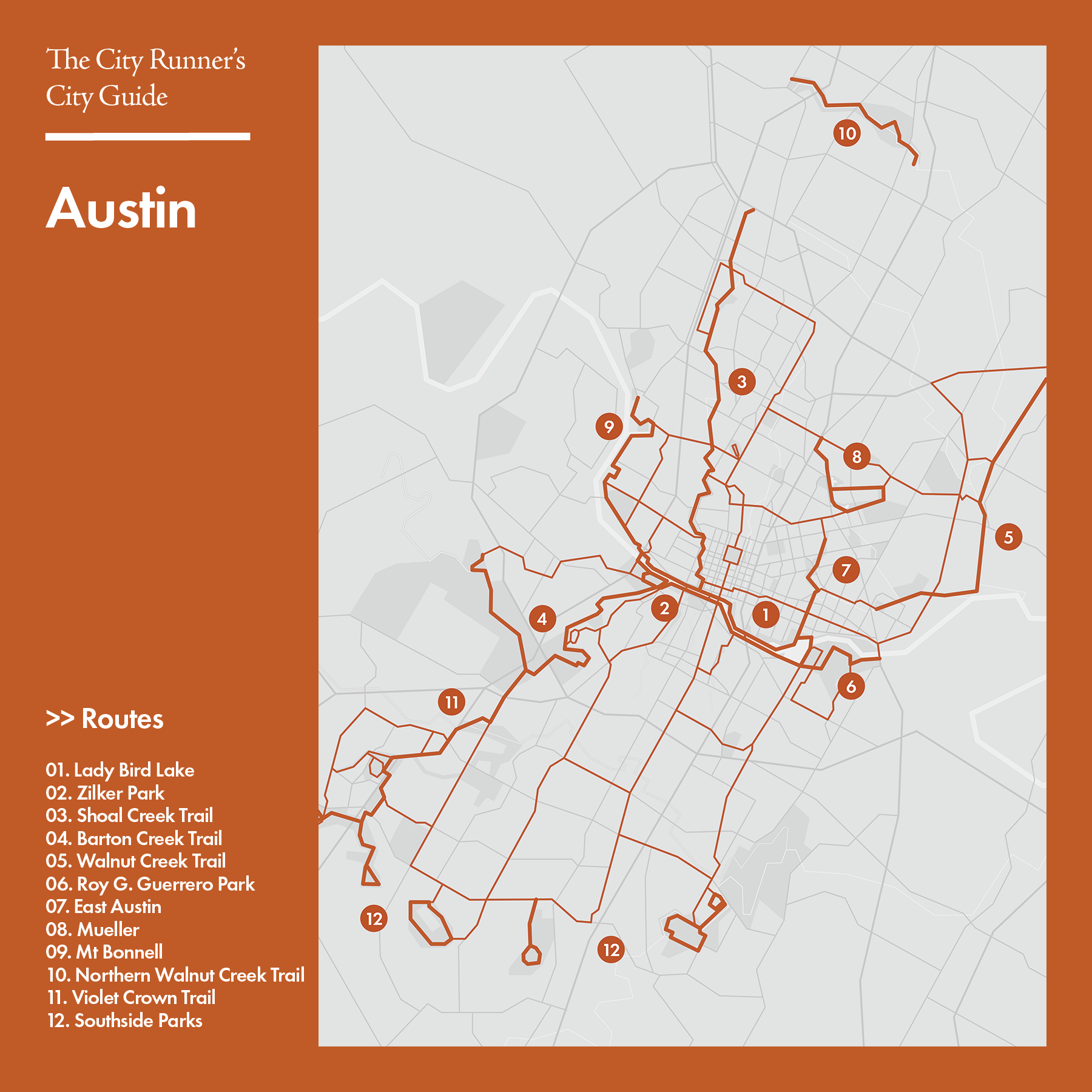
Routes
Austin’s running scene thrives on its outdoor spirit and scenic natural spaces, even though the city’s running infrastructure is still developing. The Ann and Roy Butler Hike-and-Bike Trail, commonly known as the Town Lake Loop or Lady Bird Lake Loop, is the city’s signature route: a mostly flat, well-used path circling Lady Bird Lake with skyline views and shaded sections that make it the absolute local favorite. Beyond downtown, the Walnut Creek Trail offers a mix of paved and natural segments that wind through parks and neighborhoods; though currently split into two main sections, plans are underway to connect them into a continuous corridor. The Barton Creek Greenbelt provides a more rugged option, with rocky singletrack weaving through woods and limestone cliffs popular among trail runners. While Austin’s trail network can feel fragmented, its combination of lakeside paths, greenbelts, and park trails offers plenty of variety for runners looking to mix city views with nature.
1. Lady Bird Lake Loop
• Start & Finish: anywhere along the loop
• Course Profile: 9.9 miles loop, 194 ft+, mostly dirt trail
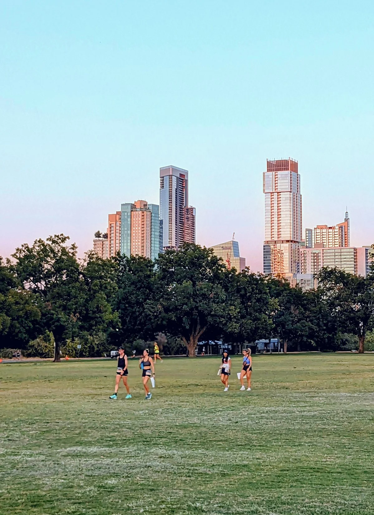
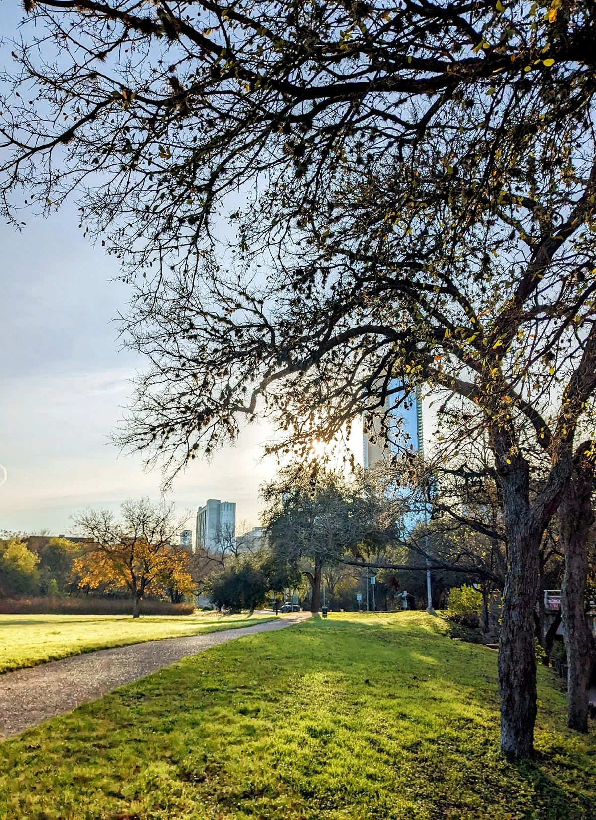
Lady Bird Lake (formerly known as Town Lake) is a river-like reservoir in the center of city, and the centerpiece of Austin's vibrant running scene.
This route follows the Ann and Roy Butler Trail that encircles the lake, crossing the river via MoPac Bridge on the west and Longhorn Dam on the east. It is by far the most popular, scenic and accessible running destination in Austin, and the home base for many different run groups.
There are several other bridges on the lake, all of them can be used to create different loops. Pfluger Pedestrian Bridge, Congress Bridge and the broadwalk on the south shore have excellent views of the lake as well as Downtown Austin. Moreover, Congress Avenue Bridge is home to a large colony of bats. During the summer months, especially around sunset, thousands of bats emerge from under the bridge, creating a spectacular sight.
Along the shores of Lady Bird Lake, a series of green spaces and trailheads further extends the running route:
- Both Shoal Creek Trail (route #3) and Barton Creek Trail (Route #4) start off this route
- Zilker Park (Route #2): Austin's largest and most cherished public park
- Auditorium Shore: a sprawling outdoor oasis that offers panoramic skyline views and big lawns
- Roy G. Guerrero Park (Route #6): a tranquil, forested park on the east end of the lake
- Blunn Creek Greenbelt in Travis Heights on the south bank has a quiet, neighborhood run/hike trail
Cafe / On the north bank, from the Seaholm District through Downtown to East Austin, options are abundant – ranging from cozy cafes and trendy coffee trucks to authentic taco joints, conveniently dotted every few blocks. On the south bank, South Congress Ave has the best options.
Transit / The central location of this route makes it well served by public transit. Guadalupe St, S Lamar Blvd, S Congress Ave, E Riverside Dr, and Cesar Chavez St all have frequent bus service to downtown.
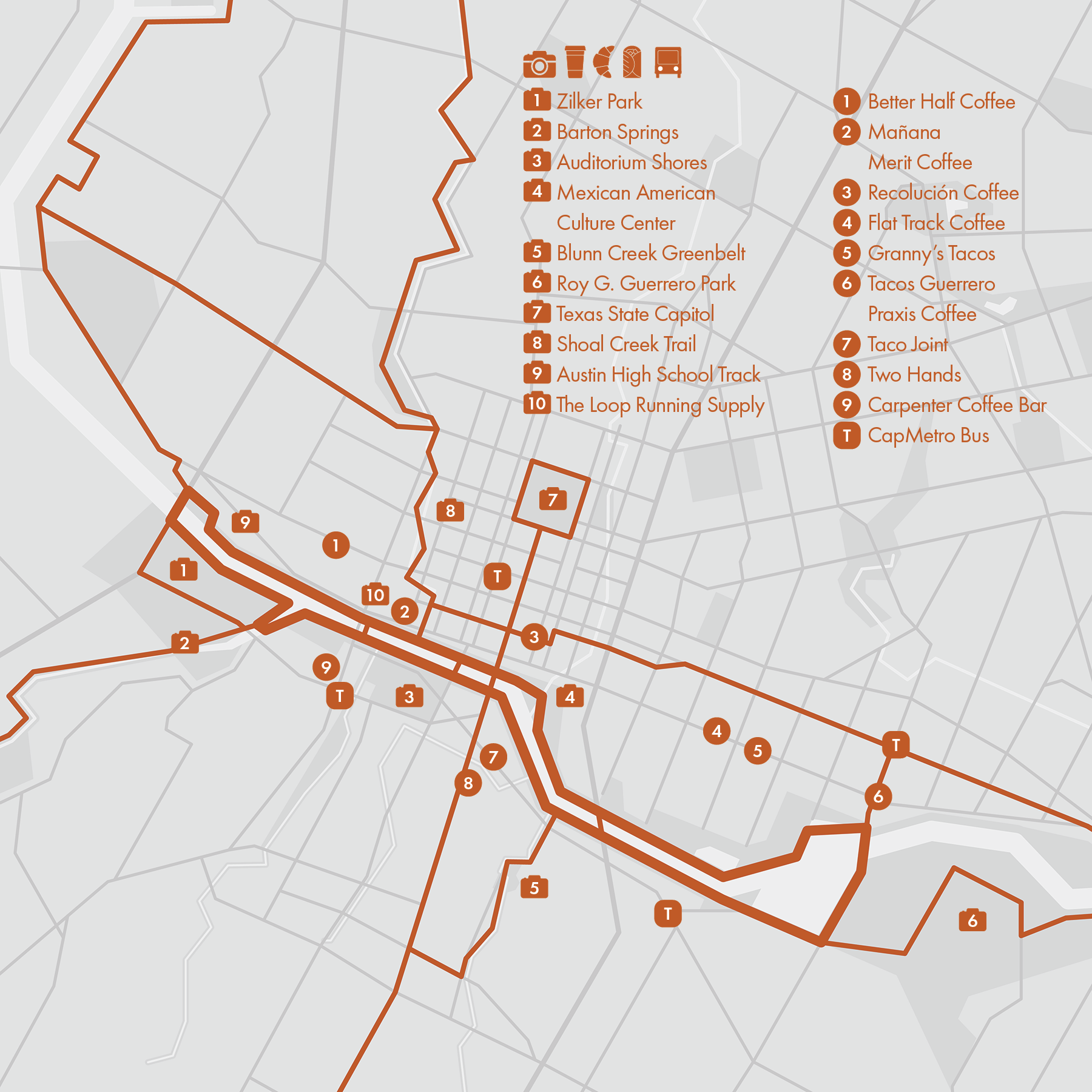
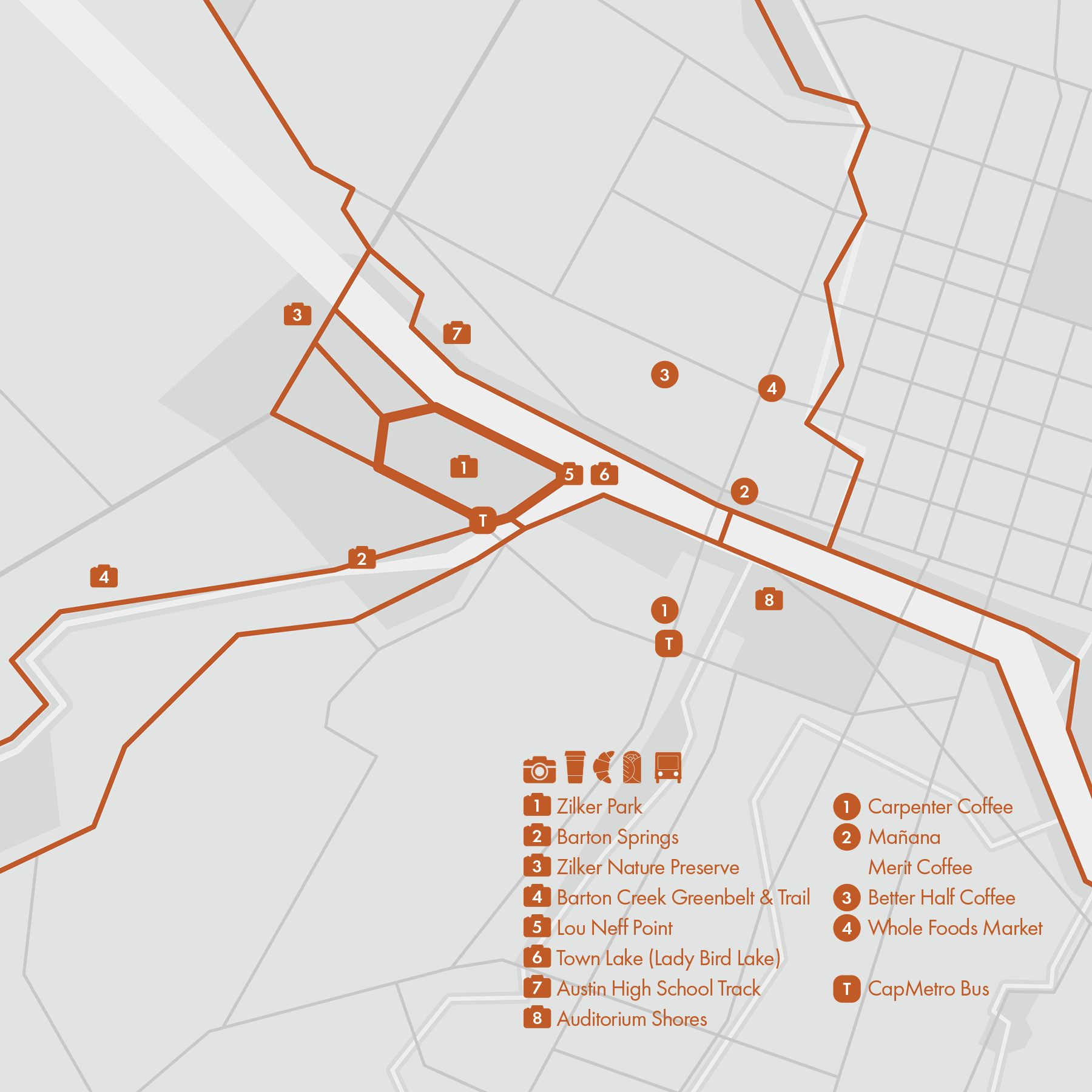
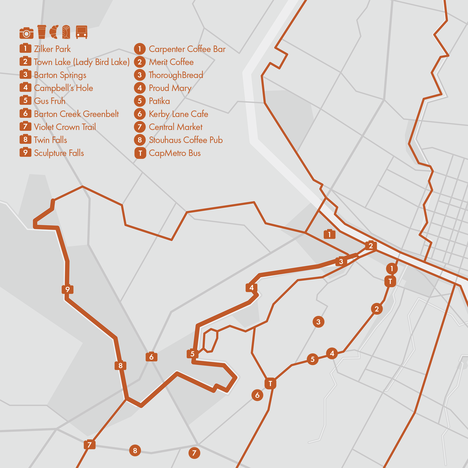
2. Zilker Park
• Start & Finish: Barton Springs Rd at Lou Neff Rd
• Course Profile: 1.5 miles loop, 63 ft+, soft surface trail and sidewalks
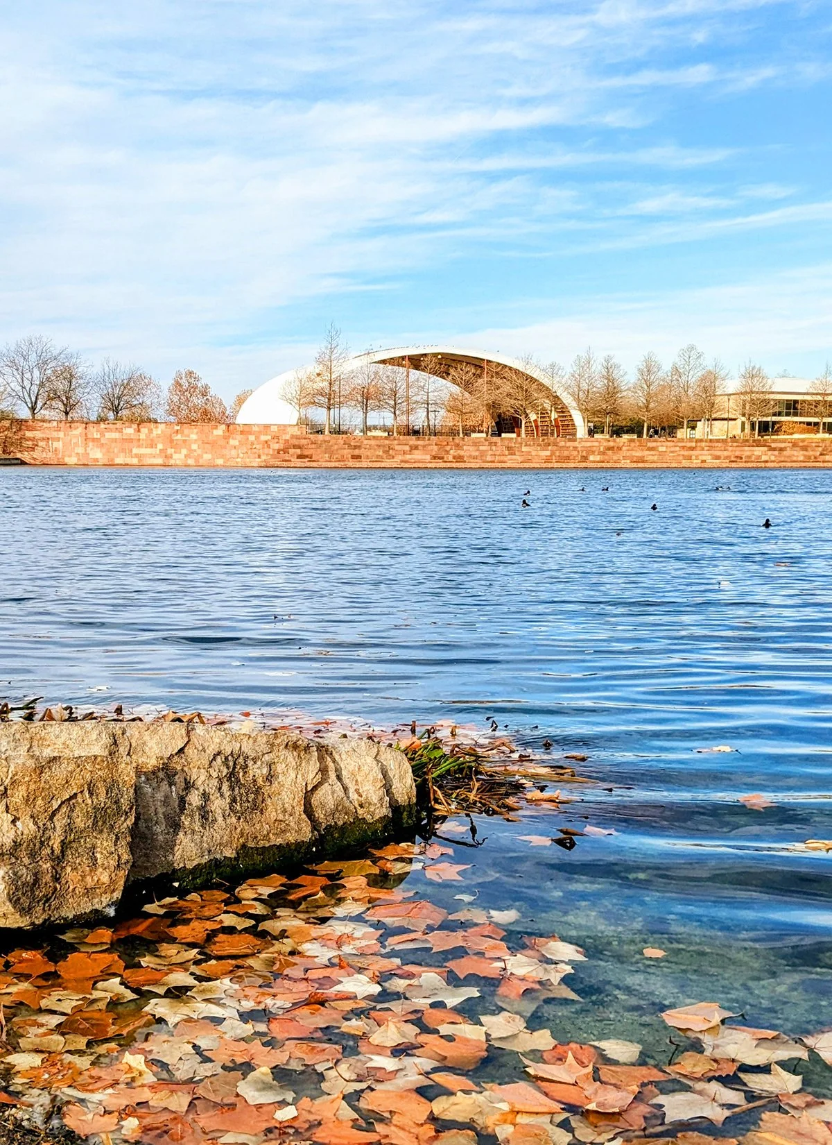
Zilker Metropolitan Park is Austin's most iconic and beloved public space, offering a wide range of recreational activities and natural beauty. The park is home to a botanical garden, the famous Barton Springs, and large events like the Austin City Limits Music Festival and the Zilker Park Kite Festival. Zilker Relays, a 10-mile relay race held every September, is one of the biggest and most fun running events in Austin.
Zilker Park is positioned at the crossroads of two prominent trails: the Roy and Ann Butler Trail (also known as the Town Lake/Lady Bird Lake trail, Route #1) runs along the park's northern edge. The Barton Creek Trail (Route #4) start their journey from Barton Springs within the park. There are also multi-use paths along Barton Springs Rd, and Mopac Expy. Moreover, a small loop is carved out by Barton Springs Rd and Lou Neff Rd, which is part of Zilker Relays course and is the route featured here.
- Don't miss Lou Neff Point at the confluence of Barton Creek and Colorado River. This vantage point provides a stunning view of Downtown Austin's captivating skyline.
- Barton Springs is a pupolar destination and gathering place, particularly given Austin's warm climate. For many local runners, finishing a run with a refreshing dip into the cool waters of Barton Springs is the perfect post run relaxation. There is a pool, as well as an open water area.
- Zilker Nature Preserve on the west side of Mopac, boasts a trail system highlighted by a fantastic lookout point at the hilltop. Trailheads are located off Barton Springs Rd and Stratford Dr.
- Austin High School Track on the other side of the Town Lake is open to the public outside school hours.
Cafe / There is no food or drink venders inside the park :-/
Transit / While Zilker Park is close to the city center, it's poorly served by public transit and most park users drive to the park or pass through via the trails. Bus 30 runs on Barton Springs Rd but the service is infrequent.
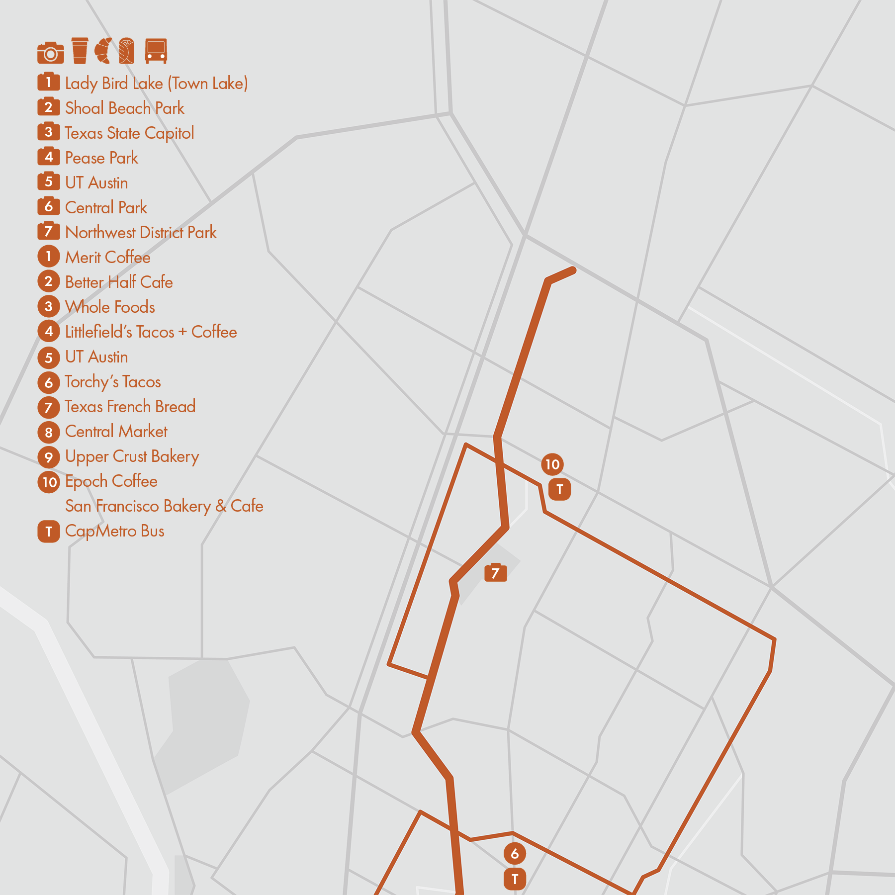
3 Shoal Creek Trail
• Start & Finish: Shoal Creek at Lady Bird Lake, Shoal Creek Blvd at Research Blvd
• Course Profile: 9.2 miles one way, 437 ft+ gradual uphill, mostly paved paths or city street sidewalks, a short section of rugged trails.
This route begins on a narrow and shaded paved path tracing the course of Shoal Creek. Passing through the Seaholm neighborhood, the trail meanders past Duncan Neighborhood Park, briefly merging onto Shoal Creek Blvd sidewalks before arriving at the scenic Pease District Park. Within the park, a pair of parallel trails flank both sides of the creek, guiding trail-users through its green surroundings. Continuing northward, the trail extends into the Shoal Creek Greenbelt, featuring a brief section of rugged trail around mile 3, followed by a transition onto city street on W 31st St. The route comes out of the woods at W 38th St and remains on the sidewalks of Shoal Creek Blvd for the rest 5 miles till the end of the road at Hwy 183.
More places to run:
- Northwest District Park: located around mile 7 of this route, this large park has a path along Shoal Creek and a restroom near the playground.
- Great Norther Blvd: the one-mile bike friendly section of Great Northern Blvd between Foster Ln and Hunt Trail is a popular spot for tempo and speed workouts.
- Lady Bird Lake (Route #1): the start of the route sits right on the 10-mile loop around Lady Bird Lake.
Cafe / There are a few concentrations of shops and cafes on or near Shoal Creek, including Seaholm District, UT Austin, Central Park area, and the Village on W Anderson Ln.
Transit / CapMetro Bus 3, Rapid 803 and some other bus routes serve neighborhoods along the creek.
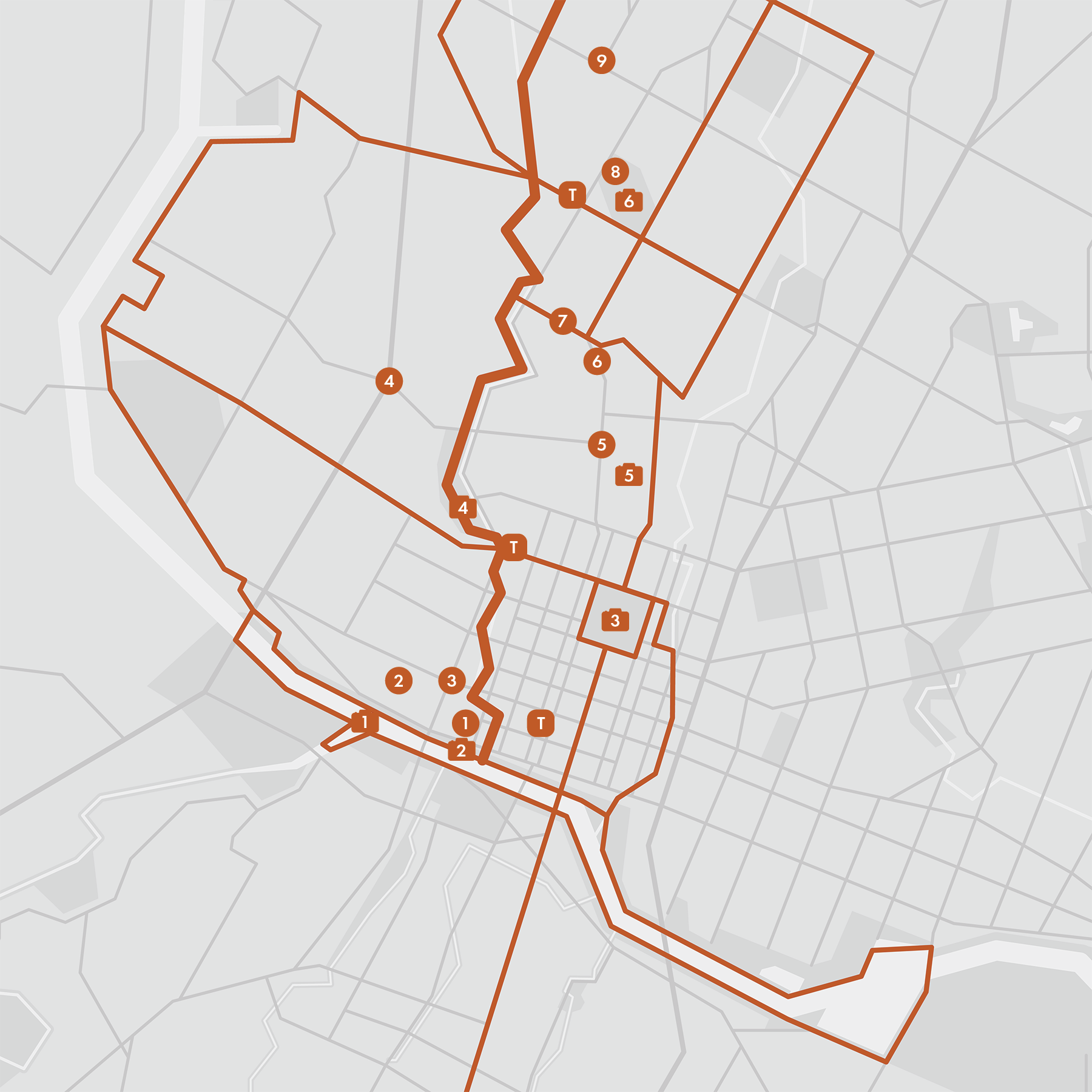
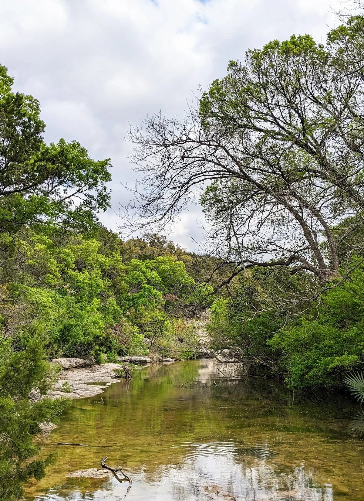
4. Barton Creek Trail
• Start & Finish: Barton Springs, trailhead on Camp Craft Rd
• Course Profile: 7.85 miles one way, 549 ft+, unpaved and rocky. It's another 4.5 miles to get back to Barton Springs via city streets.
The initial stretch of the Barton Creek Greenbelt near Barton Springs Pool is a wide, flat, unshaded path, often bustling with trail users including cyclists. Approximately 1.5 miles into the trail, the landscape transforms as the terrain becomes rocky and the path narrows, leading into the forested greenbelt. It is recommended to wear trail running shoes for this part of the trail to provide ankle support.
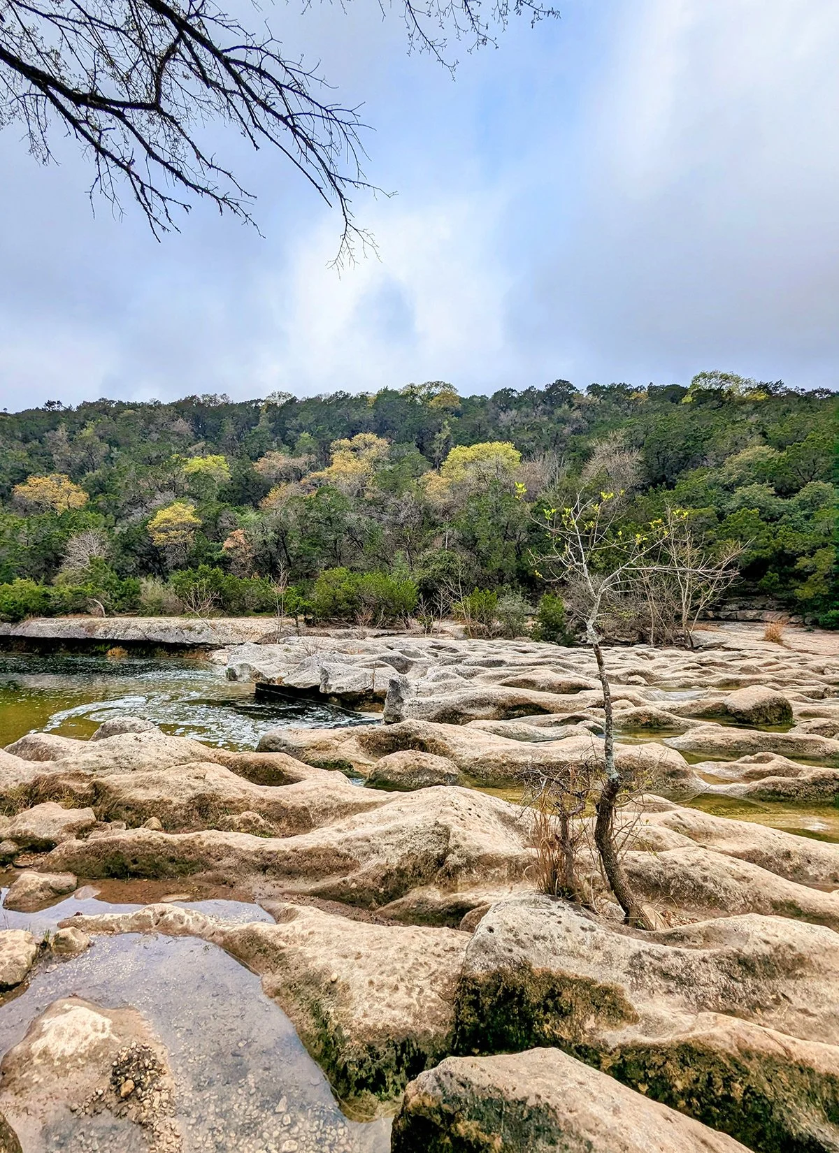
Along the next few miles there are two swimming holes, Campbell's Hole and Gus Fruh. Around 4.5 miles from Barton Springs, there is the access point to the Capitol of Texas Hwy and parking, along with a connector trail to the Violet Crown Trail. Further west, the trail features two waterfalls: Twin Falls and Sculpture Falls. The water levels in the creek fluctuate based on rainfall conditions and these natural features may be dry due to lack of precipitation. At the end of the trail is Hill of Life—a challenging ascent that brings trail-goers back to street level.
More places to run:
- Zilker Park: Austin's largest city park. Check out Route #2
- Barton Creek Trail is connected to two other major trails in the city: Ann and Roy Butler Trail a.k.a. Lady Bird Lake loop (Route #1), and Violet Crown Trail (Route #11).
- Barton Hills Dr with a lollipop at its south end is a popular route of @5run2_atx . The group meets every Wednesday morning at Kerby Lane Cafe on S. Lamar Blvd.
Cafe / South Lamar is a prominent business corridor in South Austin, boasting a vibrant array of cafes and restaurants, including one of my favorites Proud Mary (P10). Additionally, ThoroughBread in the Barton Hills neighborhood is a local favorite.
Transit / Rapid Transit 803 operates along South Lamar Blvd, connecting Downtown to Westgate Transit Center. There is currently no public transit available on the west end of the trail.
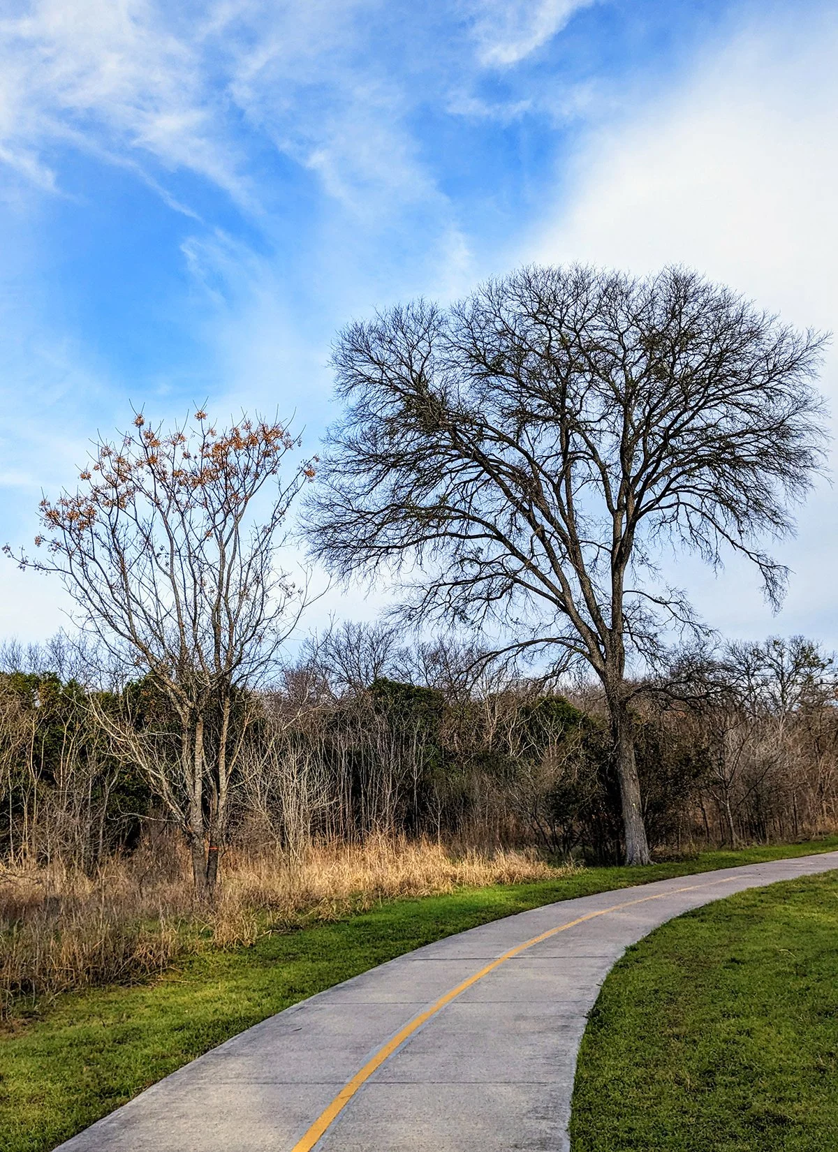
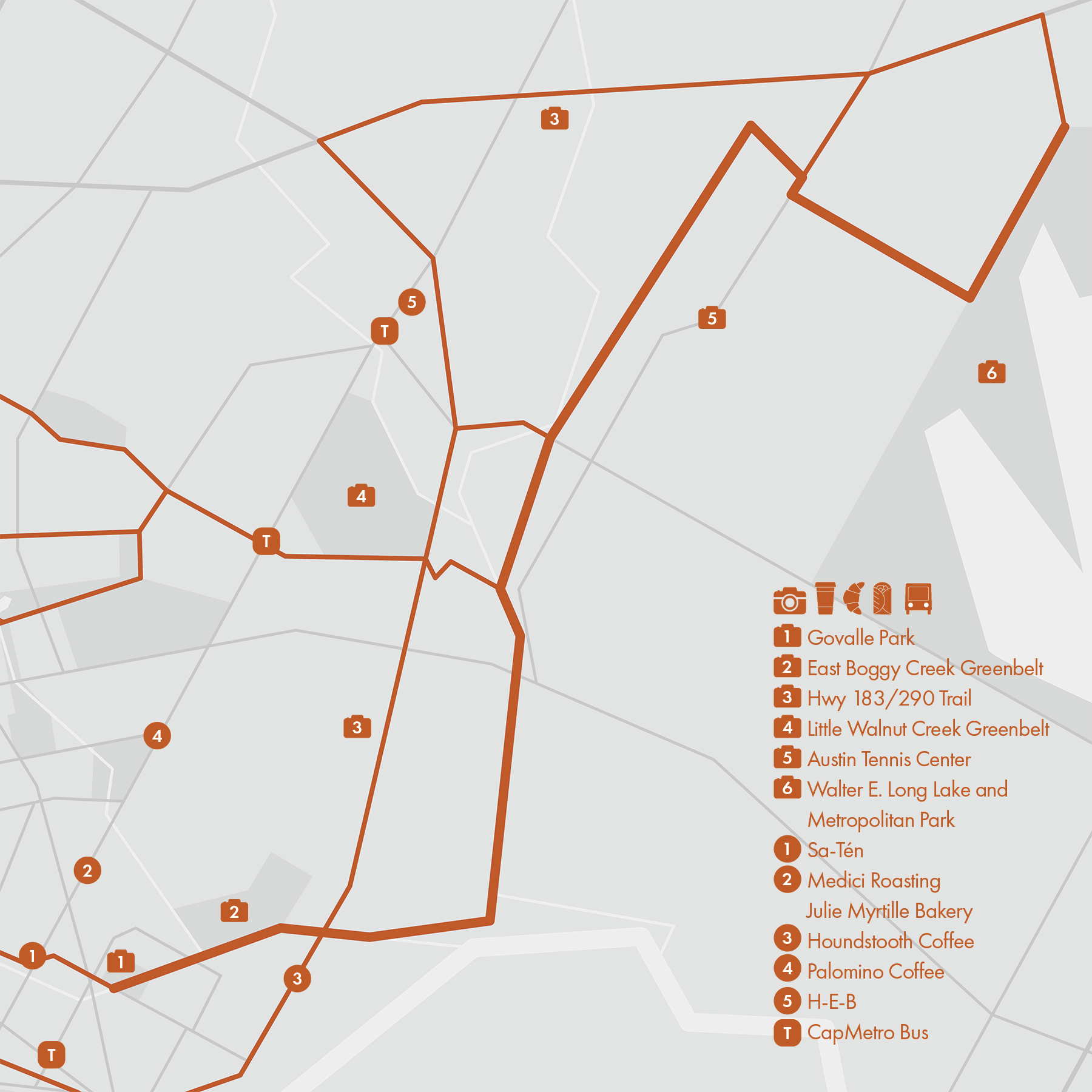
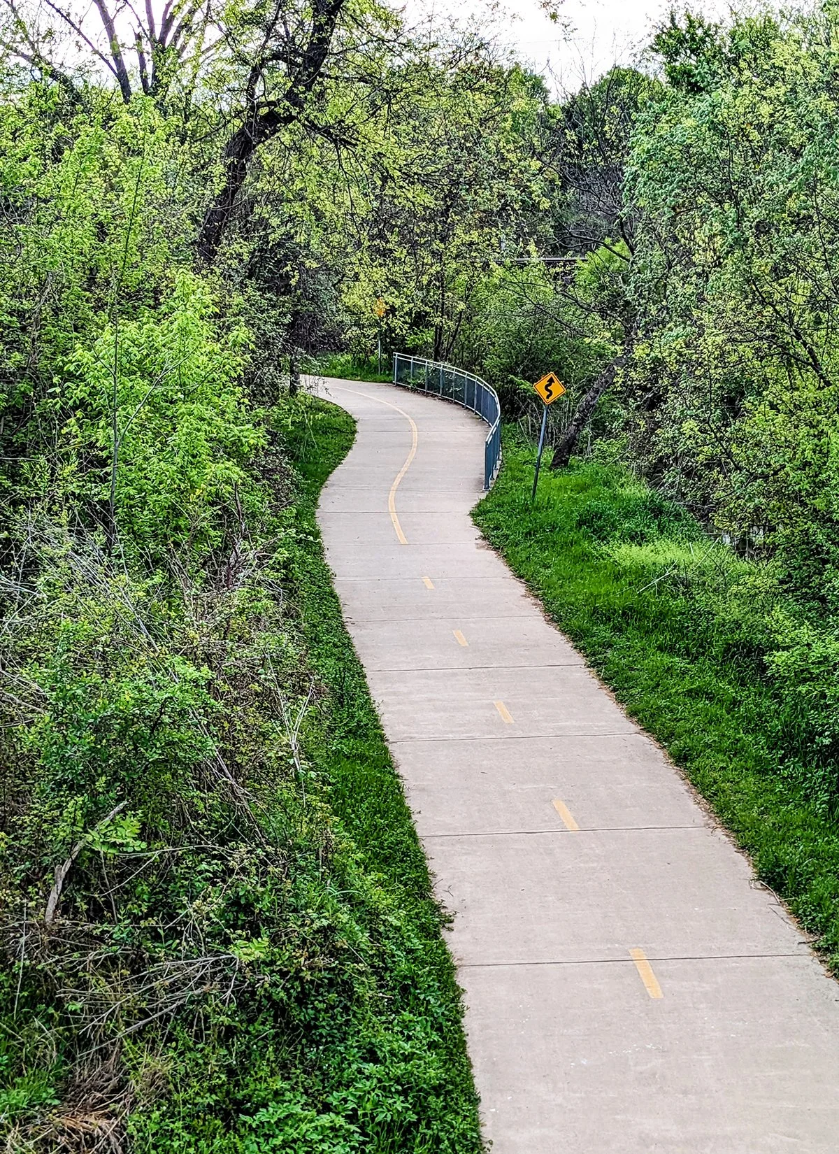
5. (Southern) Walnut Creek Trail
• Start & Finish: Govalle Park, trailhead off Lindell Ln at Decker Ln
• Course Profile: 10.3 miles one way, mostly flat, paved, multi-use path
Located in East Austin, (Southern) Walnut Creek Trail is Austin’s newest and longest multi-use path to be enjoyed by hikers, runners and cyclists. The trail winds through diverse landscapes, including open spaces, woodlands, and some soft hills, all roughly alongside the Walnut Creek. The entire trail is paved with ample signage, ensuring ease of wayfinding.
The Southern Walnut Creek Trail is a portion of the planned Walnut Creek regional trail system. The system's recently completed Northern portion is featured in Route #10.
If you are going for a long run, an alternative to going out-and-back on Walnut Creek Trail, is looping back to East Austin through Hwy 183/290's wide walk/bike sidewalks. There are multiple points along the Walnut Creek Trail to make the connection, as well as at the end. Note that this path is completely exposed to sunlight.
Alternatively, for a more urban experience, consider looping back via Springdale Rd. While this route has more traffic and intersections, it offers a glimpse of urban scenery and provides additional options for breaks or pivots along the way.
More places to run:
- Connect to Roy G. Guerrero Park (Route #6)
- Connect to East Austin (Route #7)
Cafe / Once you are on the east side of Hwy 183 (just over 1 mile from the start of the trail in Govalle Park), you are on your own. Make sure to bring energy and water, and fuel up before you go deep into the trail.
Transit / Walnut Creek Trail runs mostly in areas not served by CapMetro. The closest streets with public transit are Springdale Rd and Manor Rd.
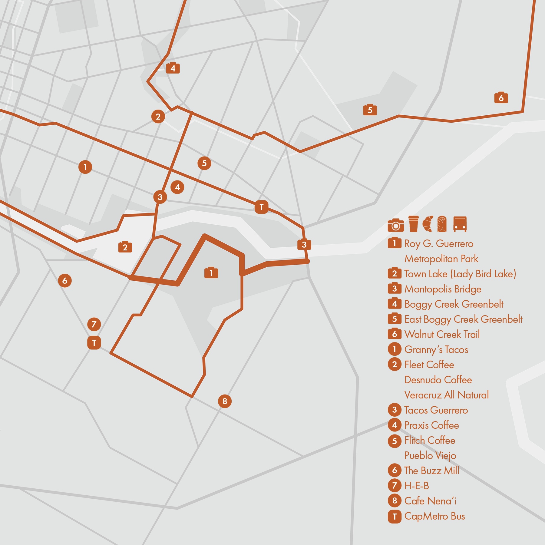
6. Roy G. Guerrero Metropolitan Park
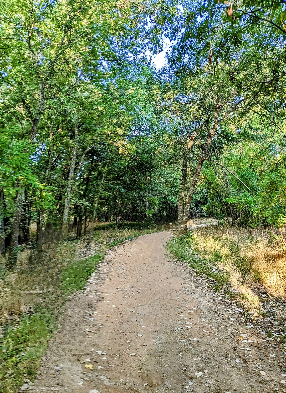
• Start & Finish: S Pleasant Valley Rd & S Lakeshore Blvd, trailhead at south end of Montopolis Bridge
• Course Profile: 2 miles one way, dirt trail with some paved segments, mostly flat (except the end climb near Montopolis Bridge);
Roy G. Guerrero Colorado River Metro Park is an expansive park along the shores of the Colorado River in southeast Austin. This route winds its way through the park from west to east, connecting Lady Bird Lake loop (Ann and Roy Butler Trail) with the Montopolis Bridge.
A creek meanders through the center of the park, creating a natural division between its two distinct parts. On the western side, there is a substantial recreational complex, featuring a series of softball fields. On the eastern side, the landscape includes a golf course, a disc golf course, additional ball fields, a nature preserve, and a spacious wooded area with intertwining hiking trails. As of late 2023, ongoing construction has led to the closure of the northwest corner of the wooded area and a bridge crossing the creek. As a result, the only connections between these two parts lies along the southern edge of the park.
More places to run:
- Hop on the Lady Bird Lake 10-mi loop (Route #1)
- Take Grove Rd (P5) to East Riverside Dr then back on Wickersham Ln
- Looping back through Montopolis Bridge, E 5th St, and Pleasant Valley Rd.
- Connect to Walnut Creek Trail (Route #3) through Montopolis Bridge or Hwy-183 bike path
- Connect to East Austin (Route #7) through Pleasant Valley Rd
Cafe / On the other side of the Colorado River, East Austin has tons of options for post-run coffee, food, and drinks. On the park's side, there are cafes and food trucks scattered along Riverside Dr as well as an H-E-B supermarket.
Transit / Two sides of the park are served by CapMetro buses: Riverside Dr, Pleasant Valley Rd. If you cross the Colorado River to the Northside, Cesar Chavez St is also a transit corridor.
7. East Austin

• Start & Finish: Pedernales St at Holly St, MLK light rail station
• Course Profile: 2.45 miles one way, sidewalks and paved paths, mostly flat
East Austin is a vibrant and culturally rich area known for its diverse community, artistic vibe, and eclectic mix of businesses. The central attraction in East Austin is the Boggy Creek Greenbelt trail. Spanning approximately 1.5 miles, the trail extends from the light rail MLK station to Webberville Rd. For those seeking a longer route, Pedernales St, extending further south, is runner-friendly and seamlessly connects the trail to the Town Lake Loop (Route #1). There is also a bike path running along 3rd/4th/5th St from Downtown to Chicon St.
Not far from Boggy Creek Greenbelt is the Mueller (Route #8) neighborhood. JJ Seabrook Greenbelt is a nice connector trail to get there. Just over a mile to the east of Boggy Creek Greenbelt lies Govalle Park, marking the beginning of the Walnut Creek Trail (Route #4). This dedicated multi-use path extends for several miles.
More places to run:
- Connect to Roy G Metro Park (Route #6) through Pleasant Valley Rd or Montopolis Bridge.
- Adjacent to the greenbelt, Yellow Jacket Stadium is a popular track with public access.
- For those seeking a city street conducive to speed work, Tillery St and Holly St are locals' favorites, thanks to the relatively ease of crossing streets.
@esbrunnersatx is an East Austin favorite and meets every Wednesday at Central Machine Works for runs and beers.
Cafe / East Austin, in my opinion, stands out as the culinary center of the city, offering fantastic options for post-run coffee, food, and drinks. The neighborhood is home to a plethora of local coffee roasters, numerous coffee and food trucks, and most cafes in East Austin feature outdoor patios. My favorites in the area are pastries and bread at Sour Duck Market, and Fleet Coffee on Webberville Rd.
Transit / CapMetro buses run on all east-west arterial roads in East Austin and connect it with Downtown Austin.
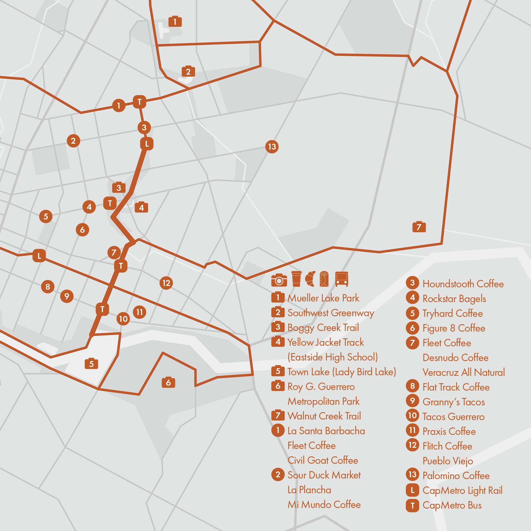
8. Mueller
• Start & Finish: Mueller Lake Park
• Course Profile: 5.25 miles lollipop loop, sidewalks and paved paths, mostly flat
Mueller is a dynamic urban development on the site of the former Robert Mueller Municipal Airport that closed in 1999. Known for its mixed-use design, the neighborhood features a diverse blend of residential, commercial, and recreational spaces. The majority of streets within Mueller are designed to be bike and running friendly, offering dedicated lanes along the neighborhood's thoroughfares.
Mueller boasts an array of parks and green spaces:
- Mueller Lake Park: Located at the heart of the community, featuring a picturesque lake, inviting walking trails, and an outdoor event venue.
- Northwest Greenway: Positioned to the northwest of Mueller Lake Park, this greenway establishes a connection between Mueller and a prominent retail center adjacent to I-35.
- Southeast Greenbelt: Expanding to the southeast of Mueller Lake Park, this greenbelt offers a serene retreat with several ponds, a charming Butterfly Garden, and additional walking trails.
Also worth seeing is the 1961 airport's control tower. Preserved and restored, it sits on Berkman Dr near the south end of the community.
More places to run:
- East Austin (Route #7)
- Take E 51st St to Walnet Creek Trail (Route #4), and potential make a loop
- Marshall Middle School in Mueller has a shiny new track that is open to the public (outside school hours).
Run Clubs / Mueller is home to run clubs like @muellerrunclub and @austincoffeerunclub, check them out for their weekly runs.
Cafe / Bottega stands out as a new cozy café in the Mueller neighborhood. Venture beyond Mueller, you'll discover a plenty coffee and food options along Airport Blvd and Manor Rd. Additionally, the vibrant East Austin area boasts an abundance of excellent coffee shops and street foods.
Transit / CapMetro buses serve several key streets within the Mueller neighborhood, notably covering Manor Rd, E 51st St, and Berkman Dr.

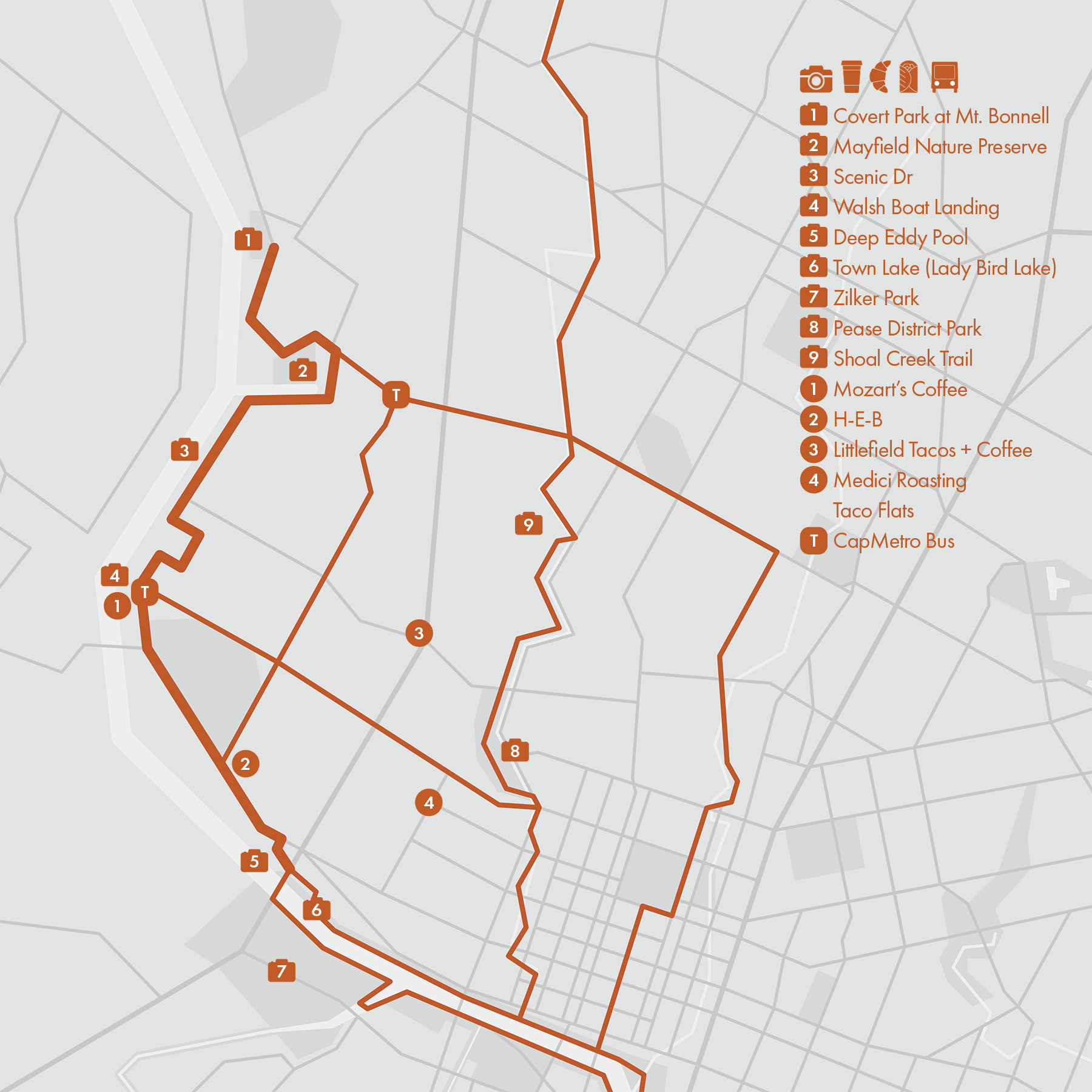
9. Mount Bonnell
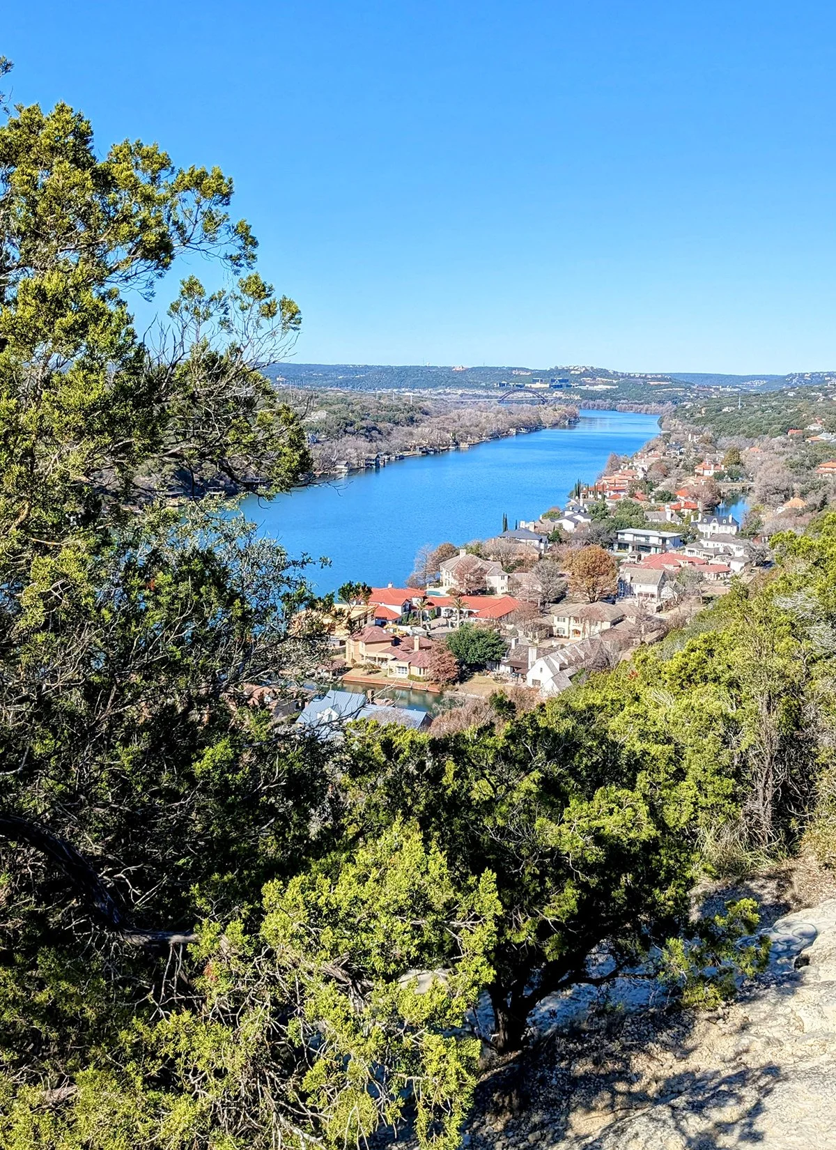
• Start & Finish: The Rock at Town Lake, Mount Bonnell
• Course Profile: 4.9 miles one-way, city streets, 474 ft+
This route starts from the iconic Town Lake (Lady bird Lake) trail and follows Lake Austin Blvd and Scenic Dr to the summit of Mount Bonnell at Covert Park—the highest point in Austin. The route ends with a challenging 0.45-mile segment, boasting a 253 ft elevation gain.
Along the way, you'll have the opportunity to explore and visit (in reverse order):
- Covert Park at Mount Bonnell: the hilltop park features a rugged trail and rewards adventurers with panoramic views of the meandering Colorado River below. . A staircase is located before the end of the climb as another access point to the summit.
- Mayfield Park and Nature Preserve: the park has a small but intricate walking trail system, as well as free-roaming peacocks in the historic cottage garden near the entrance.
- Scenic Drive: The 1.2-mile segment has elevated vantage points that offer good views of the surrounding areas. Does it live up to the name? I think it's OK but you should check it out yourself.
- Walsh Boat Landing: Nestled within a small park, this site offers lake access and great lake views.
- Deep Eddy Municipal Pool: Established in 1915, this historic pool stands as one of the oldest in Texas, featuring crystal-clear spring water.
Connecting with more routes
- Town Lake Loop (Route #1)
- Shoal Creek Trail (Route #3)
- Enfield Rd's iconic rolling hills are featured in Austin Marathon and Half Marathon courses.
Cafe / Mozart's Coffee is a popular cafe known for its lake views. Other than that, there aren't much west of Mopac, you have to venture out to Old West Austin or Clarksville for coffee and tacos. H-E-B on Lake Austin Blvd is another option.
Transit / CapMetro Route 18 that goes around the golf course and Route 335 on W 35th St are the closest public transit options to this route.
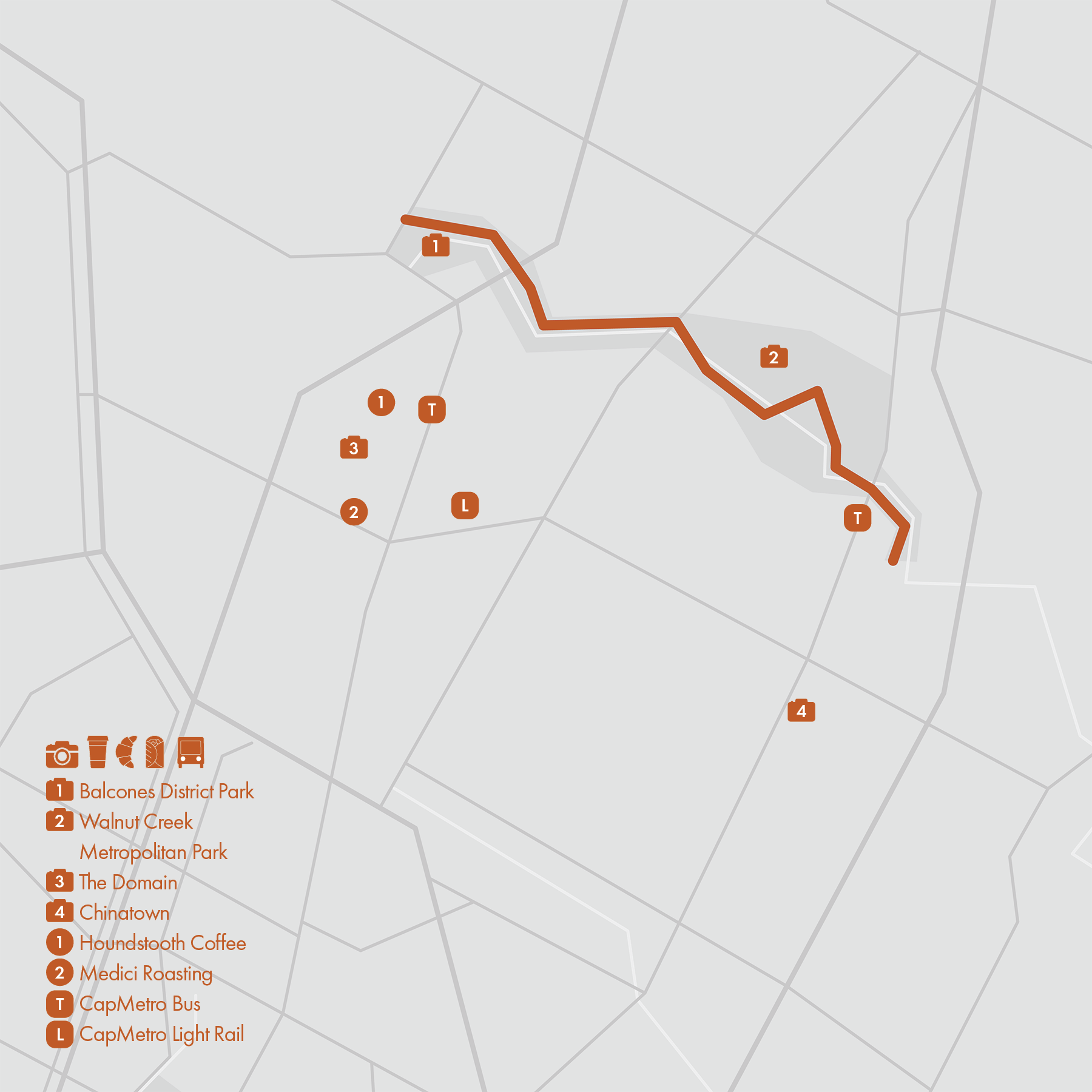
10. Northern Walnut Creek Trail
• Start & Finish: Balcones District Park, Walnut Bluffs Trailhead near N Lamar Blvd
• Course Profile: 4.4 miles one-way, paved multi-use path, 150 ft+
The Northern Walnut Creek Trail is the currently finished 4.4-mile northern segment of the 19-mile planned Walnut Creek Trail. When complete, Walnut Creek Trail will seamlessly link Balcones District Park in North Austin to Govalle Neighborhood Park in East Austin. 8.7 miles of the southern section that have been completed will be detailed in Route #4.
This route has well-paved surface, clear markings, and multiple trailheads, facilitating a shared experience for walkers, runners, and cyclists. While some city streets around the trail are ok for running, this route is currently isolated from the the city's other great running routes.
Two notable places to check out:
- Walnut Creek Metropolitan Park: on the east side of this route is this large public park featuring an extensive network of 15 miles of hiking trails. While the Northern Walnut Creek Trail is paved, the majority of the park's other trails are dirt trails and accommadate mountain bikers. Always exercise caution as this park is popular amount MTBers.
- The Domain: to the southwest of this trail is The Domain, a prominent mixed-use development and shopping district, known for its high-end retail options, and a diverse selection of dining establishments ranging from casual eateries to upscale restaurants. The outdoor shopping center is designed with a pedestrian-friendly layout.
Cafe / Houndstooth Coffee and Medici Roasting in The Domain are two well-regarded local coffee shops. Austin's Chinatown is located on N. Lamar Blvd about a mile south of the trail.
Transit / CapMetro Rapid 803 connects The Domain and Downtown; Route 1 stops near the trailhead on N. Lamar Blvd. In addition, there is a light rail station near The Domain too.
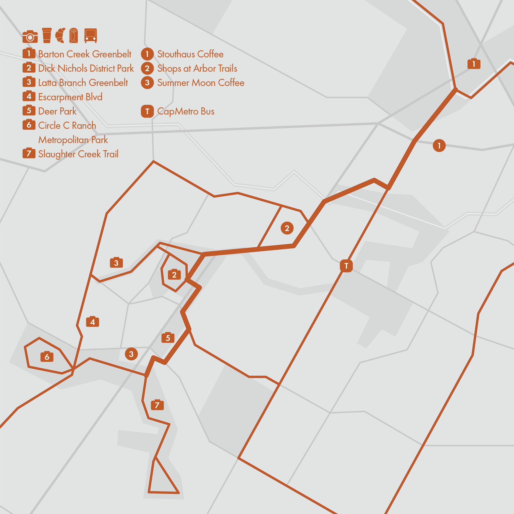
11. Violet Crown Trail
• Start & Finish: Barton Creek Greenbelt Trailhead, Slaughter Creek Trailheard
• Course Profile: 6.1 miles one-way, mixed terrains, 315 ft+
The Violet Crown Trail stands as one of Central Texas's first regional trail systems, spanning a current length of 13 miles from Zilker Park to the Lady Bird Johnson Wildflower Center. This particular route highlights the central portion, with Barton Creek Greenbelt (Route #5) and Southside Parks (Route #12) encompassing the two ends.
The Violet Crown Trail has a diverse array of terrains, including city streets, paved paths, gravel, and dirt trails. Please note that the segment within Barton Creek Greenbelt has a more challenging, rocky terrain for runners. The trail winds through various twists and turns, traversing both on and off city streets, hence it's important to pay attention to signage along the route.
Along this 6-mile section of the Violet Crown Trail, there are several additional running route options:
- Barton Creek Greenbelt: This expansive urban wilderness in Austin offers a (rocky) trail that roughly traces the meandering creek. The Violet Crown Trail trailhead is approximately 4.5 miles south from Barton Springs.
- Dick Nichols District Park: this park has a one-mile running loop. Positioned on the east side is the Violet Crown trailhead, while on the west side, another trailhead leads to the Latta Branch Greenbelt.
- Circle C Ranch Metropolitan Park: Situated near the south end of this route, the park features an 1.4-mile running loop. The connector trail to Violet Crown Trail is narrow and sometimes technical.
Cafe / Stouthaus Coffee on S Lamar, provides an excellent option for grabbing coffee and snacks after exploring the Barton Creek Greenbelt. The Shops at Arbor Trails offer several fast-food joints and house a Whole Foods Market.
Transit / Regrettably, this area lacks direct access to public transit. The nearest bus stop is at Route 333, situated at William Cannon Dr and Brodie Ln. For travel to/from Downtown, a transfer is required.
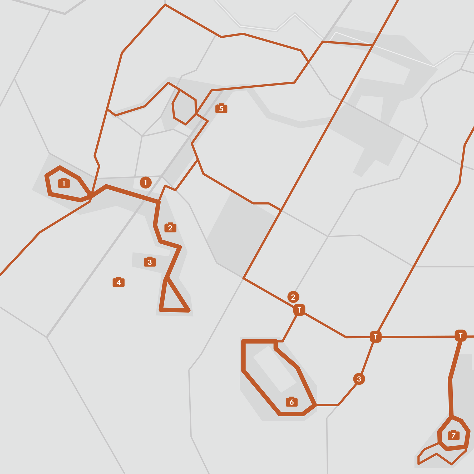
12. Southside Parks
There is a series of metropolitan parks along Austin's south edge. While they are far from the city center and not particularly scenic, these parks offer a refreshing alternative for those in South Austin seeking a change of pace from running through urban street.
- Circle C Ranch
The Metropolitan Park features a 1.4-mile dirt trail loop. East of Escarpment Blvd, a rugged dirt trail follows Slaughter Creek for approximately 2.5 miles one way. For a different running experience, Escarpment Blvd also offers another excellent route.
Adjacent to the Slaughter Creek Trail, Veloway Park provides a dedicated circuit for cycling enthusiasts. Please note that pedestrians and runners are not allowed on this cycling path.
- Bauerle Ranch
There is a 2.8 miles slightly rocky trail loop in Bauerle Ranch. The easy trailhead is on Lindshire Ln just south of Lindshire Park. There is also an unmarked access point on Menchaca Rd.
- Mary Moore Searight Metropolitan Park
There is a 1.15-mile loop in the southern section of the park, located 1 mile south of the park entrance on Slaughter Ln.
For a more challenging and serene alternative, there is a trail following Slaughter Creek, though it requires slightly more navigation skills.
- Onion Creek Metropolitan Park
There is a 1-mile loop off Pleasant Valley Rd, complemented by a 1-mile one-way trail tracing the scenic greenbelt. Across Onion Creek to the south, there is a compact yet intricate trail system. During periods of low water levels, runners can safely traverse Onion Creek.
- McKinney Falls State Park
The state park charges $10/car entry fee and is very hard to access for folks on foot. Not recommended 👎
Connecting with more routes: Violet Crown Trail (Route #11)
Cafe / Praxis Coffee Rosters (P10) on Menchaca Rd is a hidden gem. The owner couple is very nice and often works at this lovely airstream coffee trailer next to their roastery.
Transit / Slaughter Ln is the southmost major street that CapMetro serves.