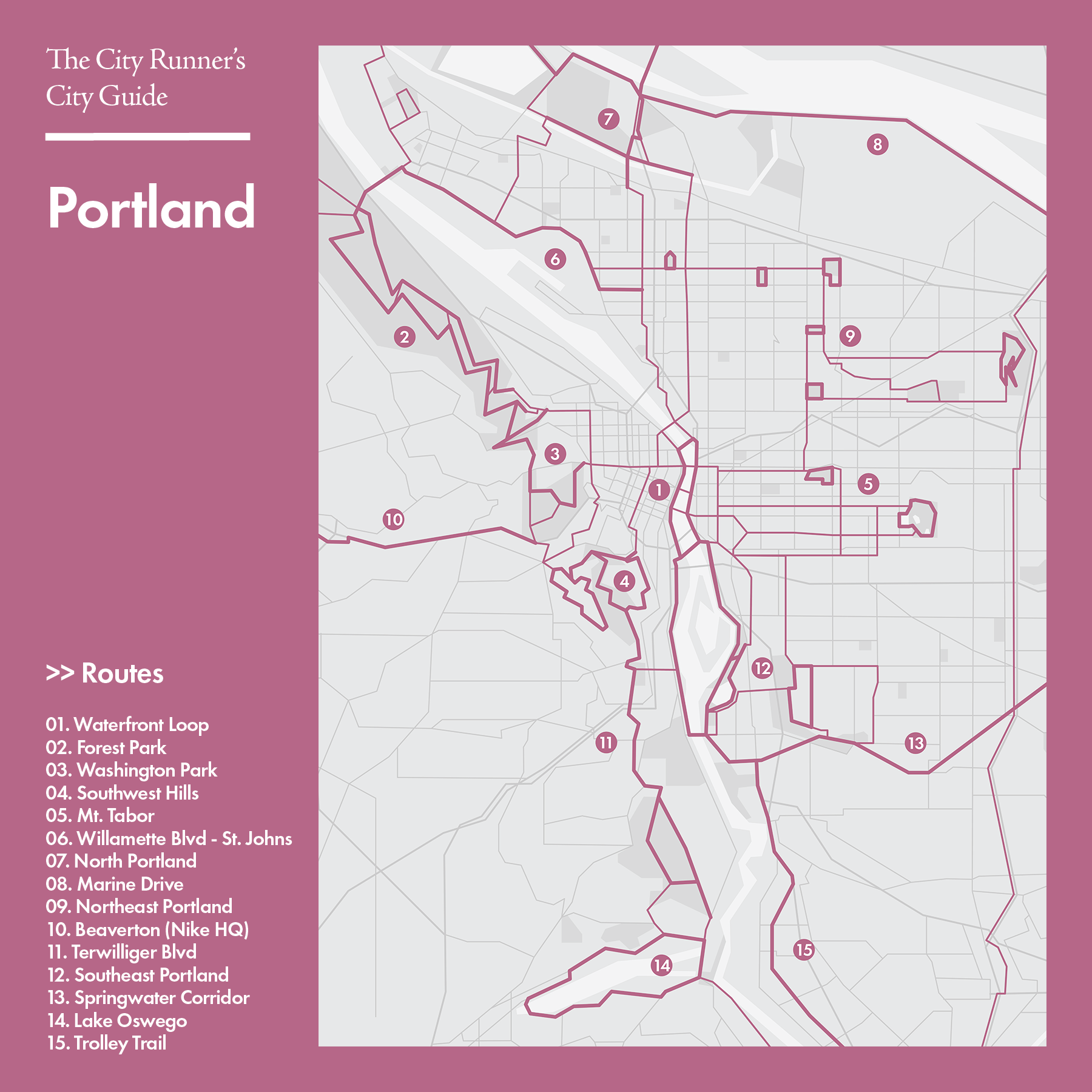
Routes
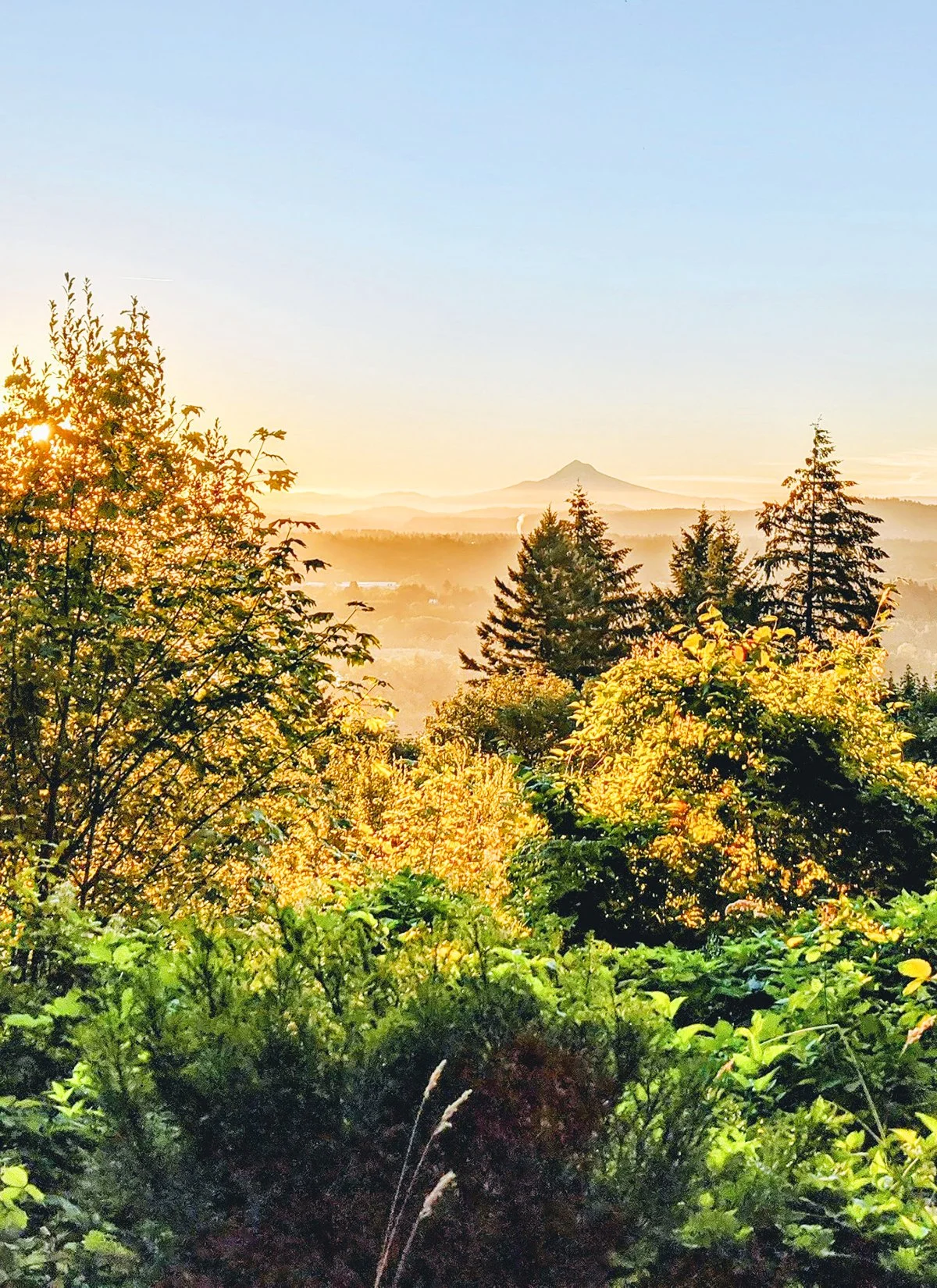
Portland offers an exceptional range of running routes that showcase the city’s blend of rivers, forests, parks, and well-connected greenways. Along the Willamette riverfront, runners can stitch together long, smooth loops using the city’s many bridges and waterfront paths. Just uphill, Forest Park provides more than 80 miles of soft trails weaving through old-growth forest, while Washington Park adds steep, shaded routes ideal for hill work. For track sessions, the beloved Duniway Track tucked between downtown and the South Waterfront serves as a popular hub for runners all day long. Across the east side, the Springwater Corridor offers a long, continuous multi-use path that stretches deep into the suburbs and farmland, perfect for marathon training and quiet long runs. City parks add even more variety, especially the iconic Mt. Tabor, whose volcanic slopes and loops provide both views and tough climbs. Beyond Portland proper, the running options expand further: Beaverton features wooded neighborhood paths and easy access to additional trail systems, Oregon City mixes riverfront stretches with hilly historic districts, and Vancouver, WA offers scenic miles along the Columbia River and through its growing network of parks and greenways.
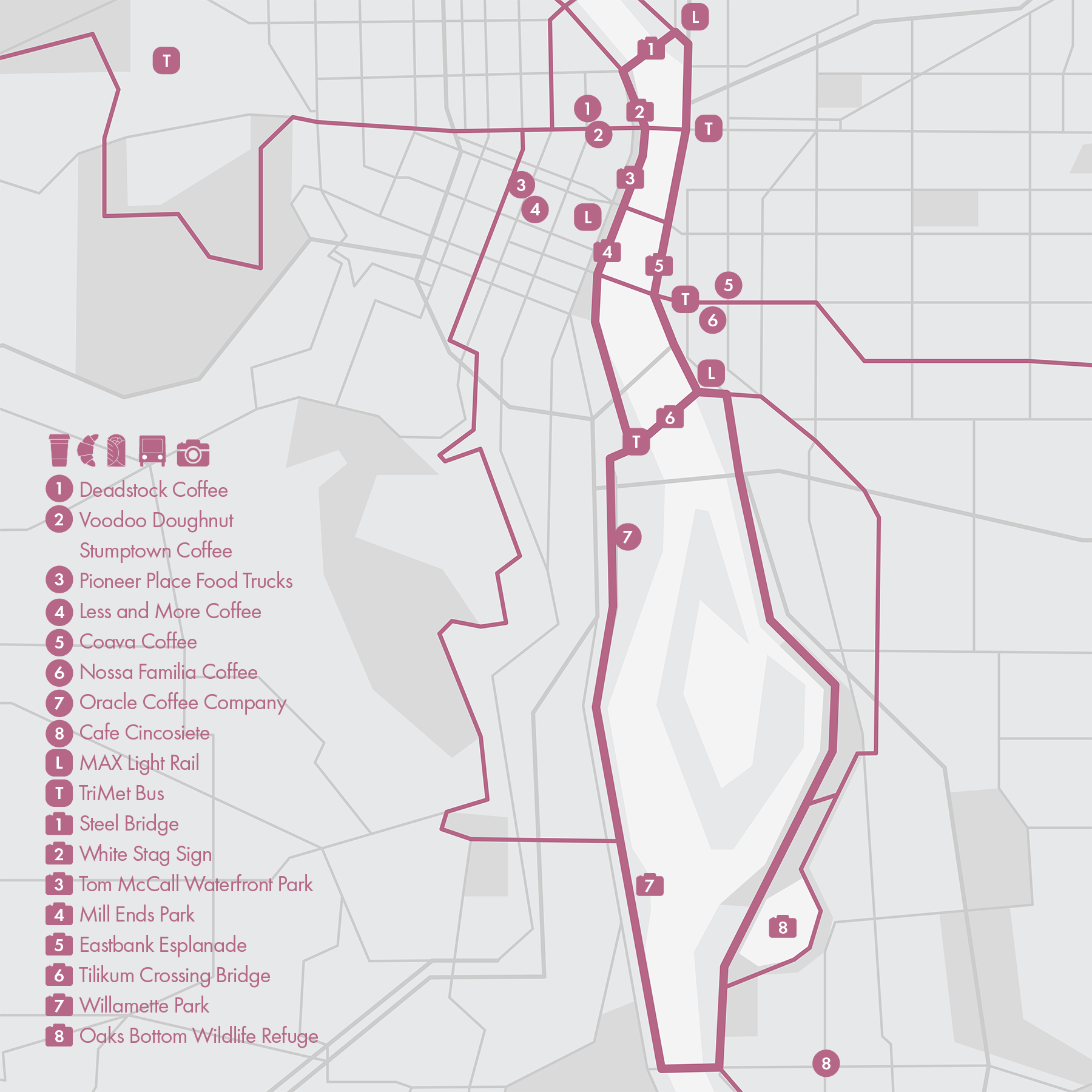
1. Waterfront Loop
• Start & Finish: Steel Bridge; Tilikum Crossing Bridge or Sellwood Bridge
• Course Profile: 4.1 mile (Tilikum) or 10.4 mile (Sellwood) loop, mostly flat, paved path (strava in bio).
Portland's waterfront stretches along the banks of the Willamette River in the heart of the city, it is home to various parks, pathways, and cultural attractions. Thanks to a great multi-use path network and a series of bridges over the Willamette, this is one of the most accessible, scenic and iconic running routes in the city.
Make sure to check out the following places while running in the waterfront:
- Steel Bridge: the double-deck bridge is one of the most multimodal in the world (road, railroad, light rail, bikes and pedestrians)
- The iconic White Stag sign, also known as the "Portland Oregon" sign, is located atop the White Stag Building, facing the Burnside Bridge.
- Tom McCall Waterfront Park: this centerpiece of Portland's waterfront is named after a former Oregon governor. The park is close to downtown and offers a mix of open green spaces, walking and biking paths, and scenic viewpoints. It is a must-visit during the cherry blossom.
- Mill Ends Park: the 2-ft across circular park is the world's smallest park according to the Guinness Book of Records.
- Hawthorne Bridge: known for its distinctive vertical lift, it is the oldest of its kind in the country.
- Eastbank Esplanade: the dedicated pedestrian and cyclist path offers great views of the Willamette and the city's skyline .
Connecting with more routes
- Washington Park (Route 3)
- Mt. Tabor (Route 5)
- Southwest (Route 12)
- Springwater Corridor (Route 13)
Cafe / There is an abundance of coffee shops and cafes along the waterfront loop on both sides of the river, including Portland's famous Voodoo Donut, Stumptown Coffee, and my favorite Deadstock Coffee, Less & More Coffee.
Transit / MAX light rail, TriMet Bus and Streetcar all have stops near the waterfront, with Rose Quarter Transit Center and Pioneer Place as two transit hubs.
2. Forest Park
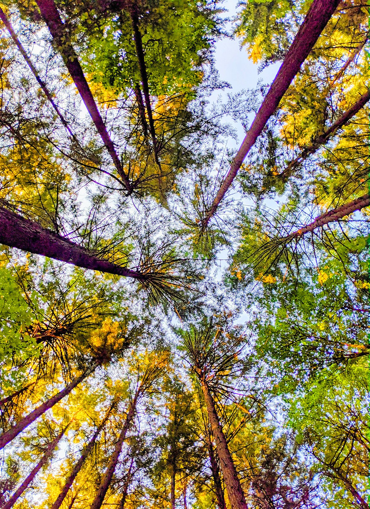
Forest Park, stretching for more than 8 miles and covering more than 5,100 acres of wooded land, is one of the country's largest urban forest reserves. The park is characterized by its diverse ecosystem, featuring lush forests, meadows, creeks, and wildlife. Its 70 miles of trails, including the Wildwood Trail that crisscrosses the park, is what I think makes Portland one of the best running cities in the country.
Two main running trails in Forest Park are Wildwood Trail and Leif Erikson Drive, intricately linked by an array of connector trails and fire lanes. Lower Macleay Park and Thurman Street are two main trailheads on the southern edge of the park. Additionally, the Ridge Trail at Wildwood Trail mile 21 and Leif Erikson Drive mile 8.5, serves as another key access point to the urban surroundings.
Wildwood Trail stretches for 30 miles, starting in Washington Park and runs through the entire length of Forest Park with significant elevation gain, especially south of Firelane 1 (Mile 11). Wildwood Trail ends at Newberry Rd, 1.5 miles away from St. Helens Rd (bus stop) and about 10 miles away from the city center (drive).
• Start & Finish: Lower Macleay trailhead; Ridge Trail trailhead
• Course Profile: 16.8 miles one-way, 1634 ft+, dirt trail (Strava route in bio)
Leif Erikson Drive is a gravel road that runs through the southern two thirds of the park and is shared among runners and cyclists. It provides a wider, flatter and usually busier route to explore the park.
• Start & Finish: End of NW Thurman St; Ridge Trail trailhead
• Course Profile: 8.5 miles one-way, 496 ft+, dirt and gravel trail (Strava route in bio)
* Connecting with more routes
- Washington Park (Route 3)
- St. Johns (Route 6)
Cafe / Both Northwest District and St. Johns offer a variety of food and drink options.
Transit / Forest Park is sparsely served by Bus Routes 15 (northwest trailheads) and 16 (along St. Helens Rd). If you finish the run across St. Johns Bridge, Bus Route 4 will take you back to downtown.

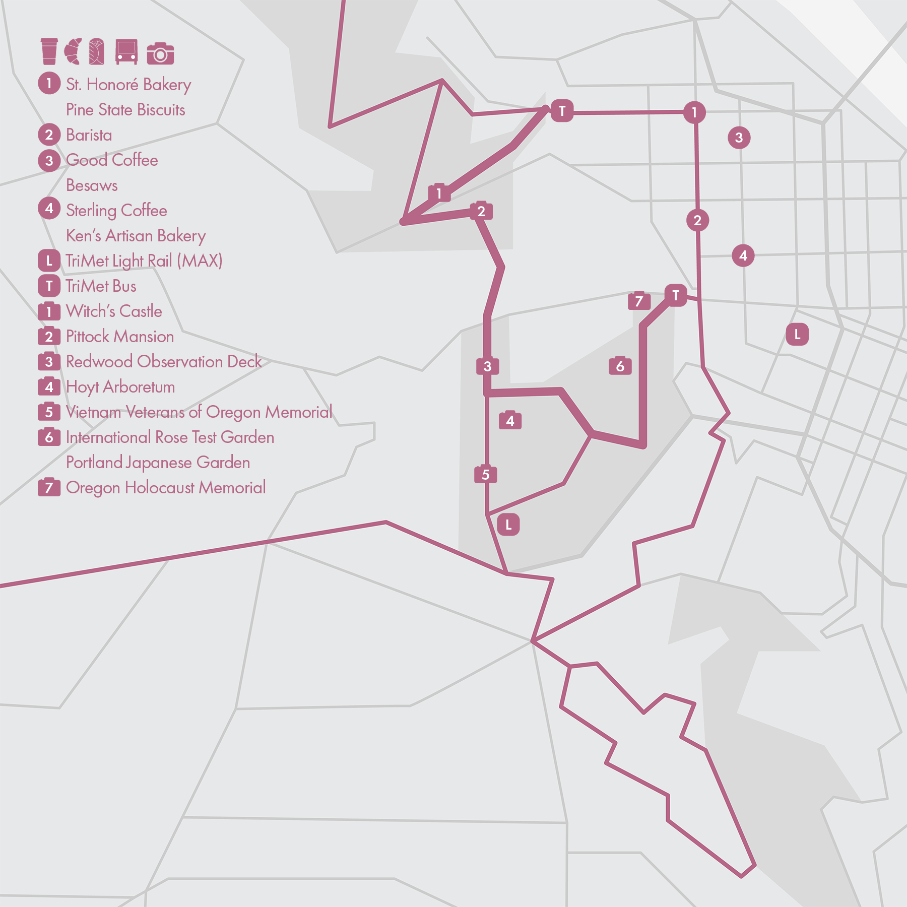
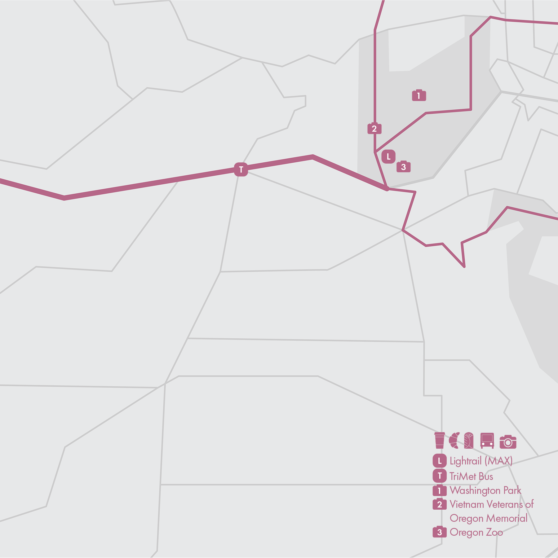
3. Washington Park
• Start & Finish: Washington Park entrance on Burnside St; Lower Macleay Park
• Course Profile: 5.6 miles one-way, 1000 ft+, mostly dirt trail (Strava route in bio)
Washington Park is an urban sanctuary on the outskirts of downtown Portland. Revered for its scenic splendor, meticulously cultivated gardens, extensive network of hiking trails, the park captures the essence of natural magnificence seamlessly blended with urban vibrancy.
This route starts at Burnside Rd and follows the MAC trail into the park. It continues on Wildwood Trail to Hoyt Arboretum and crosses Burnside Rd as it leaves Washington Park. After some steep ascents, the route passes Pittock Mansion, and crosses NW Cornell Rd into Forest Park (more on Forest Park in Route #2). Upon reaching Witch's Castle, switch to Lower Macleay Trail to exit Forest Park at Lower Macleay Park trailhead.
Along the route, check out:
- International Rose Test Garden: Portland is known as the "City of Roses", this garden features thousands of rose varieties.
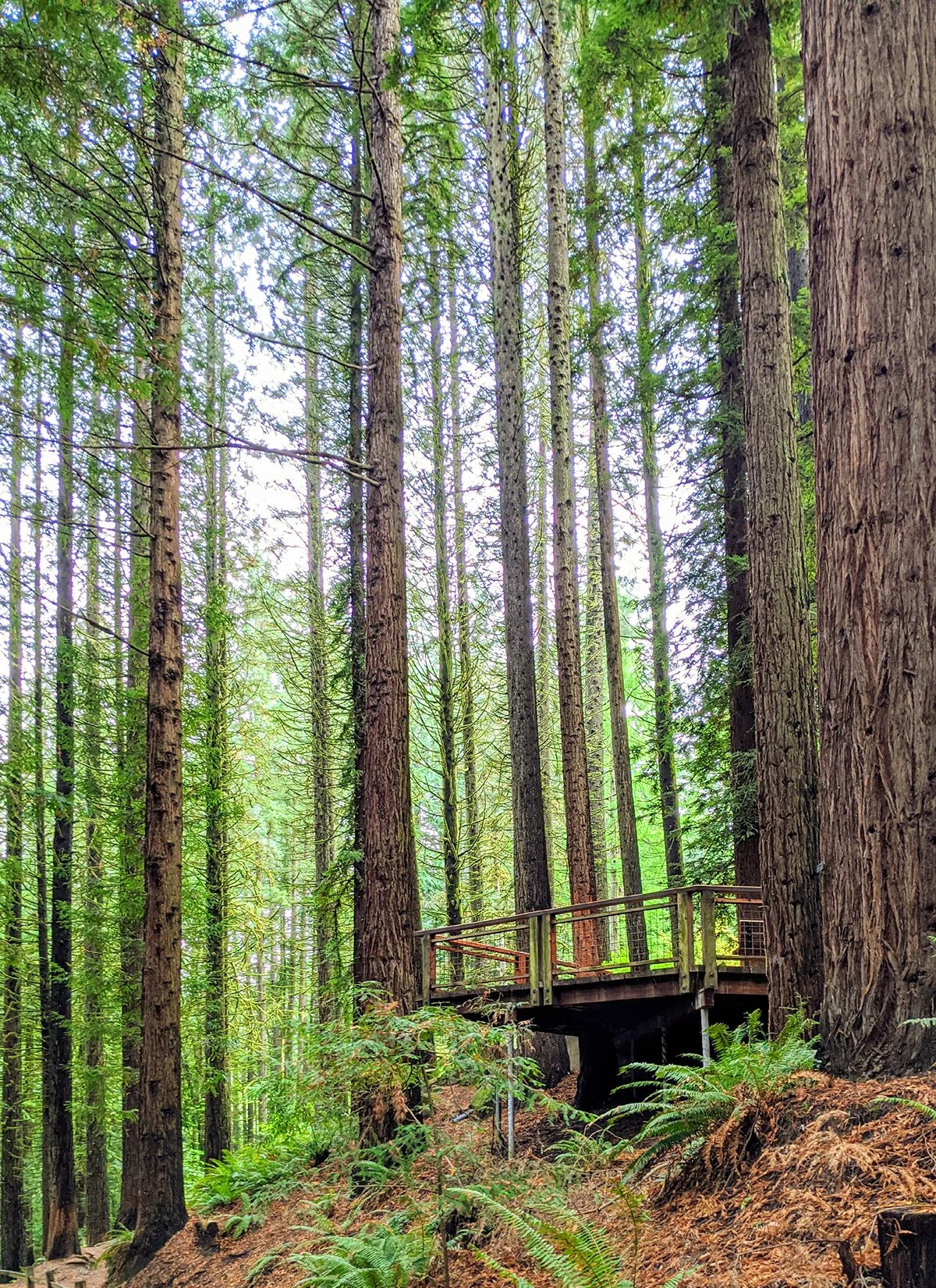
- Hoyt Arboretum: features over 2,000 species of trees and shrubs, and a Redwood Observation Deck (cover) right on Wildwood Trail.
- Pittock Mansion: a historic mansion originally built as a private residence for Henry Pittock, the owner of The Oregonian newspaper, and his wife Georgiana. It offers panoramic views of the city, the Willamette River, and the Cascade Mountain Range.
- In Washington Park, you'll also find Portland Japanese Garden, Portland Holocaust Memorial, Vietnam Veterans of Oregon Memorial, Oregon Zoo, among other landmarks.
Connecting with more routes
- Forest Park (Route 2)
- Southwest Hills (Route 4)
- Sunset Hwy (Route 10)
Cafe / Northwest District has a great concentration of coffee shops and cafes.
Transit / There is a light rail station (Max Red and Blue Line) at the southwest corner of Washington Park at Oregon Zoo. You can also find bus Route 20 on Burnside St and Route 26 near Lower Macleay Park.
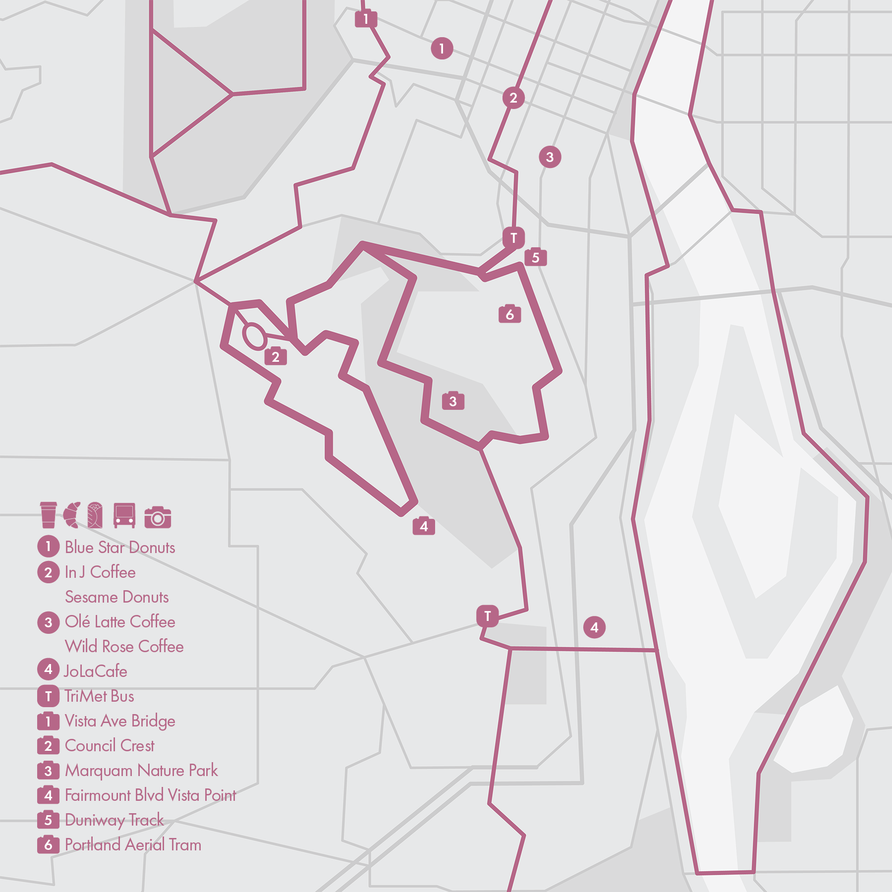
4. Southwest Hills
* Fairmount Blvd Loop
• Start & Finish: Fairmount Blvd at Talbot Ter
• Course Profile: 3.5 mile loop, 150 ft+, shared street (Strava route in bio)
This 3.5-mile loop runs along the ridge of the southwest hills, with a great view point at its southeast end. The route is a hidden gem known only to local runners. Fairmount Blvd is primarily a residential area, lined with elegant and often historic homes sitting on spacious lots, contributing to the neighborhood's upscale and peaceful ambiance.
Situated at the northwest end of the loop is Council Crest, a popular park and viewpoint, with its peak being the highest point of the city at 1,071 feet (326 m) and offering an excellent view of the surrounding landscapes.
To get to Council Crest and Fairmount Blvd, one can take
1. Marquam Trail from Washington Park (Route 3)
2. Vista Ave from Burnside St, featuring a great city view at Vista Ave Bridge (p6)
3. Marquam Trail from Marquam Nature Park (below)
* Marquam Nature Park
• Start & Finish: Duniway Park
• Course Profile: 5.1 miles loop, 855 ft+, dirt trail and sidewalk (Strava route in bio)
Marquam Nature Park is an urban park just outside Downtown Portland and known for its lush forested areas and hiking trails. The park has a network of well-maintained hiking trails that wind through the forested hills, varying in length and difficulty. This route traverses the park and loops back on Terwilliger Blvd to Duniway Track.
Connecting with more routes
- Waterfront (Route 1)
- Washington Park (Route 3)
- Sunset Hwy (Route 10)
- Terwilliger Blvd (Route 11)
Cafe / There are plenty of places to grab coffee or breakfast around PSU, just north of Duniway Track. If you take the George Himes Park exit, there are also cafes along the south waterfront.
Transit / This hilly residential area isn't well served by TriMet network. Plan a few extra miles to start and finish in downtown or waterfront. You may also experience the Portland Aerial Tram from OHSU to south waterfront.
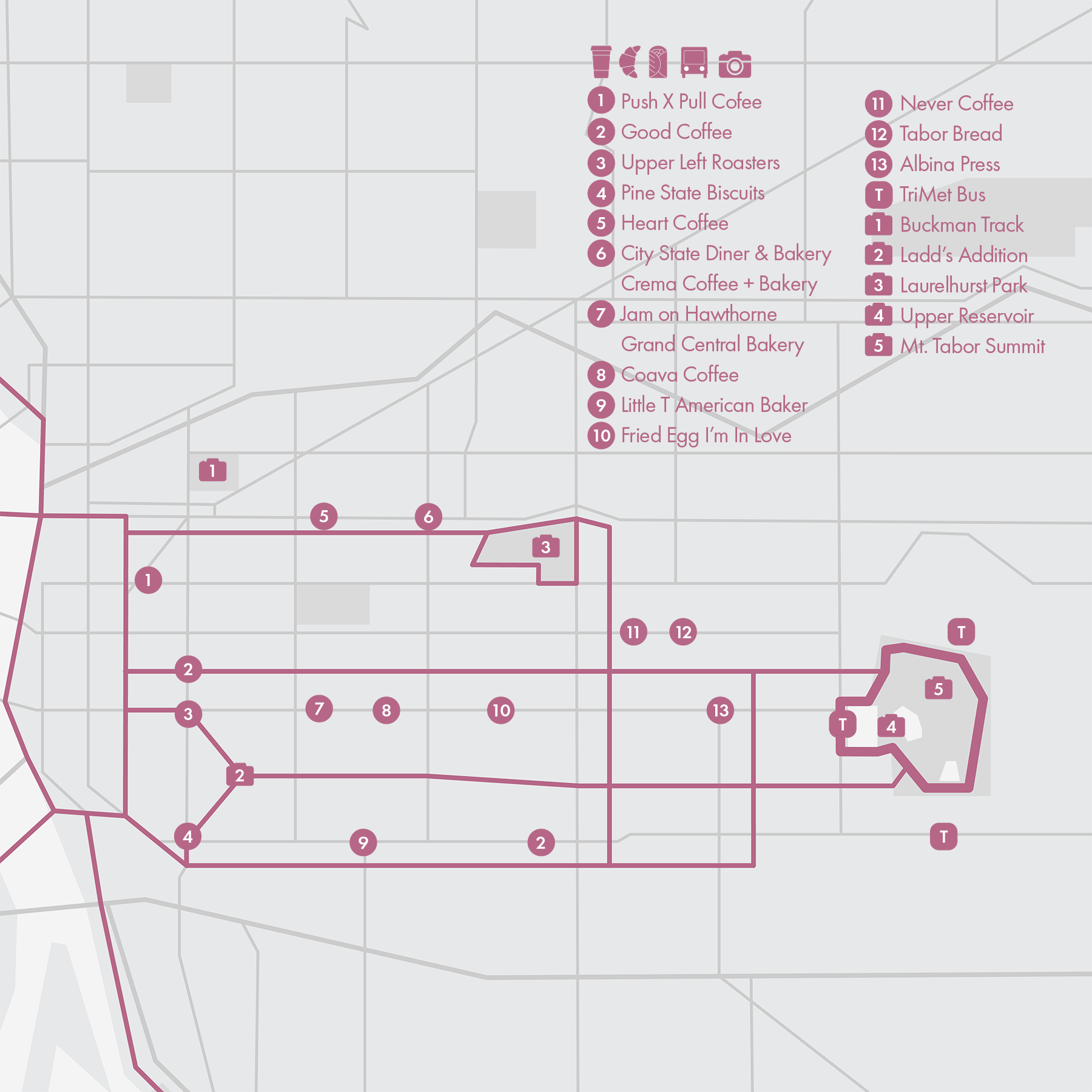
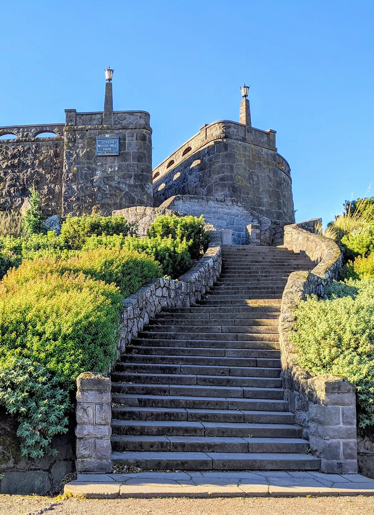
5. Mt. Tabor & Eastside
• Start & Finish: Anywhere along the loop
• Course Profile: 2.15 miles outer loop, 270 ft+, sidewalks and dirt trails (Strava route in bio)
Portland's Eastside is home to a variety of unique neighborhoods, some of the city's most iconic streets, as well as Mt. Tabor, one of the city's most prominent natural landmarks and a popular destination for outdoor recreation.
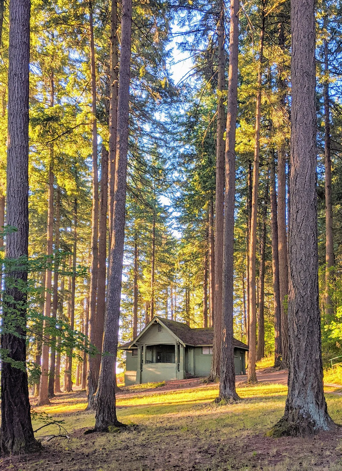
Mount Tabor is an extinct volcanic cinder cone formed around 300,000 years ago and is one of the few dormant volcano sites within a city's limits in the United States. Today a large urban park is built around it, offering intertwining hiking trails and three open-air reservoirs. The scenic summit is accessible through a winding climb or a series of steep stairs.
While Mt. Tabor is some 60 city blocks east of the Willamette River, it is connected to the riverfront by Neighborhood Greenways, designated as slow streets prioritizing pedestrians and cyclists. These streets include Ankeny St (to Laurelhurst Park), Salmon St/Taylor St, Harrison St/Lincoln St, and Clinton St.
Also to check out in the Eastside:
- Laurelhurst Park: designed by the renowned landscape architects John Charles Olmsted and Frederick Law Olmsted Jr. The park is covered by a diverse array of trees and a network of walking trails.
- Ladd's Addition: a historic neighborhood known for its unique radial street layout and beautiful early 20th-century architecture. It features four small rose gardens on four sides and a bigger one in the center.
- Buckman Track: a 1/3 mile non-standard track.
* Connecting with more routes
- Waterfront (Route 1)
- Northeast Portland (Route 9)
- Southeast Portland (Route 12)
Cafe / Eastside has a ton of great cafes and restaurants, especially along Belmont St, Hawthorne St, Division St, and SE 11th/12th Ave.
Transit / Most TriMet buses run East-West on the east side, including frequent service Route 2/14/15/20 along Division St/Hawthorne St/Belmont St/Burnside St. Route 75 runs north-south on César Chavez Blvd.
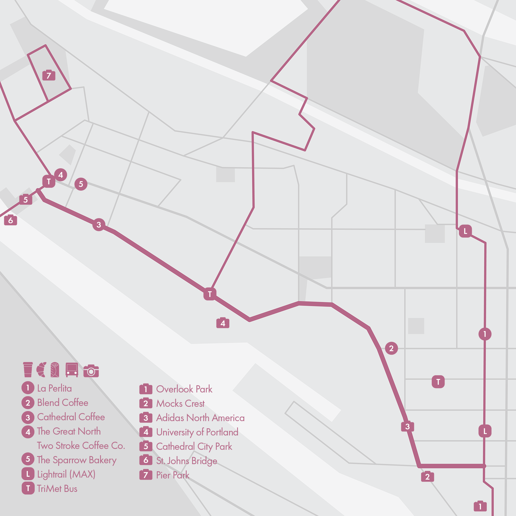
6. Willamette Boulevard - St. Johns
• Start & Finish: Going St at Interstate Ave to Cathedral City Park
• Course Profile: 5.0 miles, mostly flat, sidewalks (Strava route in bio)
Willamette Blvd is a scenic road that stretches along the west side of the Willamette River, on a picturesque bluff that offers great views of the city skyline and the river. Two of the best viewpoints are slightly south of this route, at Overlook Park and Mocks Crest.
There are a few interesting places to visit along Willamette Blvd, including Adidas' North America headquarters and University of Portland, a private Catholic university known for its beautiful campus.
The highlight of this route is the destination–St. Johns, a vibrant, underrated (in my opinion) neighborhood at the Northwest corner of Portland. The charming downtown area boasts a mix of historic buildings, trendy shops, cafes, and restaurants. A mile north of downtown you'll find Pier Park, a big and tranquil green space that's great for relaxing or running.
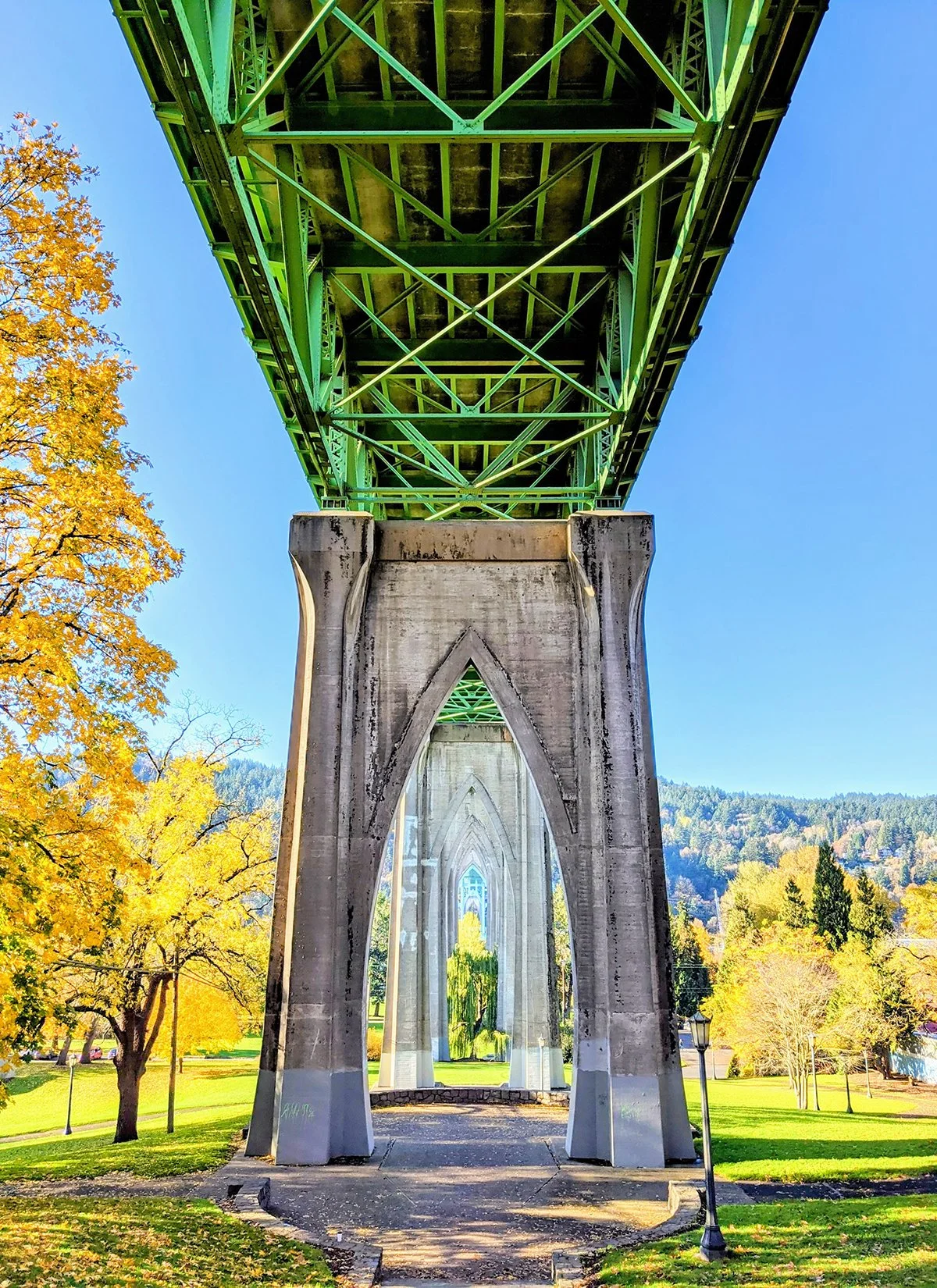
A must visit of St. Johns is the waterfront Cathedral Park, featuring the iconic St. Johns Bridge. This Gothic-style bridge has a main span of an impressive 1,207 feet (368m), and two towers that rise 400 feet (122m) above the river, giving the bridge a majestic and distinctive appearance. St. Johns Bridge is one of the most recognizable landmarks in Portland and is a favorite spot for photography enthusiasts.
Connecting with more routes
- Forest Park (Route 2)
- North Portland & Vancouver, WA (Route 7)
- Marine Dr (Route 8)
- Northeast Portland (Route 9)
Cafe / At the start of the route, you'll find an array of scattered cafes along Interstate Ave; near the end of the route, St. Johns is home to some charming cafes, eateries, and shops. Also check out Cathedral Coffee, a popular and cyclist-friendly spot on Willamette Blvd.
Transit /
MAX Yellow Line runs along Interstate Ave.
TriMet Bus 44 runs along Willamette Blvd.
TriMet Bus 4, 16, and 75 serve the St. Johns neighborhood
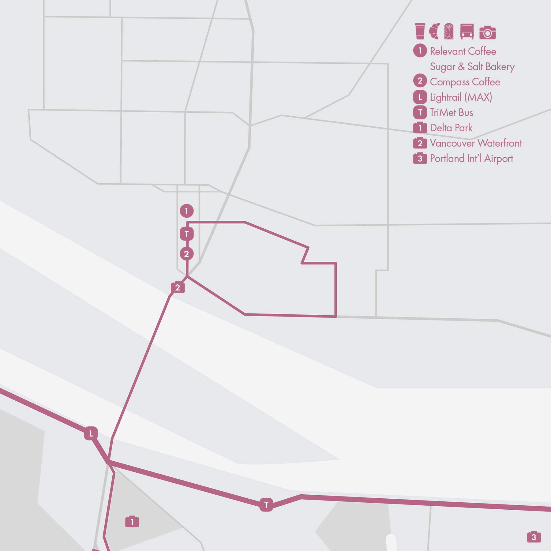
7. North Portland - Vancouver, WA
• Start & Finish: Kenton Park to Vancouver Waterfront
• Course Profile: 7.4 miles incl. a 4-mile loop in Vancouver, WA. 225 ft+, mostly sidewalks (Strava route in bio)
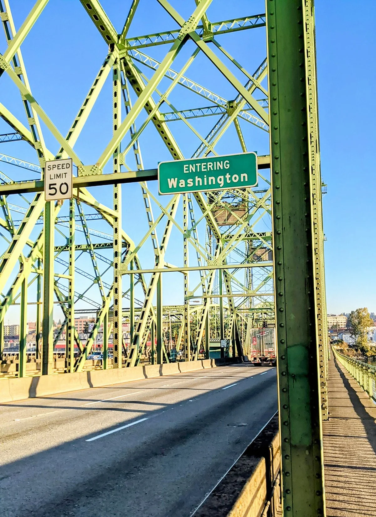
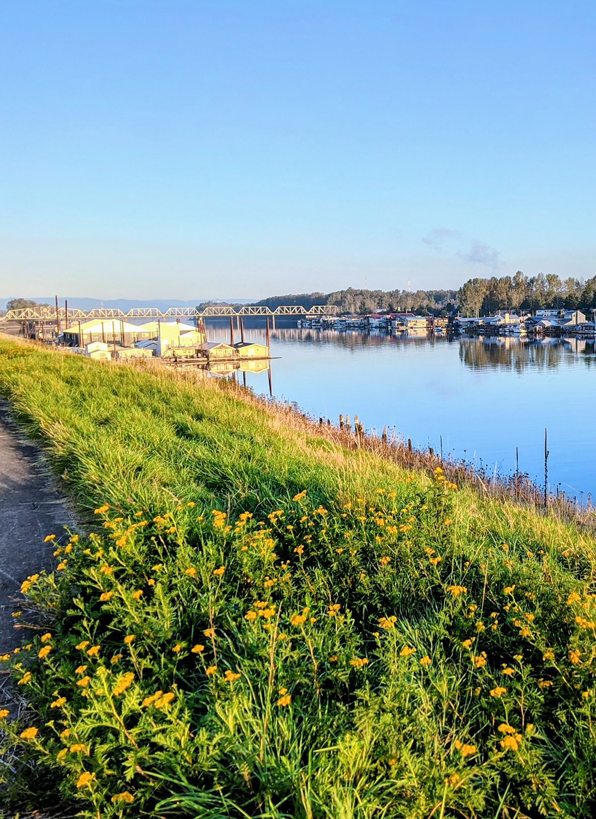
Vancouver, WA is situated on the northern bank of the Columbia River, serving as a counterpart to the city of Portland just across the water. The two cities are connected by the I-5 and I-205 bridges, each equipped with dedicated paths for pedestrians and cyclists. This route uses the I-5 Bridge multi-use path (cover), starting at the northern tip of Delta Park and incorporating a brief ramp detour on Hayden Island before crossing the state line and leading directly to the picturesque Vancouver waterfront.
Vancouver's Waterfront Park offers great views of the Columbia River, green spaces, walking paths, public art installations, and a waterfront trail that connects to the larger Columbia River Renaissance Trail, part of it is featured in this route's 4-mile loop in Vancouver. The loop is between Evergreen blvd and waterfront, circling around the Pearson airfield and passing by Fort Vancouver National Historic Site.
On the Portland side of the Columbia River, a popular running route in North Portland is the Columbia Slough Trail, which runs about 2 miles following the path of the Columbia Slough, stretching from Vancouver Avenue to Portland Road.
* Connecting with more routes
- Marine Dr (Route 8)
- Northeast Portland (Route 9)
Cafe / As this is a rather industrial area, the cafes concentrate either south of Columbia Slough in Portland's Kenton neighborhood (p10), or north of Columbia River in Vancouver WA.
Transit / MAX Yellow Line stops near Delta Park and terminates at Expo Center by I-5. Vancouver's C-TRAN route 105 is an express bus line between downtown Vancouver and downtown Portland. You can use Portland's HOP card to pay for its fare.

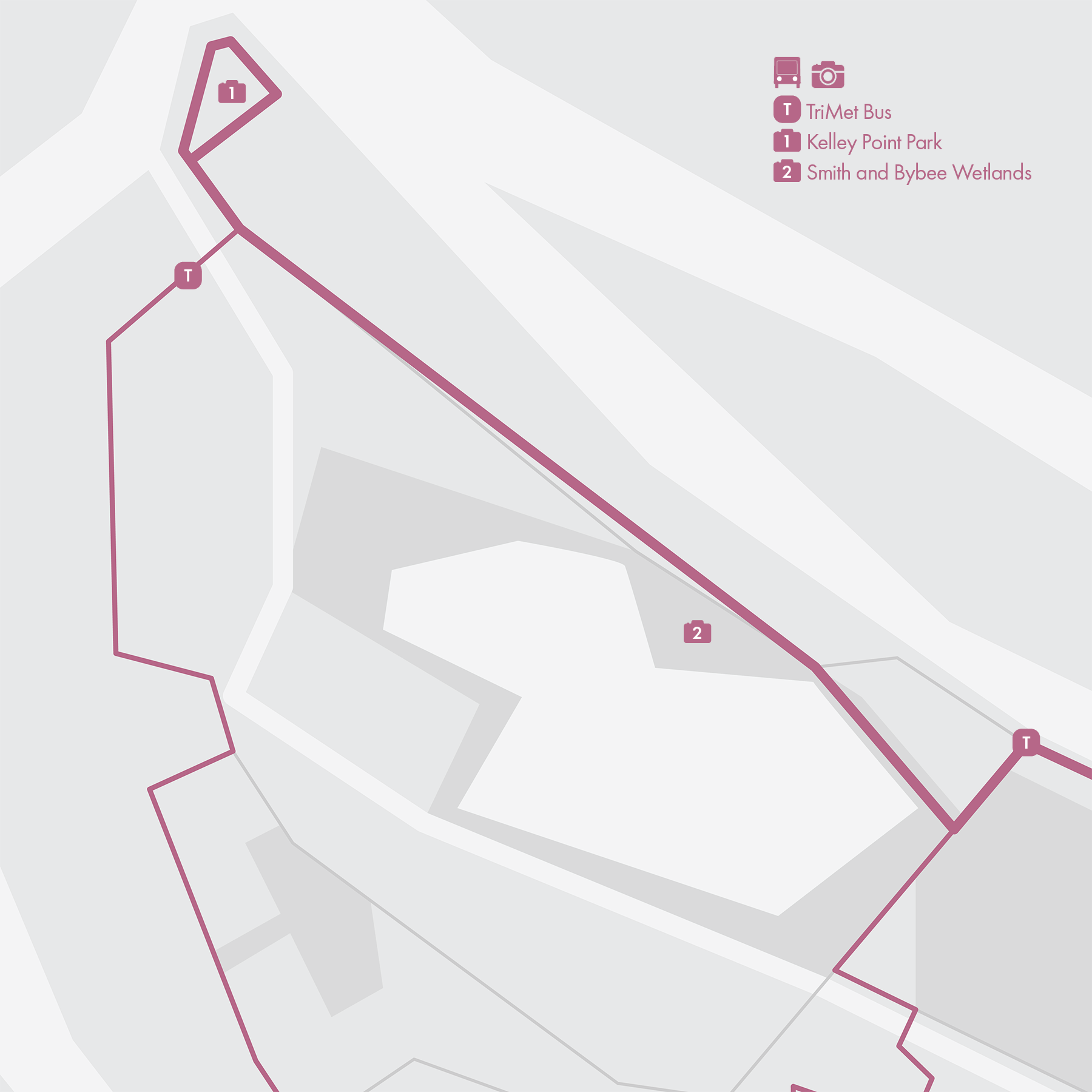
8. Marine Dr
• Start & Finish: Marine Dr at I-205; Kelley Point Park
• Course Profile: 14.7 mile one way, flat, multi-use path (Strava route in bio)
Marine Dr runs through an industrial corridor on the north edge of Portland. It traces the south bank of Columbia River, and offers beautiful riverfront views. The majority of this route is a designated biking and walking path; the long, straight route is ideal for distance running.
While the area along Marine Dr is mostly industrial, there are a few interesting places to check out:
- Portland International Airport: located near the east end of the route, you'll have a great view of the airport tarmacs and big steel birds from several points on the bike path.
- Smith and Bybee Wetlands Nature Preserve: one of the largest protected urban wetlands in the country. The wetlands cover an area of approximately 2000 acres and provide crucial habitat for a diverse range of plant and animal species. There is a trailhead opposite the entrance of Kelley Point Park, and another shorter trail on the north side of Smith Lake.
- Kelley Point Park: located at the west end of the route and at the confluence of the Willamette and Columbia Rivers. The park offers a unique natural setting where visitors can enjoy various outdoor activities and appreciate the scenic beauty of the river confluence. It has several miles of trails that wind through the forested areas.
* Connecting with more routes
- North Portland & Vancouver (Route 7)
- Northeast Portland (Route 9)
Cafe / There aren't any cafes or restaurants along or near Marine Dr. If you are looking for a place to refuel or relax after the run, go to St. Johns or Kenton neighborhood of Portland, or cross the river to downtown Vancouver, WA.
Transit / MAX Yellow Line terminates at Expo Center near the intersection of Marine Dr and I-5. MAX red line serves Portland Airport and its Cascade Station is less than 1 mile from Marine Dr. Bus route 11 serves Marine Dr with limited service.
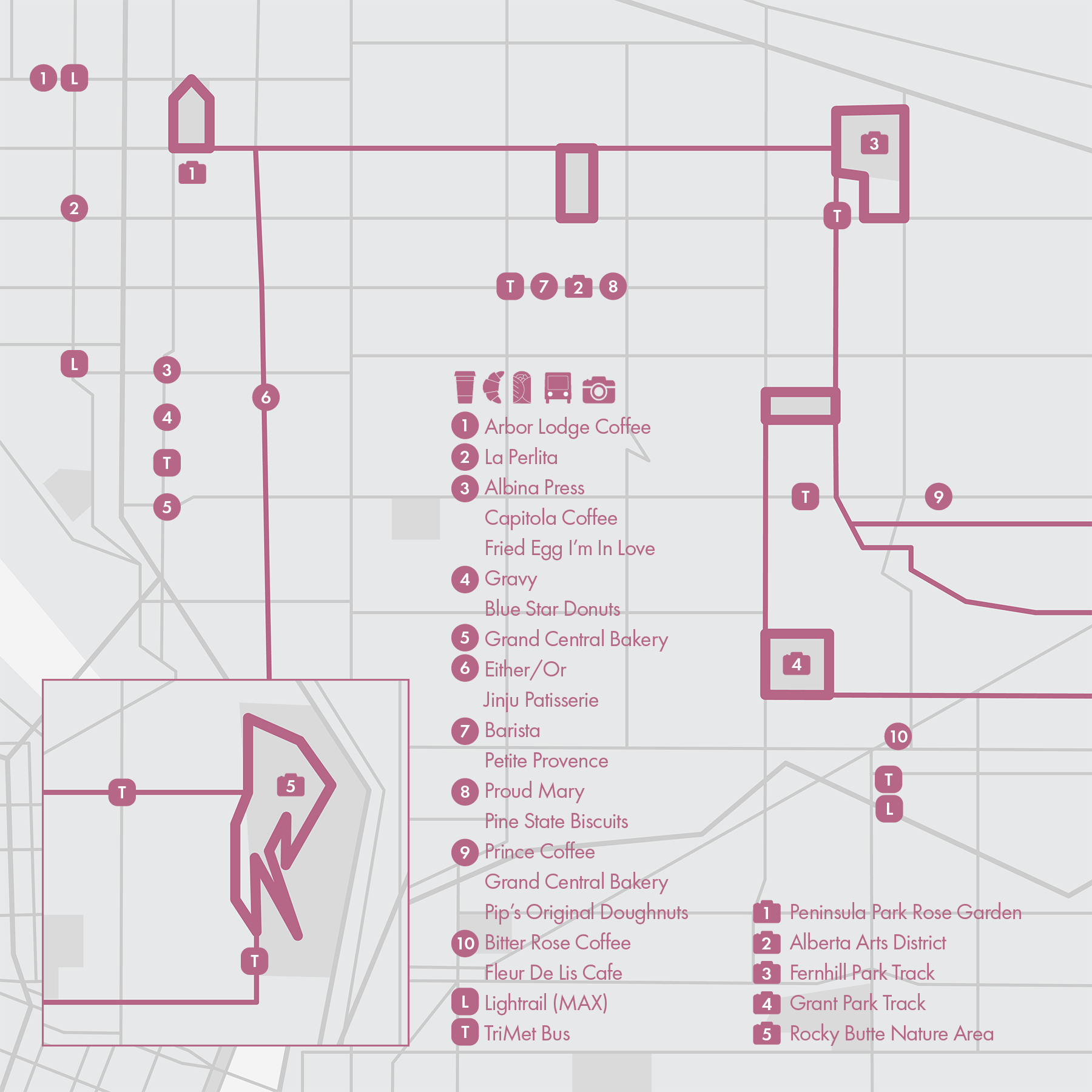
9. Northeast
Northeast Portland is a vibrant and diverse region, boasting an array of eclectic neighborhoods, historic homes, and charming tree-lined streets. Running in this entire area is pleasant, especially on the Neighborhood Greenways, which are select streets designated as "slow" streets, prioritizing biking and walking as preferred modes of transportation.
In the east-west direction,
- Ainsworth St: this boulevard style street with grass median connects Peninsula Park/Rose Garden (0.5-mi loop), Alberta Park (0.6-mi loop), and Fernhill Park (1-mi, public track)
- Neighborhood greenways: Going St, Klickitat St, Tillamook St.
In the north-south direction,
- Vancouver St / Williams St: two parallel one-way streets that form a business corridor
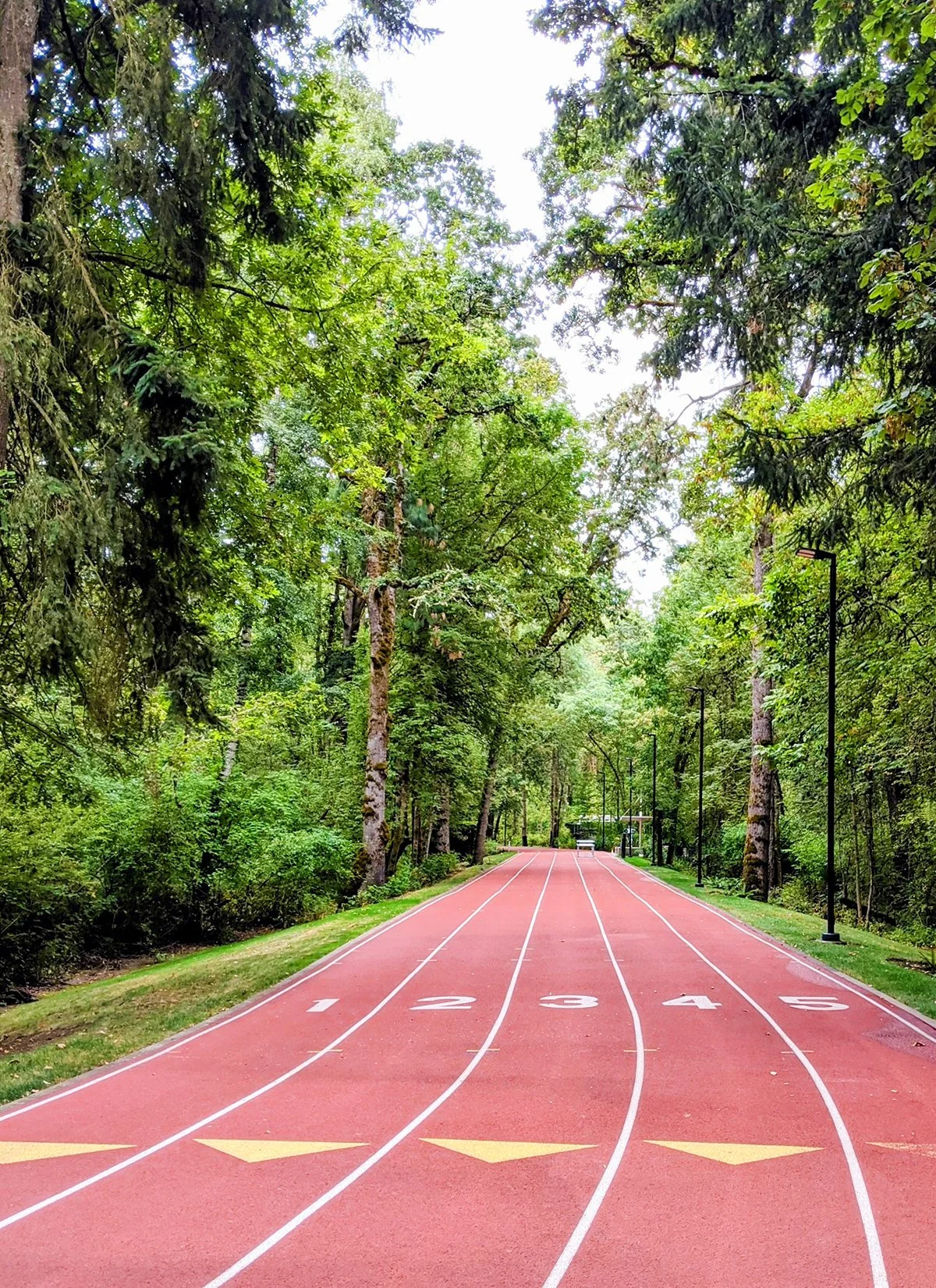
- 37th Ave & Alameda St: this neighborhood greenway connects Fernhill Park, Wilshire Park (0.5-mi loop), Grant Park (public track).
• Start & Finish: NE 92th Ave & Fremont St
• Course Profile: 3.2 mile one way, 416 ft+, sidewalks (Strava route in bio)
Further east is Rocky Butte Natural Area, a scenic and prominent natural landmark 600 feet above sea level, named after the volcanic rock formation that makes up its summit. It offers stunning panoramic views of the surrounding areas.
* Connecting with more routes
- Willamette Blvd (Route 6)
- North Portland & Vancouver (Route 7)
- Marine Dr (Route 8)
Cafe / NE Portland is a true haven for food and coffee enthusiasts. Notable neighborhoods known for their vibrant culinary scenes are the Alberta Arts District (p10) and the Boise neighborhood.
Transit / MAX Red, Blue and Green Lines run along I-84 and MAX Yellow Line runs along I-5, both on the border of this area. Bus routes with frequent service that serve this area include 4, 6, 8, 12, 72, 75.
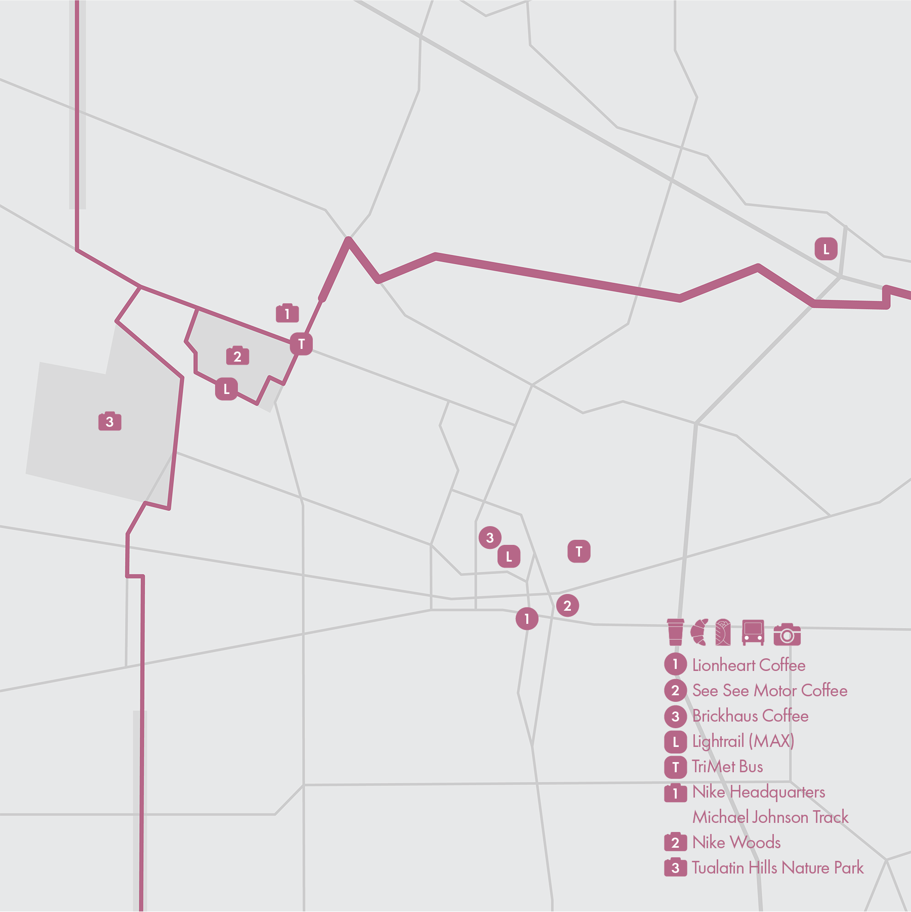
10. Beaverton (Nike HQ)
• Start & Finish: Washington Park to Nike HQ
• Course Profile: 5.9 mile one way, 213 ft+, multi-use path and sidewalks (Strava route in bio)
Beaverton is a suburb of Portland, probably best known to the running world as home to Nike's Worldwide Headquarters. The route begins at the Washington Park, taking the multi-use path along the Sunrise Highway (US-26) ans SW Park Way to the main campus of Nike HQ, located at One Bowerman Drive.
Nike HQ main campus is centered around a small lake, with its buildings named after legendary Nike athletes, including running icons like Steve Prefontaine and Joan Benoit Samuelson.
There are a few nice running options in and around Nike HQ, but keep in mind that these areas are Nike's properties and may not be open to the public. It's essential to be respectful...and smart–avoid wearing competitor brand apparels or shoes.
- Michael Johnson Track: this scenic 5-lane track encircles a small forest and has a bronze statue of Michael Johnson on its sideline.
- Nike Campus Loop: this 2-mile wood chip trail loop winds around the perimeter of the campus.
- Nike/Hollister Woods: this dense woods features a 1.5-mile loop trail. Although still Nike's property, it is more likely to access this trail.
Not far from Nike HQ, Tualatin Hills Nature Park offers a variety of trails that wind through forests, wetlands, and meadows. From the park, there are regional multi-use paths like Waterhouse Trail and Westside Trail.
One can also add more miles at the beginning of this route with
- Washington Park (Route 3)
- Marquam Park (Route 4)
Cafe / There isn't a great place to grab coffee or snacks along this route, but you'll find plenty cafes in Beaverton Downtown.
Transit / MAX Red and Blue Line connect Portland with downtown Beaverton, via Washington Park station, which is near the start of the run. The Blue Line also passes by Nike Woods. Beaverton Transit Center is a transit hub with bus services to Portland and other suburbs.
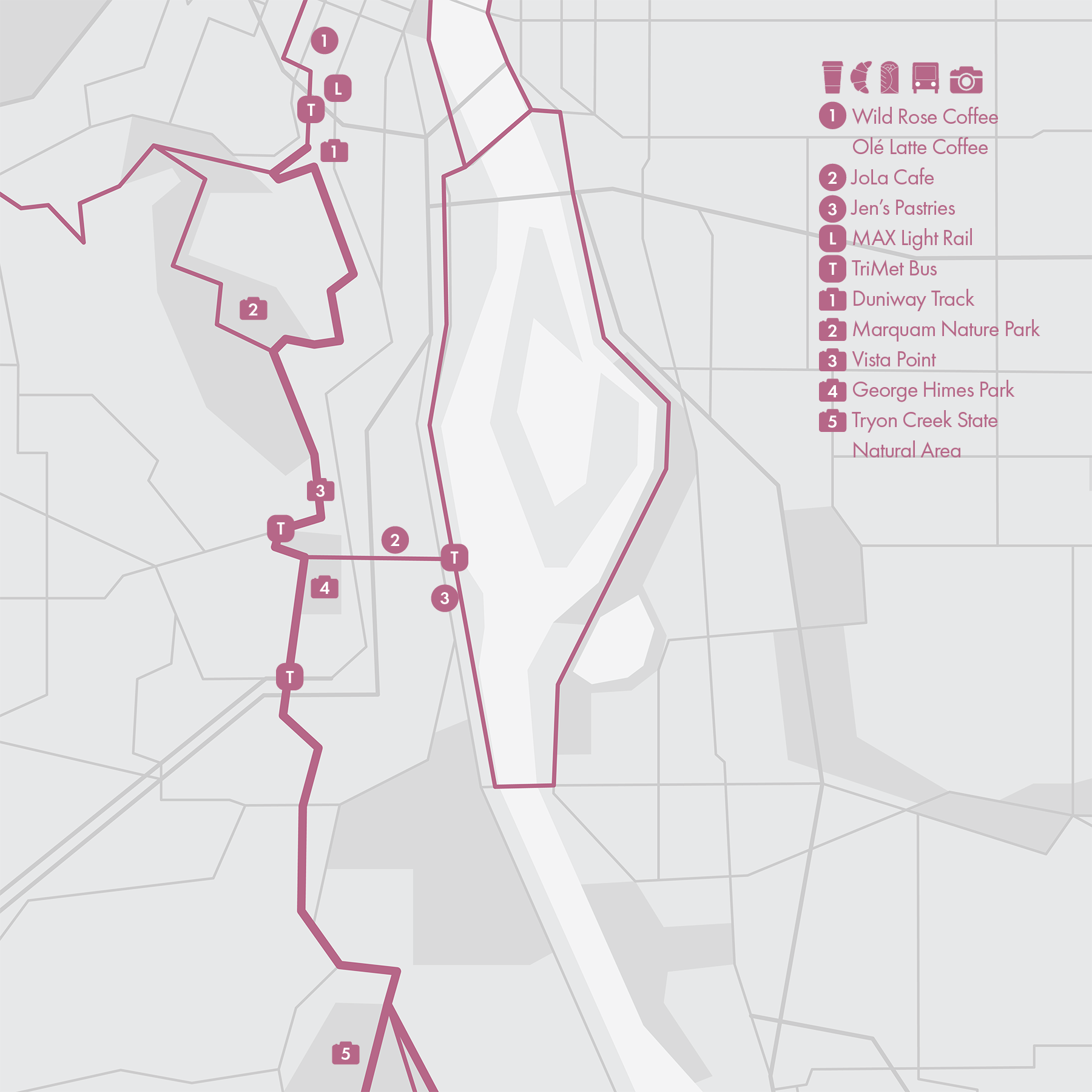
11. Terwilliger Blvd
• Start & Finish: Duniway Track and Lake Oswego
• Course Profile: 7.5 miles loop, 609 ft+, mostly sidewalks (Strava route in bio)
Terwilliger Boulevard is a scenic and well shaded parkway in Portland's Southwest neighborhoods. It starts at Duniway Track, Portland's most popular public track, passes by OHSU campus, the Portland Aerial Tram, Marquam Nature Park, and leads to Tryon Creek Park. The hillside parkway offers several overlooks for panoramic views of downtown Portland, the Willamette River, and the Cascade Mountains in the distance (the best marked in the map).
The most popular running routes on Terwilliger Boulevard is the out-and-back run covering the initial 2.7 miles (to Capitol Hwy) or 3.5 miles (to Barbur Blvd) of the boulevard. The run begins with a notable incline, followed by a series of rolling hills. For those seeking an alternative route or a loop option, George Himes Park offers a dirt trail that connects Terwilliger with S Iowa St and further extends to the waterfront trail, offering a different set of sceneries.
South of Barbur Blvd, the highlight along Terwilliger Blvd is Tryon Creek State Nature Area. The 650-acre park has an extensive trail system, with well-maintained trails varying in difficulty. The easiest to follow is the Terwilliger trail, which runs next to Terwilliger Blvd. As you venture deeper into the park, you'll encounter a myriad of other trails meandering through the forested landscape, offering serene views and a chance to explore the park's diverse ecosystems.
* Connecting with more routes
- Waterfront Loop (Route 1)
- West Hills (Route 4)
- Lake Oswego (Route 14)
Cafe / There are plenty of places to grab coffee or breakfast around PSU, just north of Duniway Track. If you take the George Himes Park exit, there are also cafes along the south waterfront.
Transit / MAX Orange Line serves PSU. TriMet Bus has infrequent services along Terwilliger Blvd, and frequent services at the intersections of Terwilliger Blvd with Capital Hwy and Barbur Blvd.
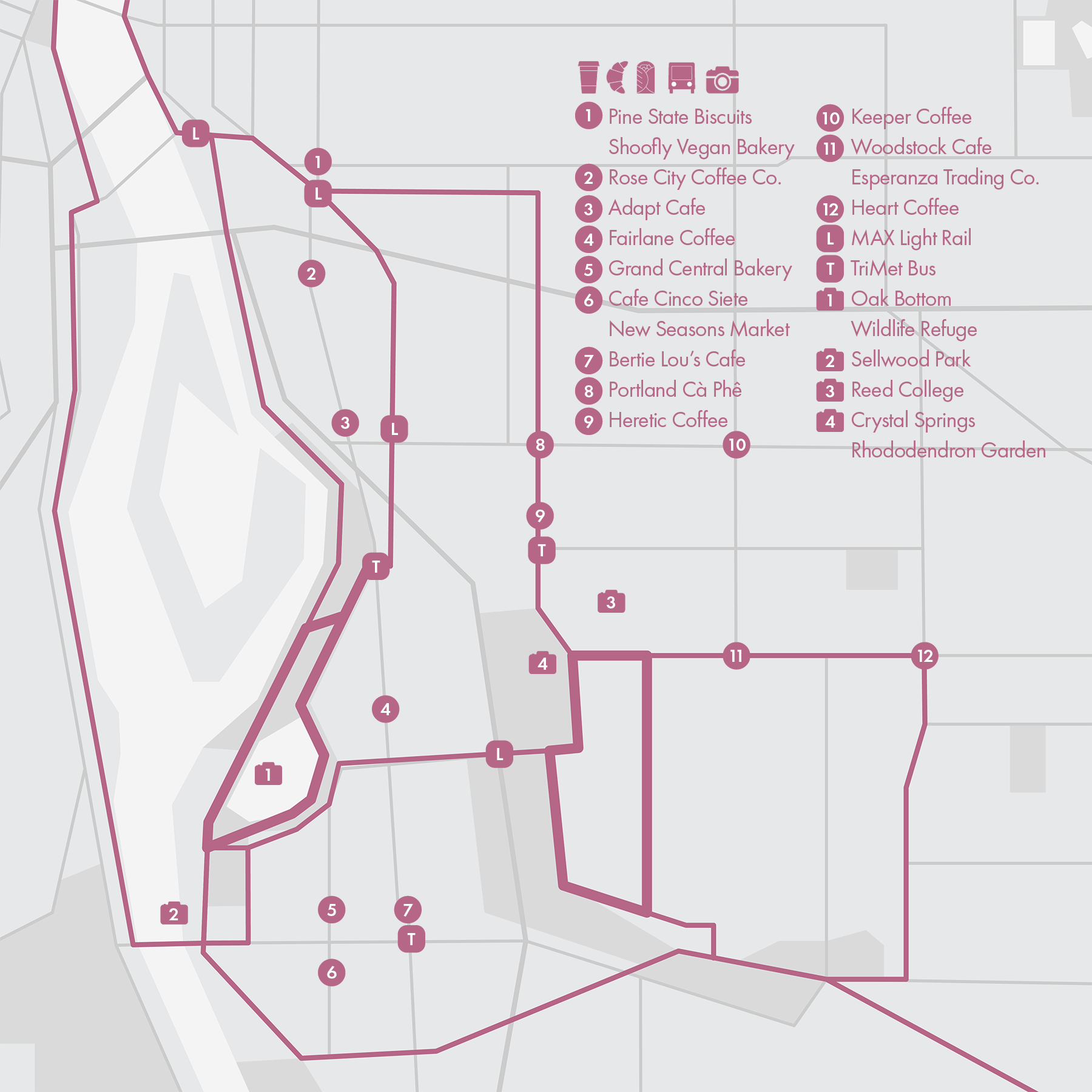
12. Southeast
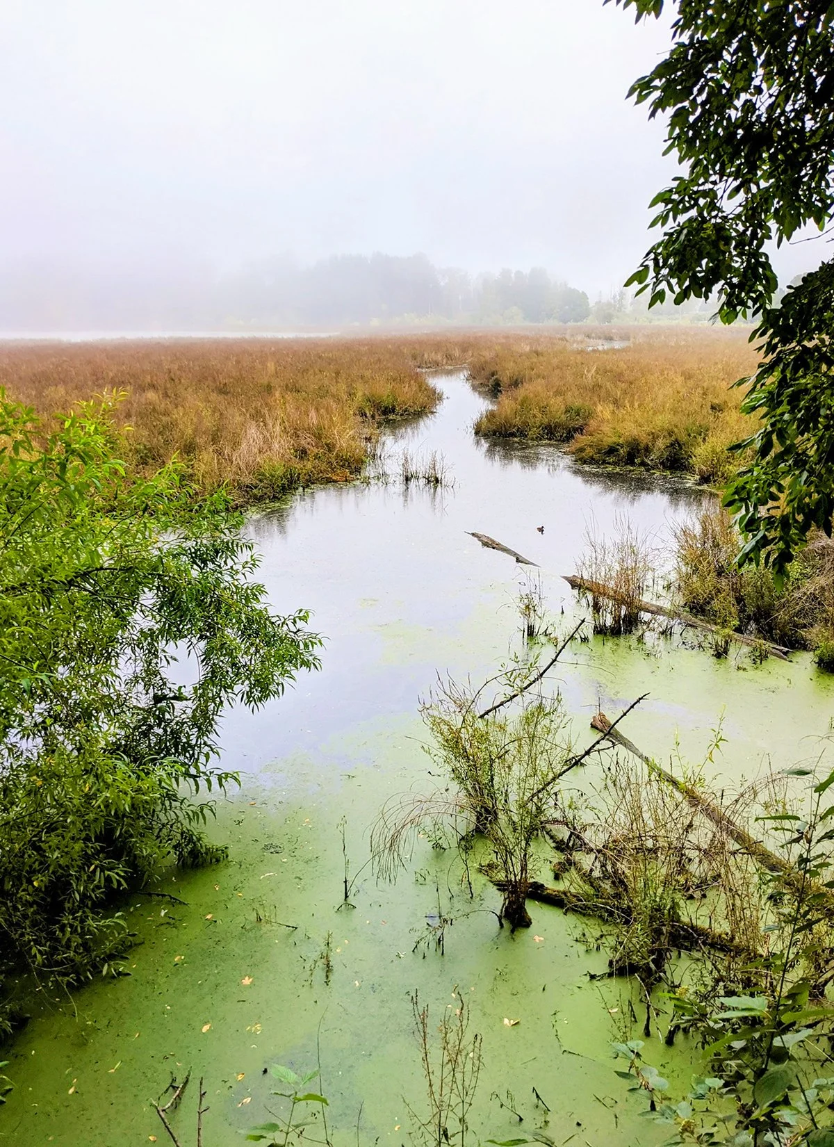
Oaks Bottom Wildlife Refuge
• Start & Finish: Trailhead on Milwaukie Ave (at Mitchell St)
• Course Profile: 2.9 miles loop, 115 ft+, multi-use path and dirt trail (Strava route in bio)
Oaks Bottom Wildlife Refuge is one of the largest urban wildlife habitats in the country, and provides a crucial habitat for a diverse array of plant and animal species. It is named after the oaks that grow in the area and the "bottoms," which refer to the low-lying wetlands and floodplain.
This route utilizes part of the paved multi-use Springwater Corridor trail and links it up with the dirt trails inside the refuge, forming a loop around the lake in the center of the refuge.
Reed College Parkway
• Start & Finish: Reed College Parkway at Woodstock Blvd
• Course Profile: 2.4 miles loop, 86 ft+, sidewalks (Strava route in bio)
Reed College is a private liberal arts college in the residential neighborhood of Eastmoreland. This 2.4 mile loop runs just outside the college and is part of the Portland Marathon route, featuring the tree lined Reed College Parkway. Got some more time? Check out the Crystal Springs Rhododendron Garden nearby.
The above two segments can be connected via Bybee Blvd. A few other local streets in this neighborhood that are popular for running include Woodstock Blvd, SE 28th, 41st, and 52nd Ave.
* Connecting with more routes
- Waterfront Loop (Route 1)
- Springwater Corridor (Route 13)
- Trolley Trail (Route 15)
Cafe / Southeast Portland is home to some of the best coffee shops in the city. Located in these tranquil and unassuming neighborhoods, these hidden gems remain a well-kept secret, often overlooked by tourists and even some locals. The City Runner's personal favorites include Adapt Cafe (p10), Keeper Coffee, and Portland Cà Phê.
Transit / MAX Orange Line connects this area with Downtown Portland along Milwaukie Ave and SE 17th Ave. TriMet Bus also serves this area: route 10, 17 (frequent), 19, 70, 75 (frequent).
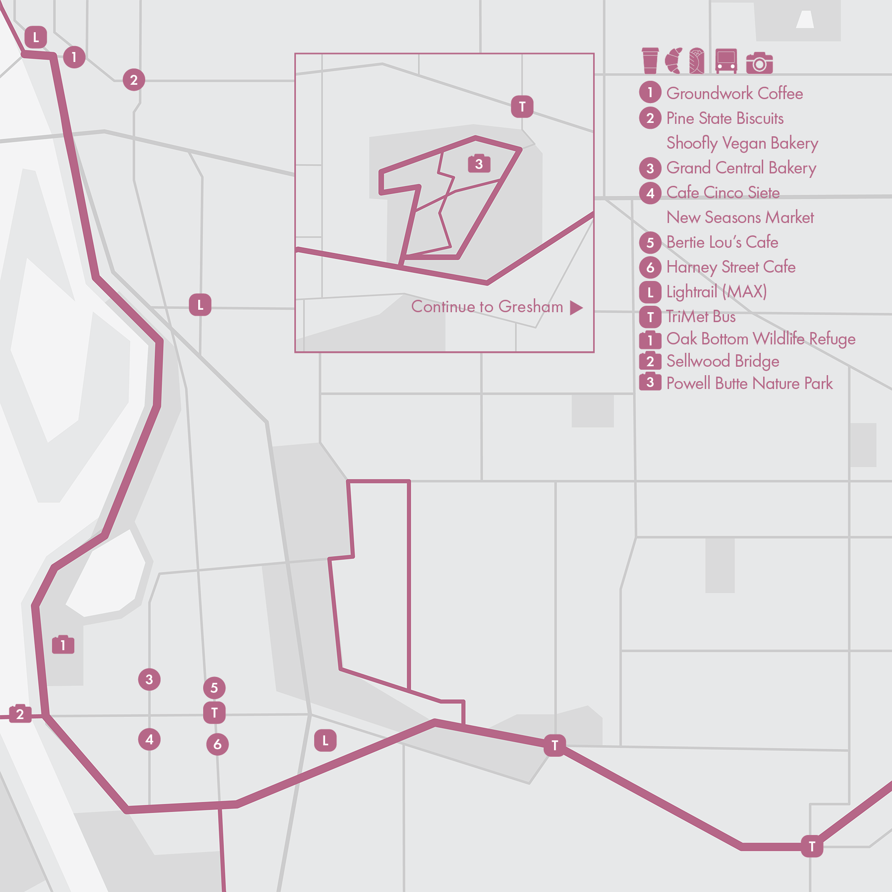
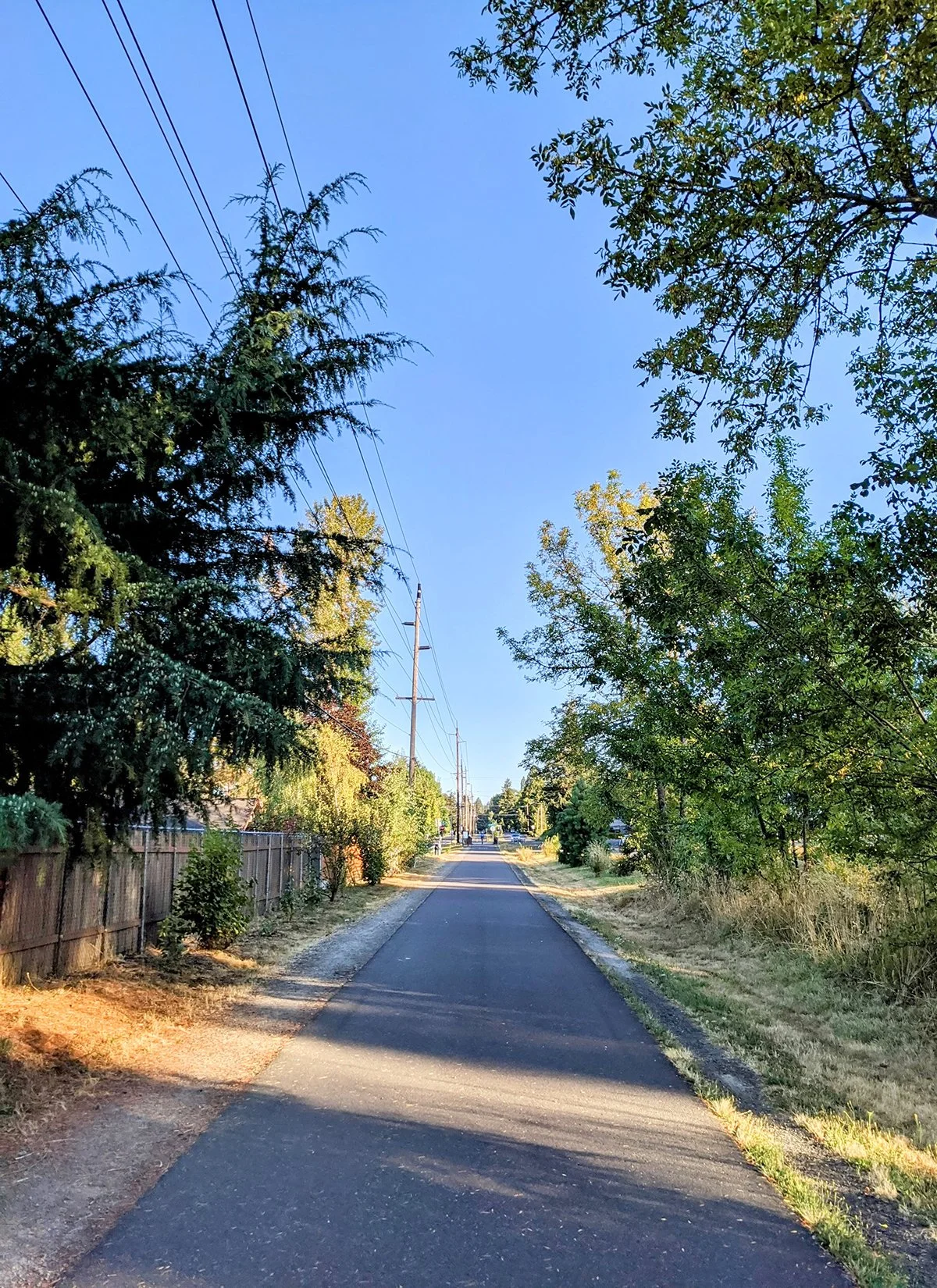
13. Springwater Corridor & Powell Butte Nature Park
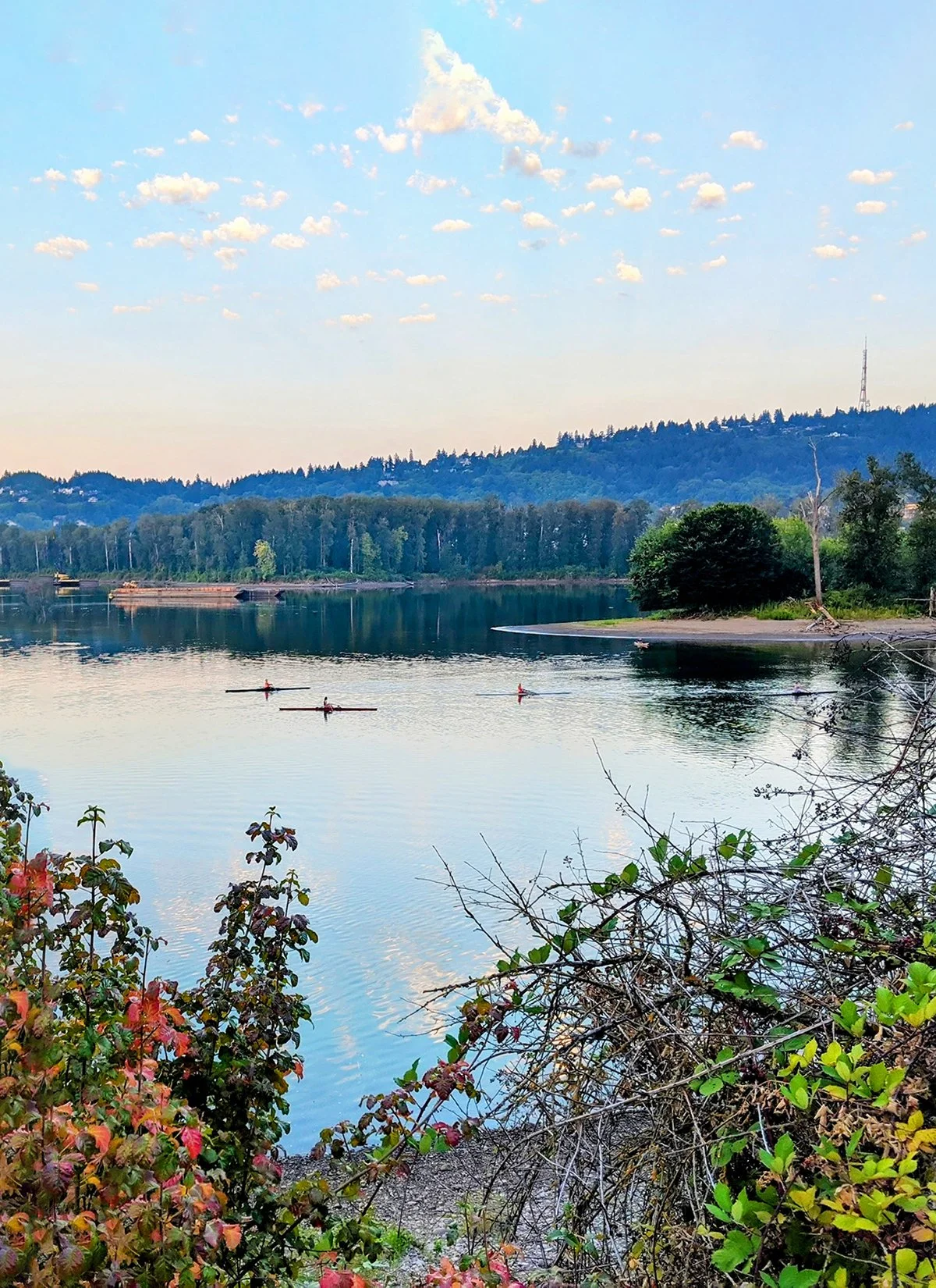
• Start & Finish: West end of Tilikum Crossing Bridge; Gresham Main City Park
• Course Profile: 15.8 miles one way, 318 ft+, multi-use path (Strava route in bio)
This route features the first 16 miles of the Springwater Corridor, a multi-use path from downtown Portland to Downtown Gresham.
Along the trail, you'll encounter scenic views, wetlands, wooded areas, and several parks. The first 3 miles, between is part of the Willamette Waterfront loop (Route 1) and the most popular segment of the trail, frequently used by runners and cyclists. There are two trailheads to Oak Bottom Wildlife Refuge (Route 12), a great wetland area to enjoy nature.
As the trail continues eastward from the Sellwood neighborhood, it moves away from the urban core, offering a quieter and more serene experience. 11.5 miles from the start, or about 8 miles from Sellwood, there is the trailhead to Powell Butte Nature Park.
• Start & Finish: Powell Butte Parking Lot
• Course Profile: 3.8 miles one way, 490 ft+, dirt trail (Strava route in bio)
Powell Butte is an extinct volcanic cinder cone. The park offers a diverse range of ecosystems including grassy meadows and oak woodlands, and it provides panoramic views of the surrounding landscapes, including the city skyline and Mount Hood. There are multiple dirt and mountain bike trails in the park. Besides the trailhead on Springwater Corridor trail, the main entrance and parking lot are off SE Powell Blvd in the northeast corner of the park.
Cafe / There are an abundance of cafes and restaurants in Hosford-Abernethy, not far from the start of the trail; as well as in Sellwood, about 3-4 miles in along the trail. Once leaving the urban area, however, there isn't much along the trail.
Transit / TriMet MAX Orange Line serves the start of Springwater Corridor, and Blue Line serves Downtown Gresham, about 16 miles in the trail. Bus Route 70 serves the Sellwood and Route 9 serves Powell Butte Nature Park.
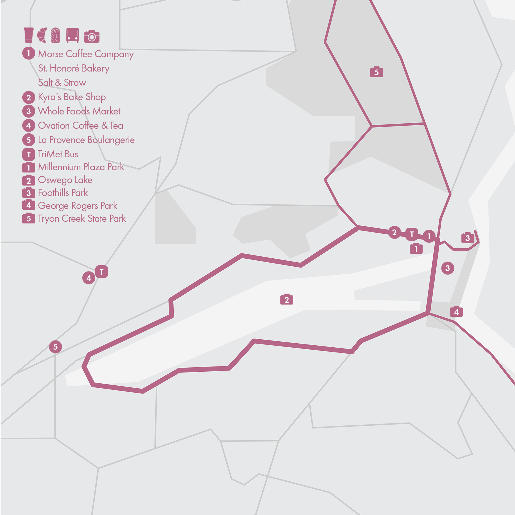
14. Lake Oswego

• Start & Finish: Lake Oswego Millennium Plaza Park (p3)
• Course Profile: 6.8 miles one way, 540 ft+, mostly road shoulder (Strava route in bio)
Lake Oswego is an affluent suburban city of Portland and once the hub of Oregon's brief iron industry in the late 19th century (you can find the restored remains of the 1866 Oregon Iron Company furnace in George Rogers Park). The city features upscale waterfront homes, tree-lined streets and encompasses Oswego Lake, a popular destination for various recreational activities, including boating, fishing, swimming, and paddle-boarding.
This route is a loop around Oswego Lake from Millennium Plaza Park in Downtown Lake Oswego. Clockwise it follows S. State St, McVey Ave, South Shore Blvd, Lakeview Blvd, Iron Mountain Blvd, and A Ave.
The lake is surrounded by private properties so the route isn't really lakefront. It does have relaxing suburban scenery, and from time to time beautiful views of the lake. While there isn't a lot to check out along the route, make sure to visit Foothills Park and George Rogers Park by the Willamette. For more adventures in nature, Tryon Creek State Natural Area is a large park not far from the lake; and Mary S Young Park a few miles south on the way to Oregon City.
* Connecting with more routes
- Terwilliger Blvd (Route 11)
- Tryon Creek State Park (Route 11)
- Continue south to Oregon City: take Old River Rd from George Rogers Park, continue on Willamette Dr all the way to Oregon City Arch Bridge.
Cafe / Downtown Lake Oswego, known as Lake View Village (p10), is packed with local coffee shops and restaurants. On the other side of the lake, cafes and restaurants are scattered along Boones Ferry Rd.
Transit / TriMet Bus Route 35 is the only public transit option that runs directly between Downtown Portland and Lake Oswego.
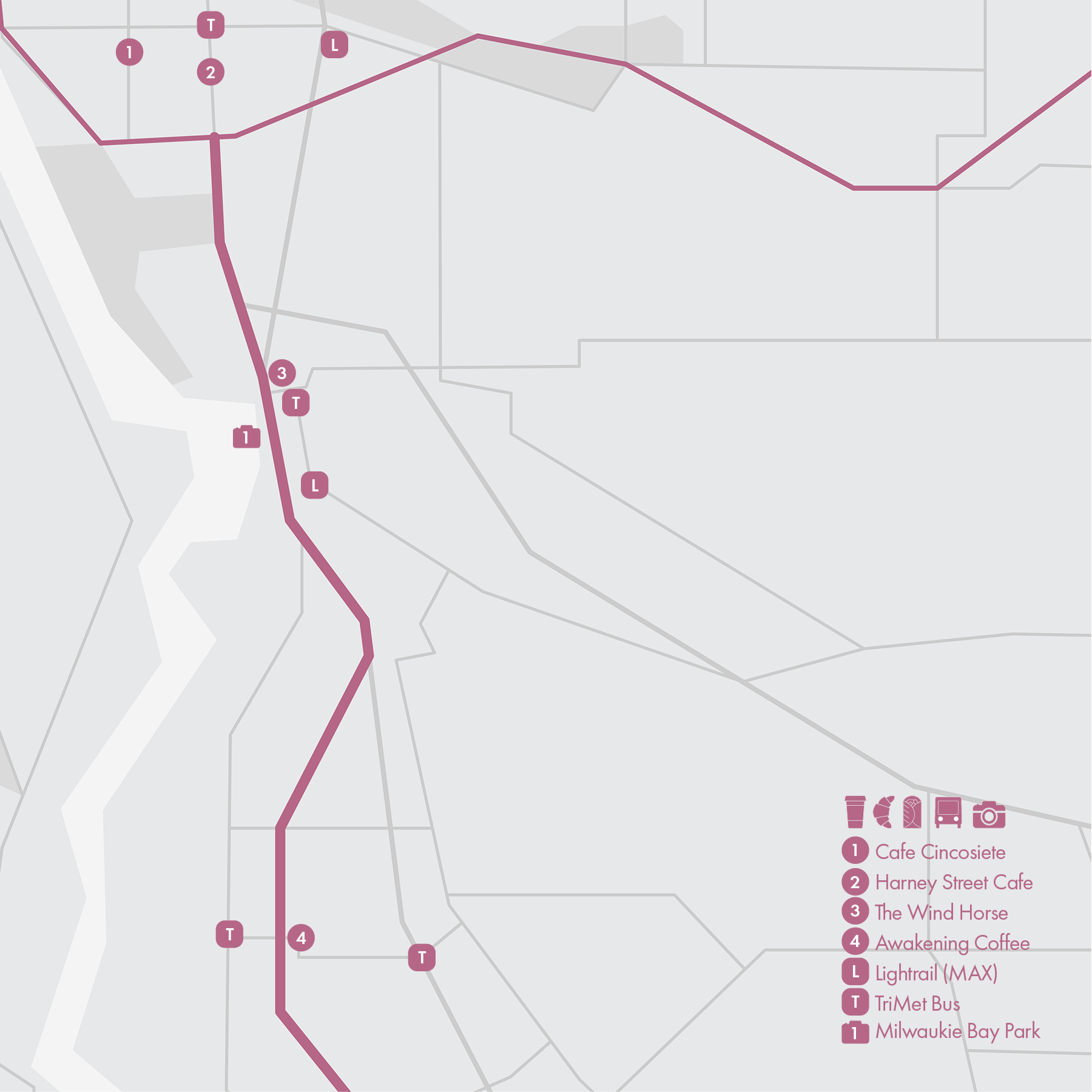
15. Trolley Trail - Oregon City
• Start & Finish: Sellwood (SE 17th Ave & SE Linn St), Oregon City (McLoughlin Blvd & Main St)
• Course Profile: 10 miles one way, 260 ft+, sidewalks and multi-use paths (Strava route in bio)
The Trolley Trail is a popular 6.2-mile multi-use trail located in the Portland metropolitan area, between the cities of Milwaukie and Gladstone. It is a recreational pathway that follows the route of the historic Oregon Electric Railway, which operated a streetcar line that ran in the area until 1968. You'll pass through tree-lined sections, residential areas, and charming towns like Oak Grove and Gladstone, providing a mix of tranquility and urban vibrancy.
This route extends from both ends of the Trolley Trail. In the north, it connects Milwaukie Bay Park with Springwater Corridor via SE 17th Ave. In the south, it crosses Clackamas River at Cross Park and follows a dirt trail to Clackamette Park and finishes in the center of Oregon City.
* Connecting with more routes
- Springwater Corridor (route 13)
- Lake Oswego - Oregon City (route 14)
- I-205 multi-use Path (sketchy, ok for biking, not recommended for running)
Cafe / The start and finish of this route are the best areas to grab a cup of coffee. Portland's Sellwood neighborhood has plenty of food options along SE 13th St. Oregon City's center spans several blocks at Willamette riverfront, with more local spots on 7th St up the hill.
Transit / TriMet Bus Route 32, 33 (frequent), 34 connect Oregon City with Milwaukie, running different routes parallel to Trolly Trail; Milwaukee is on MAX Orange Line, which goes to Portland city center. Route 35 takes the other side of the Willamette River and connects Oregon City directly with Downtown Portland.