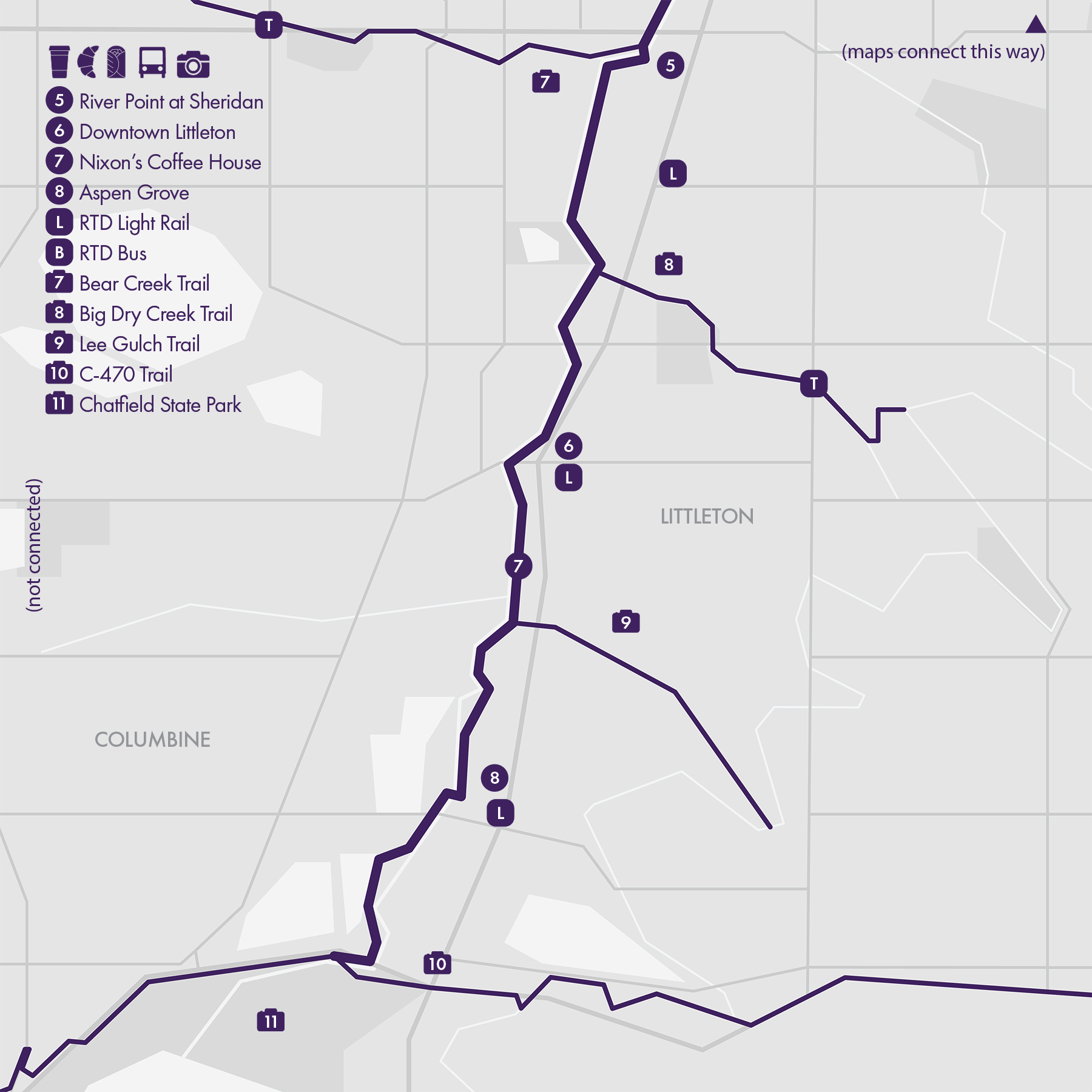
Routes
Denver’s running scene is defined by its seamless blend of urban trails, open parks, and mountain access, making it a paradise for runners who love variety. The city’s expansive trail network connects neighborhoods and suburbs through a series of well-maintained corridors, including the Cherry Creek, Platte River, and High Line Canal Trails, along with lesser-known gems like the Sand Creek, Clear Creek, and Bear Creek Trails, which extend the network deep into the metro area and beyond. Within the city, Washington Park, Sloan’s Lake, and City Park anchor Denver’s running culture with scenic loops, open space, and mountain views that make everyday runs feel special. Just to the west, runners can trade pavement for dirt on the foothill routes at North and South Table Mountains or Green Mountain, offering elevation, challenge, and panoramic views. And with Boulder only a short drive away, Denver offers unparalleled access to trails that range from flat urban miles to high-altitude adventure, all part of a running scene that thrives on both accessibility and exploration.

1. The Confluence
• Start & Finish: Commons Park or Confluence Park
• Course Profile: 3 miles loop, paved multi-use path, mostly flat (strava in bio)
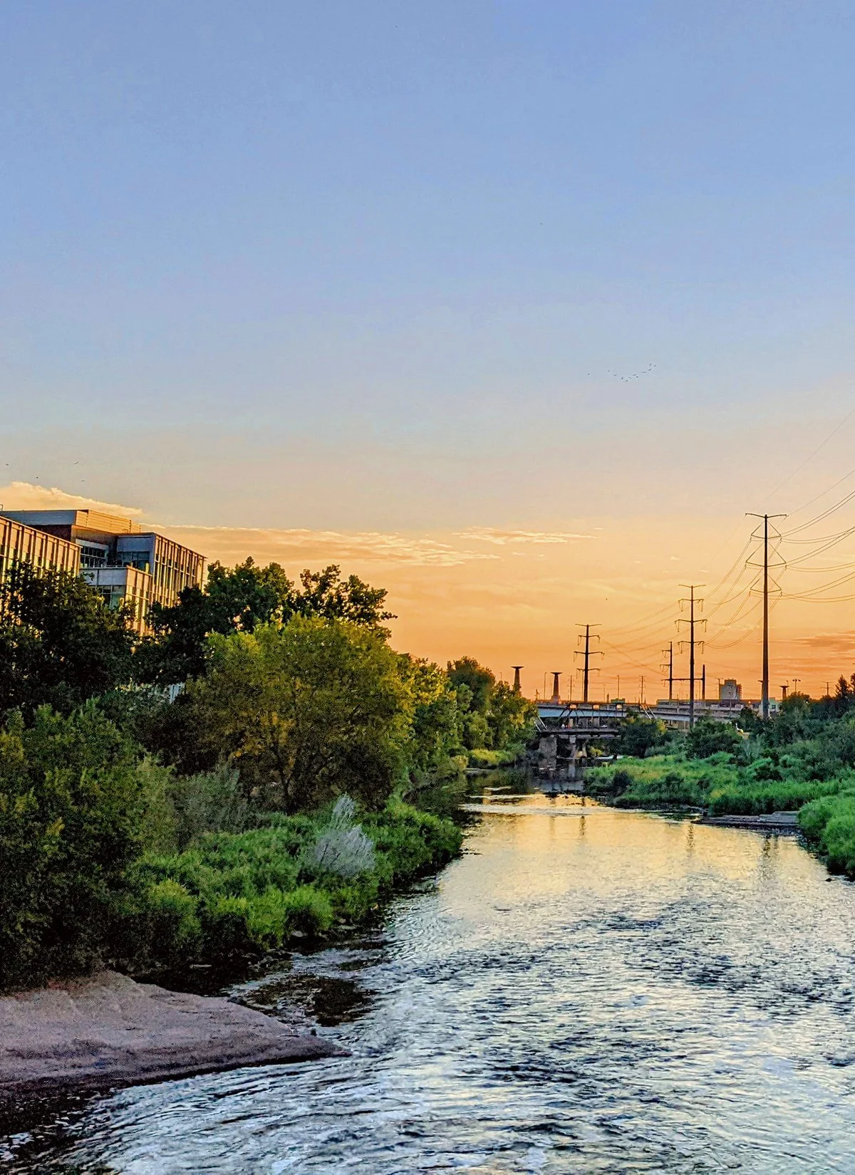
Denver is situated at the confluence of two rivers—the South Platte River and the Cherry Creek, with both rivers accompanied by an extensive, well-maintained multi-use path (Route #2, 6, 7). The confluence of these two rivers at Confluence Park, conveniently located near Downtown Denver, also marks the spot where Denver's founders first established the city in 1858.
Around the confluence, several city parks grace the banks of the South Platte River, collectively forming a linear greenbelt in the heart of the city, a premier running destination in Denver. Though technically part of the South Platte River Trail, this 3-mile loop deserves its own appreciation.
A few things to check out on or near this route:
- Commons Park: the biggest park around the confluence, featuring open green spaces, walking paths, and scenic views of the river and the city skyline.
- Millennium Bridge: known for its distinctive design and modern architecture, the bridge is exclusively for pedestrians and cyclists with beautiful city views.
- 16th Street Mall: If you are planning to go into Downtown Denver, 16th St is a pedestrian-friendly zone with ample space for pedestrians to stroll, shop, dine, and enjoy street performances.
- Skyline Lookout: Don't miss this hidden gem at Zuni St and W 27th Ave, accessible by walk/bike paths from this route.
- Empower Field at Mile High: Home of the Denver Broncos. A walk/bike path connects the stadium and the skyline lookout.
Cafes / The confluence finds itself nestled between two of Denver's most vibrant neighborhoods—LoDo (Lower Downtown) and LoHi (Lower Highland). Throughout the day, this dynamic region offers an abundance of food and drink options. If you are a coffee drinker, my favorite coffee shop in Denver is Sapor Coffee on Speer Blvd, near the skyline lookout.
Transit / Union Station is Denver's transit hub with light rail and bus services.

2. Cherry Creek Trail

• Start & Finish: Confluence Park to Cherry Creek State Park
• Course Profile: 12 miles one-way, paved multi-use path, 474 ft+
Cherry Creek meanders northwest through Denver, converging with the South Platte River at Confluence Park. A 40-mile multi-use path follows the creek, of which this route is the first 12 miles, stretching from Central Denver to Cherry Creek State Park. This trail blends urban and natural landscapes, offering a picturesque exploration of Denver's diverse scenery.
The trail commences in a dynamic urban setting, skirting the edges of Downtown Denver and leading past landmarks such as Elitch Gardens, Ball Arena, and the Colorado Convention Center, which features a sculpture garden alongside the creek. After a little over 3 miles, the trail reaches Denver Country Club. This juncture serves as a pivotal point for runners, offering choices to head south towards Washington Park (Route #3), north to Cheesman Park and City Park (Route #4), or simply return to the starting point at Confluence Park (Route #1, 6, 7).
Continuing beyond the country club, the trail undergoes a gradual transformation, from urban cityscapes to suburban and, eventually, natural landscapes. Along the way, it meanders through several city parks, intersects with the iconic High Line Canal trail (Route #8), and soon reaches the expansive Cherry Creek State Park (Route #10). The trail extends beyond the park's boundaries, reaching as far as Franktown, CO.
Cafe / The starting point of the trail in Denver's LoDo neighborhood presents an array of enticing options for morning coffee and breakfast. If in need of mid-run refueling, the nearby Cherry Creek Shopping Mall has a Whole Foods Market and a variety of cafes around E 2nd Ave.
Transit / This 12-mile route is conveniently bookended by RTD Light Rail stations at Union Station and Nine Mile Station. The initial three miles have robust public transit coverage. However, beyond University Blvd, about four miles into the route, transit options become significantly limited.


3. Washington Park

• Start & Finish: anywhere along the loop
• Course Profile: 2.3 mile loop, multi-use path, mostly flat (strava in bio)
Washington Park, affectionately known as "Wash Park" among locals, is Denver's equivalent to Central Park. This rectangular urban oasis spans a generous 8 city blocks, encompassing 165 acres. Boasting two picturesque lakes, a sprawling central meadow, flower gardens, and recreational facilities, Wash Park is a haven for outdoor enthusiasts.
Washington Park is a top running destination in Denver. There is a 2.6 mile dirt outer loop that offers great views of the area's beautiful homes; another option is the 2.2 mile paved inner loop that is a shared car-free parkway, with views of the park and park users like those playing volleyball and soccer in the central meadow.
The neighborhoods surrounding Wash Park are also great for jogging, with various options to connect to other routes:
- Marion Parkway (P9) has an exceptional dirt trail that seamlessly connects Wash Park to the Cherry Creek Trail (Route #2)
- South Platte River Trail (Route #7) is located just one mile west, although the connecting streets may not be the nicest.
- South High School lies just south of Wash Park, and I had some luck running on their well maintained track during early morning hours.
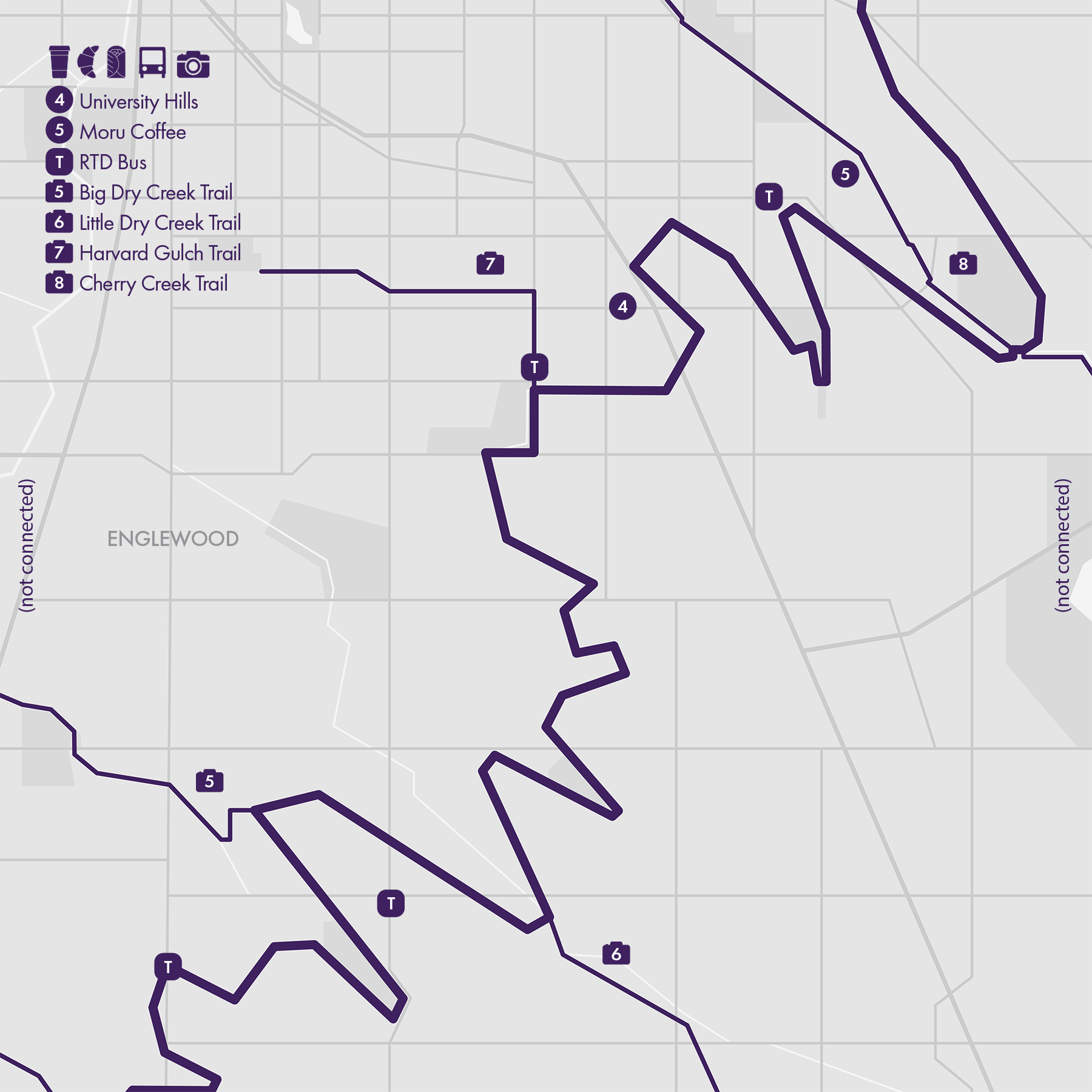
- Harvard Gulch Park and Trail are several blocks further south. The trail goes east and connects to the wonderful High Line Canal Trail (Route #8).
Cafe / To the southwest of Wash Park, South Pearl Street has a bustling business corridor spanning three blocks, featuring a Farmers' Market and several popular cafes. Moving further west, South Broadway is a major thoroughfare with businesses stretching for miles, albeit with a somewhat less charming aesthetic.
Transit / The RTD Light Rail Louisiana & Pearl Station is conveniently located just a few blocks from Wash Park. Additionally, two other stations (I-25 & Broadway and U of Denver), are also within a reasonable distance. While RTD bus services cover three sides of Wash Park, their headways are 30 minutes to an hour.

4. City Park & Cheesman Park
City Park - One mile long, three-quarters of a mile wide, City Park is Denver's largest park. It is designed in 1892 by Henry Meryweather in the tradition of Central Park in New York City with a flowing, casual design and features two lakes, a golf course, as well as the Denver Zoo and the Denver Museum of Nature and Science.
There isn't a particular running route in the park; the route I draw is roughly the outer loop.
• Course Profile: 3.1 mile loop, mostly flat
Make sure to check out City Park Pavilion, and the city view from the Ferril Lake east bank. City Park is also the start and finish of Denver Colfax Marathon.
---
Cheesman Park
Not far from City Park, Cheesman Park is another major urban park in Denver. It features a classic, formal design with a pavilion that offers panoramic views of the city skyline and the Rocky Mountains, and large open green spaces encircled by a wooded walking path (p9).
There is a soft-surface outer loop around the park for walk/run (below); one can also take the paved, figure-8 inner loop.
• Course Profile: 1.4 mile loop, flat (strava in bio)
Around Cheesman Park are some of the nicest neighborhoods in Denver, with tree-lined streets and historic buildings.
---
Between and beyond City Park and Cheesman Park, there are more running routes.
From City Park
- take Steele Street north and connect to 39th Ave GreenWay (Route #6)
- take Montview Blvd or 17th Ave Pkwy east to Central Park (Route #9)
From Cheesman Park
- take Williams St/Gilpin St south to Cherry Creek Trail (Route #2)
- take Marion St Pkwy further south to Washington Park (Route #3)
Cafe / The segment of Colfax Ave south of City Park has great drink and food options, including Lula Rose General Store for coffee and Good Bread for pastries. There are also a number of good coffee shops around Cheesman Park, especially in the Capitol Hill neighborhood.
Transit / While this area is not served by the Light Rail, there are a few frequent bus routes including route 6 (8th Ave), 15 (Colfax), and 20 (17th Ave).

5. Sloan's Lake

• Start & Finish: anywhere along the loop
• Course Profile: 2.57 mile loop, flat (Strava in bio)
Sloan's Lake is West Denver's top running destination. Encompassing 177 acres, the lake is nestled in Sloan's Lake Park, Denver's second-largest park. This loop around the lake is easy to follow and popular among westside residents, offering not only picturesque lakefront views but also glimpses of the Denver skyline.
There are a few more nice places to run on the westside:
- Berkeley Lake and Rocky Mountain Lake
These are two smaller lakes in West Denver, both sit on W 46th Ave, 2 miles north of Sloan's Lake. Both of them have a one-mile walking path loop.
- Crown Hill Lake
Further west in Wheat Ridge, CO is Crown Hill Lake and Park. The park features expansive open spaces and a trail system that includes a 1.2-mile lakefront loop and a 2.3-mile outer loop.
- Lakewood/Dry Gulch and Weir Gulch
Both are branches of South Platte River and have a trail next to the gulch. The trails along Lakewood Gulch and its branch Dry Gulch are easier to navigate, with open greenbelt views and easy RTD Lightrail access. Weir Gulch, on the other hand, weaves through a residential area and the trail is often broken by city streets.
* Connecting with more routes
- The Confluence (Route #1)
- Cherry Creek Trail (Route #2)
Cafe / Just south of Berkeley Lake, Tennyson St between W 38th Ave and W 44th Ave is one of West Denver's most bustling business corridors, packed with cafes, restaurants, and boutiques.
You'll also find places to eat and drink on W Colfax Ave, as well as in Lo(wer)Hi(ghland) as you get close to Union Station.
Transit / Frequent bus route 16 runs along Colfax Ave two blocks south of Sloan's Lake. Berkeley Lake, Rocky Mountain Lake, and Crown Hill Lake all have RTD bus services at or near one of its corners but the headway is usually an hour. Light Rail W Line runs along Lakewood/Dry Gulch Trail and goes to Union Station and Downtown.


6. South Platte River Trail (North)
• Start & Finish: Commons Park, Clear Creek Trail
• Course Profile: 6.7 miles one way, 90 ft+, paved, multi-use path (Strava in bio)
This is the north half of the two-part guide to South Platte River Trail, from Downtown Denver's Commons Park to the intersection of Clear Creek (Trail). The multi-use path follows South Platte River, it is easy to follow and well-maintained. However, this northern half of the trail is less frequented than its southern counterpart (Route #7) due to the industrial surroundings that characterize this section. The most popular segment lies between Commons Park and Globeville Landing Park, positioned next to Denver's bustling Union Station and River North neighborhoods.
River North (RiNo) is a vibrant and rapidly evolving neighborhood in Denver. It is known for its rich artistic community, creative atmosphere, and urban revitalization. Many of the neighborhood's industrial and historic buildings have been repurposed into lofts, studios, and hip restaurants and breweries, with an abundance of street art and murals.
- At the north end of RiNo, The 39th Avenue Greenway is a mile-long urban greenway. It serves as a multi-purpose trail and linear park, offering a range of outdoor activities and community amenities.
- Just south of RiNo lies Coors Field, home of the Colorado Rockies, Denver's Major League Baseball team.
* Connecting with more routes
- The Confluence (Route #1)
- Cherry Creek Trail (Route #2)
- Sloan's Lake (Route #5)
- South Platte River Trail (Route #7)
- Sand Creek Trail (Route #9)
- Clear Creek Trail (Route #17)
Cafe / Diary Block near Coors Field is a stylish complex with a range of bars & restaurants. Larimer Street is the center of RiNo, offering a wide selection of cafes and boutiques. The Source is a high-end hotel with its ground floor packed with eateries and shops.
Transit / 38th - Blake Station is the only light rail station (A Line) in RiNo. There are a few RTD bus routes that serve RiNo but their frequencies are low. RTD has almost no coverage north of RiNo because it gets very industrial.

7. South Platte River Trail (South)

• Start & Finish: Commons Park, C-470 Trail
• Course Profile: 15.91 miles one way, 317 ft+, paved, multi-use path (Strava in bio)
This is the south half of the two-part guide to South Platte River Trail, from Downtown Denver's Commons Park to Chatfield State Park. The trail follows closely South Platte River, the multi-use path is easy to follow and well-maintained, it's very popular among local runners and cyclists. The trail provides a mix of urban and natural scenery: close to the city center there are Elitch Gardens Amusement Park and Mile High Stadium, further south there are many open green spaces and city parks. In particular, Ruby Hill Park, Centennial Park, and Carson Nature Center.
South Platte River has many branches and there is usually a trail along the branch creek or gulch. Giving runners a myriad of options to explore the surrounding areas. From city center to south:
- Lakewood Gulch Trail (see Route #5)
- Weir Gulch Trail
- Sanderson Gulch Trail
- Little Dry Creek Trail
- Bear Creek Trail (see Route #13)
- Big Dry Creek Trail
- Lee Gulch Trail
* Connecting with more routes
- The Confluence (Route #1)
- Cherry Creek Trail (Route #2)
- Sloan's Lake (Route #5)
- South Platte River Trail (Route #6)
- High Line Canal Trail (Route #8)
- Chatfield State Park (Route $11)
- C-470 Trail (Route #12)
- Bear Creek Trail and Park (Route #13)
Cafe / A few coffee shops and shopping malls are scattered along the South Platte River. In particular, two notable areas stand out for their diverse array of amenities: the bustling S Broadway district and the quaint yet vibrant Downtown Littleton.
Transit / RTD Light Rail D Line runs somewhat parallel to South Platte River. RTD Light Rail W Line runs along Lakewood Gulch Trail. RTD Bus serves major city streets, including Sheridan Blvd, Federal Blvd, and Broadway.

8. High Line Canal Trail
The High Line Canal Trail winds its way for approximately 71 miles, following the path of the High Line Canal and spanning across residential neighborhoods and serene nature reserves in southeastern Denver and several neighboring suburban cities. The trail is designated a National Landmark Trail, and is a popular destination for local outdoor enthusiasts. The trail is primarily hard-packed dirt south of Hwy 285 (near Wellshire Golf Course) and largely paved concrete north of it. Much of its length is shaded by cottonwood trees.
For this guide, I take 46 continuous miles of the trail and cut it into three segments (one in each map). Each segment starts and finishes at an intersection with another regional or local trail.
* C-470 Trail to Big Dry Creek Trail: 11.7 miles one way, mostly flat, dirt (Strava in bio)
In this section, High Line Canal Trail can be connected to the city of Littleton and South Platte River Trail (Route #7) through C-470 Trail (Route #12), Lee Gulch Creek Trail and Big Dry Creek Trail. In Littleton, one can find a charming downtown, as well as two RTD Light Rail stations.
* Big Dry Creek Trail to Cherry Creek Trail: 17.8 miles one way, mostly flat, dirt and paved (Strava in bio)
In this section, High Line Canal Trail can be connected to south Denver and through Harvard Gulch Trail. Amenities, cafes and public transit can be found near University Hills on Colorado Blvd.
* Cherry Creek Trail to Sand Creek Trail: 16.6 miles one way, mostly flat, paved (Strava in bio)
This section is paved and slightly more urban than the segments in the south. Cherry Creek Trail (Route #1) is a major regional trail and takes runners all the way to city center (northwest) as well as Cherry Creek State Park (southeast). Towards the north end of this segment, there are Toll Gate Creek Trail and Sand Creek Trail (Route #9), two other connecting regional trails. Amenities, cafes and public transit can be found in Town Center at Aurora shopping mall, and along Colfax Ave.


9. Sand Creek Trail & Central Park

• Start & Finish: South Platte River Trail, High Line Canal Trail
• Course Profile: 12.33 miles one way, 433 ft+, mostly paved, some dirt, multi-use path (strava in bio)
The Sand Creek Trail commences at the South Platte River Trail and follows the course of Sand Creek, a tributary of the South Platte River. This scenic trail meanders through a diverse tapestry of urban, suburban, and natural landscapes, offering a unique blend of environments to explore. This route ends at the Triple Creek Trailhead where it intersects with the High Line Canal Trail.
The first 5 miles of the trail, stretching from the South Platte River to Central Park Blvd, lead through an industrial area in North Denver and remain largely isolated from city life. The final 4 miles, between I-225 and the Triple Creek Trailhead, are characterized by open spaces and suburban surroundings, with few amenities for trail users.
The heart of the Sand Creek Trail is in its middle sections. Along the trail's course, you'll encounter the Sand Creek Park, as well as Bluff Lake Nature Center, an expansive 123-acre wildlife refuge that boasts a symphony of diverse ecosystems of wetlands, woodlands, prairies, and a serene lake. Just south of the trail, a string of interconnected parks offers more running options. In particular, there is Denver's Central Park, one of the largest urban parks in the city. It is developed on the site of the former Stapleton International Airport and covers more than 800 acres.
* Connecting with more routes
- South Platte River Trail (Route #6)
- High Line Canal Trail (Route #8)
- Central Park, Westerly Creek Park, Greenway Park, and Fred Thomas Park
- Stapleton Link & Northfield Trail
- Toll Gate Creek Trail
Cafe / You'll find nice cafes and coffee shops in East 29th Ave Town Center, Stanley Marketplace, or a few blocks further south on Colfax Ave.
Transit / RTD Light Rail has a few stations near Sand Creek Trail: (Line A) Central Station, Peoria Station and (Line R) Fitzsimons Station, Colfax Station. There are frequent bus services on Colfax Ave too.


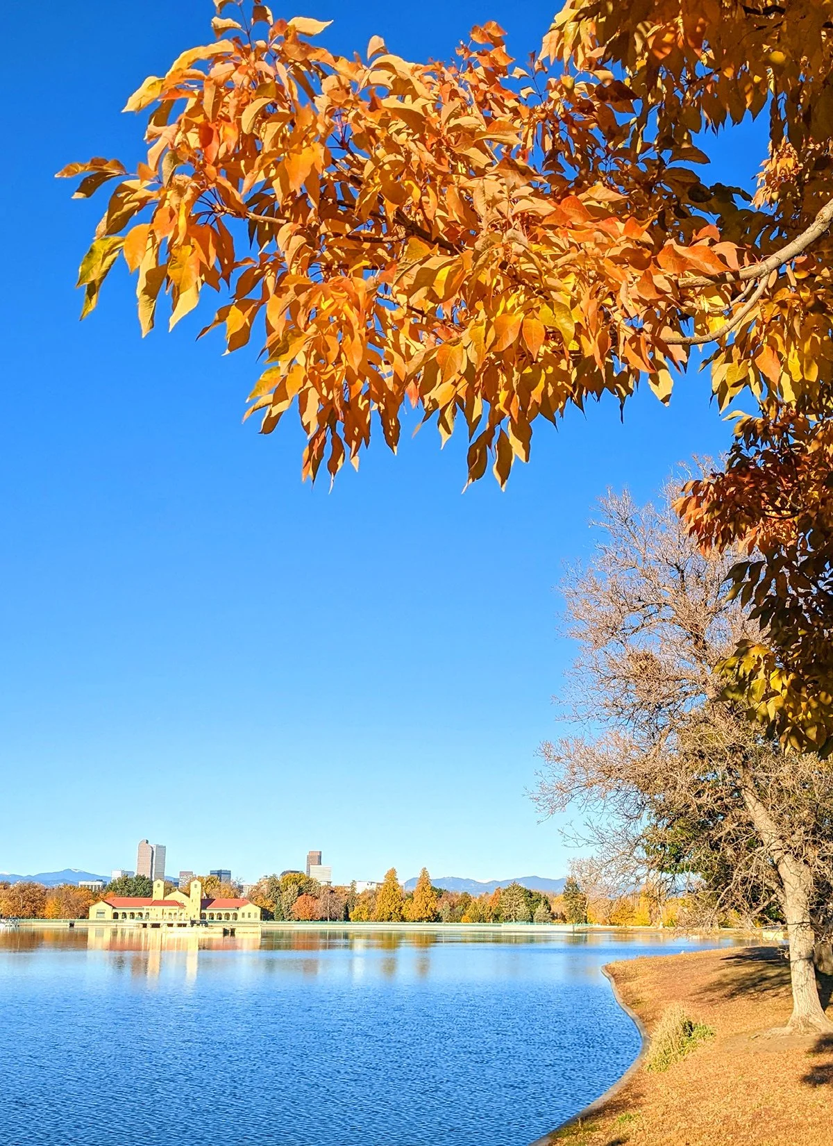
10. Cherry Creek State Park
• Start & Finish: Nine Mile Station
• Course Profile: 9.3 miles loop, 332 ft+, paved, multi-use path (strava in bio)
Cherry Creek State Park is a popular outdoor recreational area located in the southeastern suburb of Denver. It consists of a natural prairie and wetland environment with the 880-acre Cherry Creek Reservoir at its center.
With an extensive network of 35 miles of multi-use trails catering to hikers, runners and cyclists, the park offers an array of opportunities for outdoor enthusiasts. The major trail within the park is part of the Cherry Creek Trail (Route #1), entering the park from the north, encircling the reservoir's western bank, and meandering southeastward to the park's exit. There are various other trails in the park connecting roads, trails, and recreational amenities.
* Connecting with more routes
- High Line Canal Trail (Route #8)
- Cherry Creek Spillway Trail, to the northeast of the park
- Piney Creek Trail, to the southeast of the park
Cafe / There are several strip malls near Cherry Creek State Park. Notably, there's a strip mall to the north, situated at Yale Ave and Parker Rd, and another to the south, at the intersection of Arapahoe Rd and Parker Rd.
Transit / Nine Mile Station and Dayton Station offer convenient access points to Cherry Creek State Park, located along the northern boundary of the park. Both stations are part of the RTD Light Rail H Line, which provides a direct route to Downtown Denver.

11. Chatfield State Park & Waterton Canyon

• Start & Finish: Chatfield Dam Trailhead on Perimeter Rd
• Course Profile: 11.65miles loop, 291 ft+, paved, multi-use path (strava in bio)
Chatfield State Park is located in the southern suburbs of Denver, just south of the C-470 highway. The park is centered around the Chatfield Reservoir, spanning roughly 1,500 acres. The reservoir provides opportunities for a variety of water-based activities, including swimming, fishing, and boating.
The trail system consists of the Chatfield Internal Trail and the Dam Trail, and it links with the South Platte River Trail via the C-470 Trail or Perimeter Road. This path is paved and shared, with minimal shade along the route.
* Connecting with more routes
- South Platte River Trail (Route #6)
- High Line Canal Trail (Route #8)
- C-470 Trail (Route #12)
- Waterton Canyon Trail (below)
In addition to the loop trail, another trail parallels S Wadsworth Blvd and the western boundary of the park, the Waterton Link trail leads to the Waterton Canyon trailhead. From there, a highly frequented 12.5-mile out-and-back gravel trail takes you into the Waterton Canyon. This trail is the gateway to the Colorado Trail, one of the nation's premier long-distance trails. Waterton Canyon trail is known for vistas and bighorn sheep sightings.
• Start & Finish: Waterton Canyon Trailhead on Waterton Rd
• Course Profile: 12.5 miles out and back, 313 ft+, gravel path (strava in bio)
Cafe / The closest strip malls are a few miles away, along highway C-470, or check out Aspen Grove in Littleton.
Transit / RTD Light Rail Littleton Mineral Station is 1.5 miles north of the state park. , along South Platte River trail.

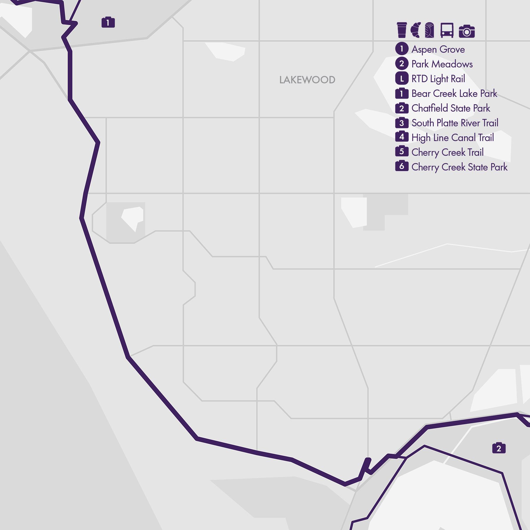
12. C-470 Trail
• Start & Finish: Green Mountain, Cherry Creek Trail
• Course Profile: 35 miles one way, 1862 ft+, paved, multi-use path (strava in bio)
The C-470 Trail is a well-maintained multi-use recreational trail in Denver's southern and western suburbs.
The trail runs alongside or near the C-470 highway. For navigation, the segments inside and south of Bear Creek Lake Park is the only part that can get confusing. The many under- and overpasses make the route a largely uninterrupted route that is great for continuous running.
While the trail isn't very scenic itself, it connects a myriad of parks and regional trails, including (from east to west)
- Cherry Creek State Park (Route #10)
- High Line Canal Trail (Route #8)
- South Platte River Trail (Route #6)
- Chatfield State Park (Route #11)
- Bear Creek Trail (Route #13)
- Red Rocks (Route #14)
- Green Mountain (Route #15)
Continued as US-6 Trail,
- Table Mountains (Route #16)
- Clear Creek Trail (Route $17)
Cafe / Gas stations and Starbucks are scattered along C-470. Two shopping malls near the trail, Aspen Grove in Littleton and Park Meadows in Lone Tree, have more food options and both are served by RTD Light Rail.
Transit / C-470 runs along the pheriphary of Denver metropolitan area and has very limited public transit access. There are, however, a couple of RTD Light Rail lines that crosses C-470.
- D Line: Littleton Mineral Station
- E and R Line: County Line Station
- W Line: Jeffco Station (further northwest, near highway US-6)

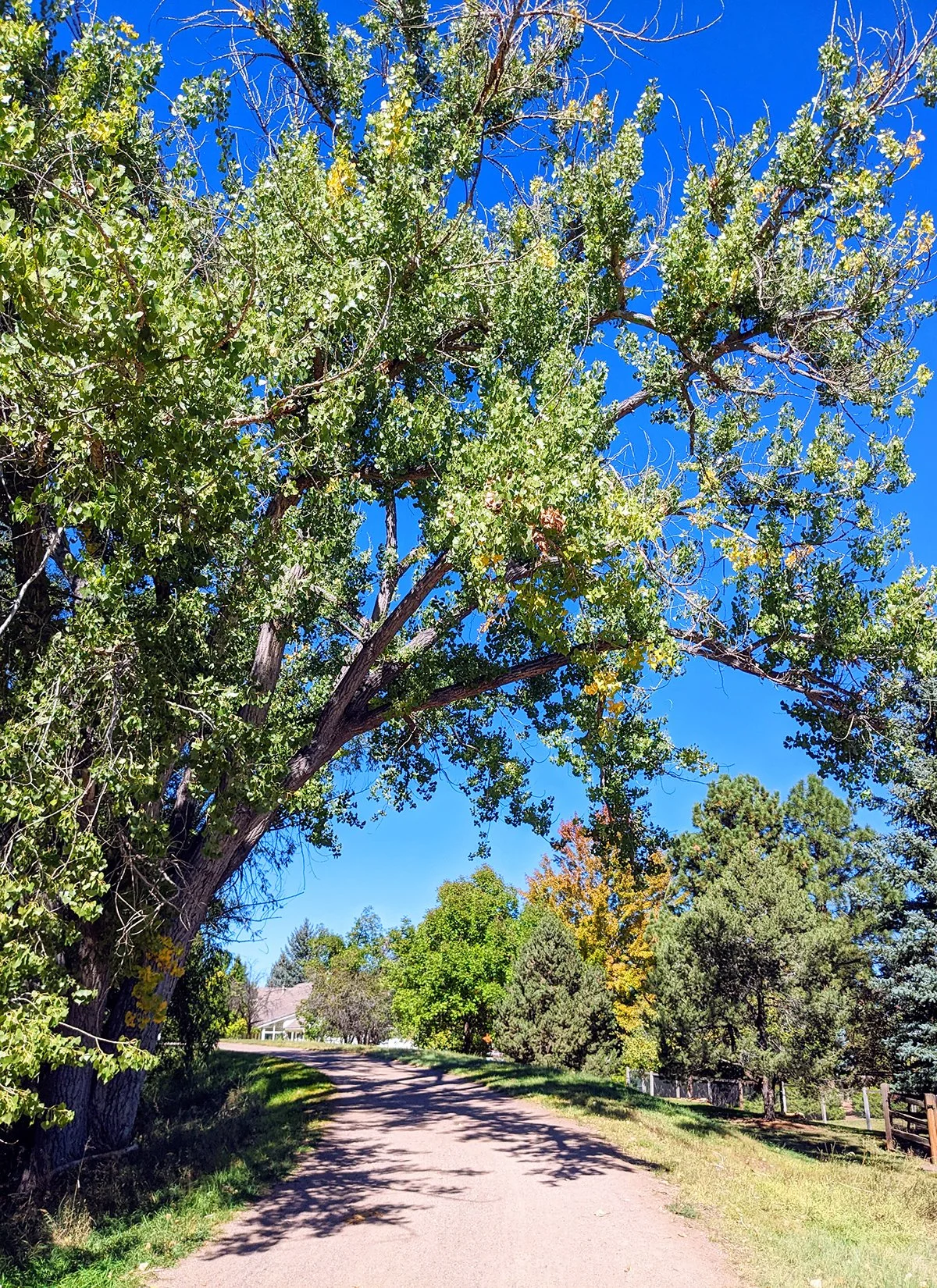
13. Bear Creek Trail, Lake & Park

Bear Creek Trail
• Start & Finish: Trailhead off South Platte River Trail, Fox Hollow (Golf Course)
• Course Profile: 7.35 miles loop, 245 ft+, multi-use path (strava in bio)
The Bear Creek Trail is situated in the southwestern part of the Denver metropolitan area, primarily within the city of Lakewood.
The trail traces the winding course of Bear Creek, extending from the South Platte River to the Bear Creek Lake. Along its path, this scenic trail meanders through a mix of residential and natural areas, offering a delightful juxtaposition of suburban and natural landscapes, and featuring a series of green spaces including Bear Creek Park and Bear Creek Greenbelt.
Mt. Carbon Loop (Bear Creek Lake Park)
• Start & Finish: anywhere along the loop
• Course Profile: 6.57 miles loop, 563 ft+, dirt and paved trail (strava in bio)
At the west end of Bear Creek Trail lies the Bear Creek Lake and Park. It covers a substantial area of over 2,600 acres, and offers a network of hiking/running and biking trails that wind through diverse ecosystems, including forests, meadows, and shoreline areas.
This route features the Mt. Carbon Loop trail, with its highest point Mt. Carbon overlooking the Bear Creek Lake. Another major trail in the park is an extension of Bear Creek Trail along the south pheriphary of the park and connects with C-470 trail.
* Connecting with more routes
- South Platte River Trail (Route #3)
- C-470 Trail (Route #12)
- Green Mountain (Route #15)
Cafe / Two little cute shops along the trail: Front Porch Coffee Shop, a coffee shop housed in a church, and Arden, a hidden gem Asian tea shop.
Transit / The area along the trail is sparsely served by RTD bus routes. The east end of the Bear Creek Trail is between two RTD Light Rail stations.


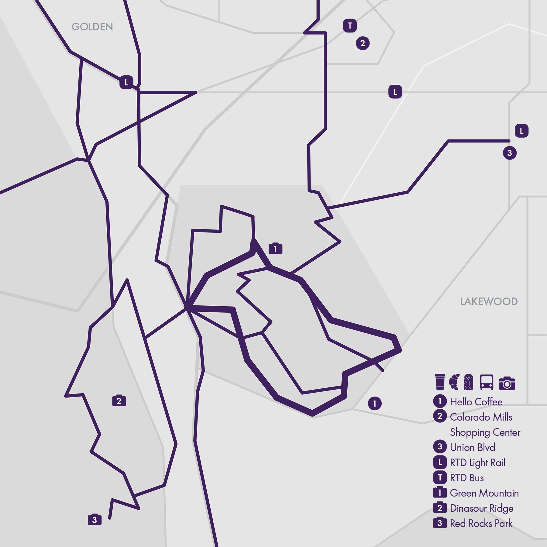
14. Red Rocks

Red Rocks, Dinosaur Ridge, and Matthew Winters Park
• Start & Finish: Dakota Ridge Parking
• Course Profile: 2.38 miles loop, 464 ft+, dirt path (strava in bio)
Red Rocks is an iconic natural amphitheater in the foothills of the Rocky Mountains, featuring massive sandstone rock formations that have been naturally sculpted over millions of years, its distinctive red color a result of iron oxide in the sandstone. Red Rocks is primarily known as a concert venue and hosts a wide range of musical performances, from rock and pop to classical and electronic music.
You might have attended a concert at Red Rocks, but visiting Red Rocks at sunrise, especially on foot, is definitely a unique experience. The closest public transit connection is Jeffco LRT Station 5 miles north. The closest trailhead is Dakota Ridge Parking off CR-93. There are many other trails in the area connecting three parks.
Apex Park, Windy Saddle Park, and Lookout Mountain
• Start & Finish: Apex Park East Trailhead
• Course Profile: 10 miles loop, 1845 ft+, dirt path (strava in bio)
Lookout Mountain is part of the Rocky Mountains front range just west of Golden, with a summit standing at 7,377 ft (2,249m) above sea level.
This modestly challenging loop starts from the East Trailhead of Apex Park, then follows Apex Trail through the park to Lookout Mountain Rd, continues on Lookout Mountain Trail to Windy Saddle Park overlook, before descending through Chimney Gulch Trail. When the trail intersects Lookout Mountain Rd again, take the road because Chimney Gulch Trailhead has no pedestrian outlet. The road turns into 19th St in Golden and you can follow US-6 trail and local streets to get back to the start point.
Alternatively, you can run out-and-back in either Apex Park or Windy Saddle Park.
* Connecting with more routes
- Bear Creek Trail & Park (Route #13)
- Green Mountain (Route #15)
- Table Maintains (Route #16)
- Clear Creek Trail (Route #17)
Cafe / None :(
Transit / RTD Jeffco Station is the closest public transit "nearby".

15. Green Mountain
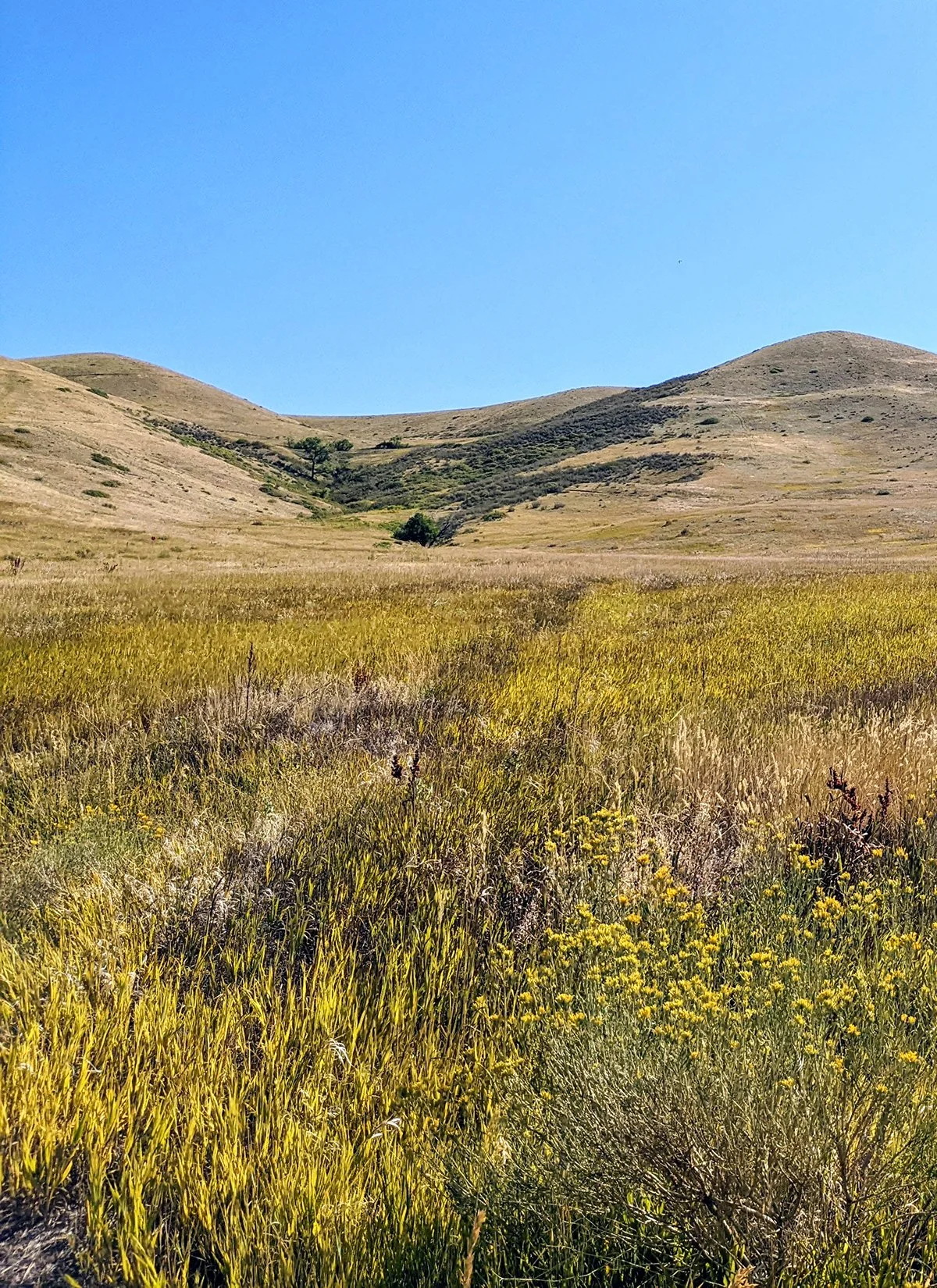
• Start & Finish: Any trailhead on the loop
• Course Profile: 6.5-mile loop, 1070 ft+, dirt path (strava in bio)
Green Mountain is located in Lakewood, a suburb to the west of downtown Denver. It is part of a protected area that offers a range of outdoor recreational activities. Its summit reaches an elevation of approximately 6,854 feet (2,089 meters) above sea level.
This 6.5-mile loop route follows the Green Mountain Trail in its entirety. There are several trailheads along the loop on the south side, four on Alameda Pkwy, and two on the CO-470 Trail. This Strava route starts and finishes from the east most trailhead on Alameda Pkwy, where a parking lot and a porta potty are on-site.
Besides the main loop trail, there are several other trails, connecting different points of the loop trail or to trailheads. In particular, the North Access Trail leads to a couple more trailheads in the north.
Green Mountain is covered in a mix of grasslands and shrubs. Just ilke table mountains, there is no shade along the trail. It is particularly beautiful during the spring and summer when wildflowers bloom across the slopes. It is also a popular spot for watching sunsets over the Denver skyline and the Rocky Mountains.
* Connecting with more routes
- Bear Creek Trail and Park (Route #13)
- Lookout Mountain (Route #14)
- Table Maintains (Route #16)
- Clear Creek Trail (Route #17)
Cafe / This area is on the border of urban area. For coffee and food, the closest business areas are Colorado Mills Shopping Center and Union Blvd, both to the northeast of the mountain.
Transit / RTD Light Rail Line W has a few stations in the vicinity of the mountain, all to the north: Jeffco Station, Red Rocks Community College Station, and Federal Center Station.
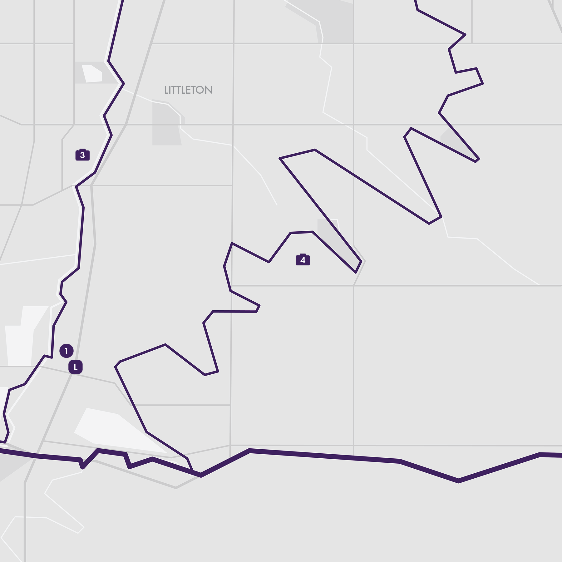
16. Table Mountains

North and South Table Mountain are two mesas in the Golden area, about 15 miles west of Denver city center. Both mountains, especially the north one, are great trail running locations with excellent views and modestly challenging elevation change. While most trails are accessible all year round, the best time to visit is in the spring and early summer when wild flowers start to bloom. Snow covered trails are hard to run on in winter, and summer heat can be a problem due to lack of shade along these trails.
* North Table Mountain
• Start & Finish: West Trailhead on Hwy 93
• Course Profile: 8.6 miles loop, 1188 ft+, dirt path (strava in bio)
North Table Mountain (cover, p3-6) is formed from volcanic rock and stands approximately 200 feet above the surrounding terrain, offering a 8.6-mile undulating hiking/running/biking trail loop, and great views of Denver and the front range of Rocky Mountains. There are a few additional trails connecting different trailheads on the loop trail. Besides the west trailhead, Golden Cliffs trailhead is another great access point to the loop trail.
* South Table Mountain
• Start & Finish: Olivine trailhead, Denver W Pkwy
• Course Profile: 4.2 miles one-way, 437 ft+, dirt path (strava in bio)
South Table Mountain (p7-10) is another mesa, located on the other side of the Golden Freeway. It also features a trail system with panoramic views on the west edge, overlooking Golden. This point-to-point route goes from Downtown Golden to Denver West, with all the climbing in the first mile.
* Connecting with more routes
- Green Mountain (Route #14)
- Lookout Maintain (Route #15)
- Clear Creek Trail (Route #17)
Cafe / Downtown Golden and Colorado Mills Shopping Center (end of South Table Mountain trail) are great places to plan your post run drink and food.
Transit / RTD Light Rail Line W offers the best connection between Downtown Denver and Golden (Jeffco Station). RTD Bus route 17 connects Golden and Light Rail Line W Oak Station .

17. Clear Creek Trail

• Start & Finish: Clear Creek Trailhead at South Platte River Trail, Downtown Golden
• Course Profile: 18.3 miles one-way, 732 ft+, paved path (strava in bio).
Clear Creek Trail is a paved multi-use path in the northwest suburbs of Denver. This scenic route meanders alongside Clear Creek, coursing upstream and westward from South Platte River to Downtown Golden. There are numerous access points along the trail, and a series of city parks adorns the pathway. There are also many other trails that runners can transition to.
- Mile 0.0: South Platte River Trail. 6.5 miles north of Downtown Denver (see route #2)
- Mile 4.1: Little Dry Creek Trail. This trail continues west for a little over 4 miles to Lake Arbor.
- Mile 6.3: Lowell Blvd. Turn south for 1.2 miles and you'll get to W 46th Ave in Northwest Denver, with Berkely Lake, Rocky Mountain Lake, and bustling Tennyson St all nearby (see route #6)
- Mile 7.4: Ralston Creek Trail. This trail follows Ralston Creek for 10+ miles in and through Arvada.
- Mile 8.2. another access point to Northwest Denver.
- Mile 11.2: Kipling St. Turn south for 2 miles and you'll get to Crown Hill Lake and Park.
From Downtown Golden, there are several more options:
- North Table Mountain via. Golden Cliffs Trail (see route #15)
- South Table Mountain via. Olivine Trail (see route #15)
- Lookout Mountain via. 19th St (see route #16)
- US-6 Trail to Jeffco RTD Light Rail station
Cafe / Clear Creek Trail runs through a mix of suburban, natural and industrial areas. You may find gas stations and Starbucks near major road intersections with a little detour. Denver's Tennyson Street and Downtown Golden are two great places to finish your run and enjoy some post run drinks and food.
Transit / RTD Light Rail Line G has several stations along Clear Creek and Ralston Creek; Line B's Westminster Station is on Little Dry Creek, and Line N has a stop near the start of this route. RTD Bus serves many north-south arterial streets (Kipling, Wadsworth, Sheridan, Federal), though services are infrequent.


18. US-36 Bikeway
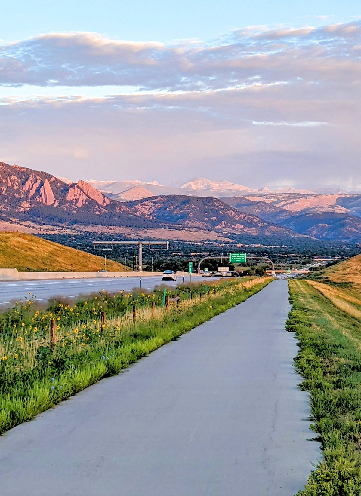
• Start & Finish: US-36 at Lowell Blvd (Westminster), US-36 at Table Mesa Dr (Boulder)
• Course Profile: 16.5 miles one-way, 880 ft+, paved path (strava in bio).
The US-36 Bikeway runs parallel to US Highway 36, a major highway connecting Denver and Boulder. It roughly follows the highway, providing a separated and mostly uninterrupted path for cyclists and runners. The bike path exemplifies The City Runner's idea of running as a way of transit: if you can run a marathon, you can run from Denver to Boulder! Moreover, the route offers scenic views of the Colorado landscape, including the Rocky Mountains. A scenic overlook (cover) is located at the highest point of the path, about 13 miles in.
To get to the path from/to downtown Denver, use Lowell Blvd. To get to the path from/to downtown Boulder, use Broadway or Bear Creek Trail.
Along its course, the bikeway connects with other bike paths and hiking trails. To name a few (south to north):
- Big Dry Creek Trail crosses the bike path in Westminster, a suburb of Denver.
- A series of trailheads lies on the south side of the highway along Marshall Rd. These trails go into Eldorado Canyon and offer great views of Boulder Flatirons. This is also the start of the iconic, though challenging, Boulder Skyline Traverse (17-mile one way, 5000 ft+). Awesome trails, although hard to get to without a car.
- Davidson Mesa Trail near the scenic overlook leads to Louisville through a beautiful open space.
Cafe / You'll find a few shopping malls along the route, with shops like Starbucks and Whole Foods. Sweet Bloom is a nationally celebrated coffee roaster and has a flagship cage conveniently located near the path in Westminster.
Transit / RTD Bus Route FF1 runs frequently between Downtown Denver and Downtown Boulder with multiple stops along US-36 bikeway, including Westminster, Louisville, Table Mesa. RTD Lightrail B Line Westminster Station is 1.5 miles away from the bike path.

