Charles Riverfront
Distance: up to 20+ miles
Route: Strava (short), Strava (long)
Profile: multi-use path, mostly flat, some intersections
Charles River Esplanade
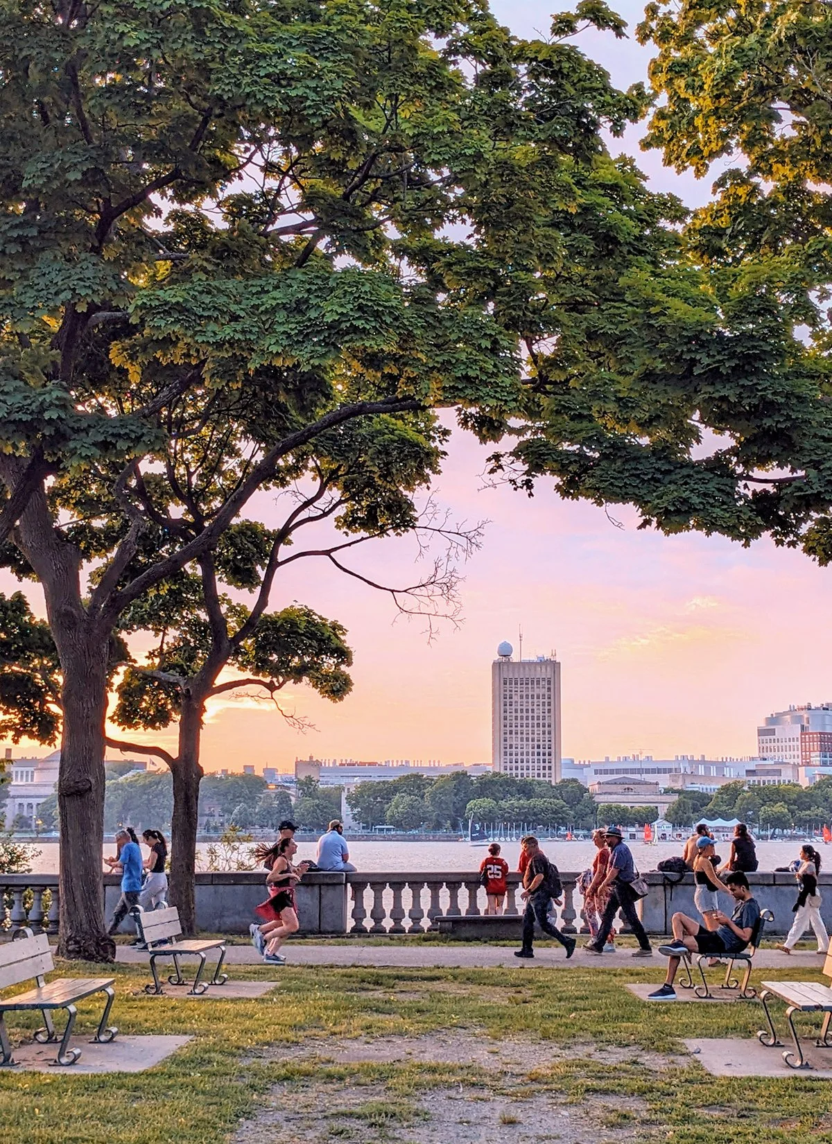
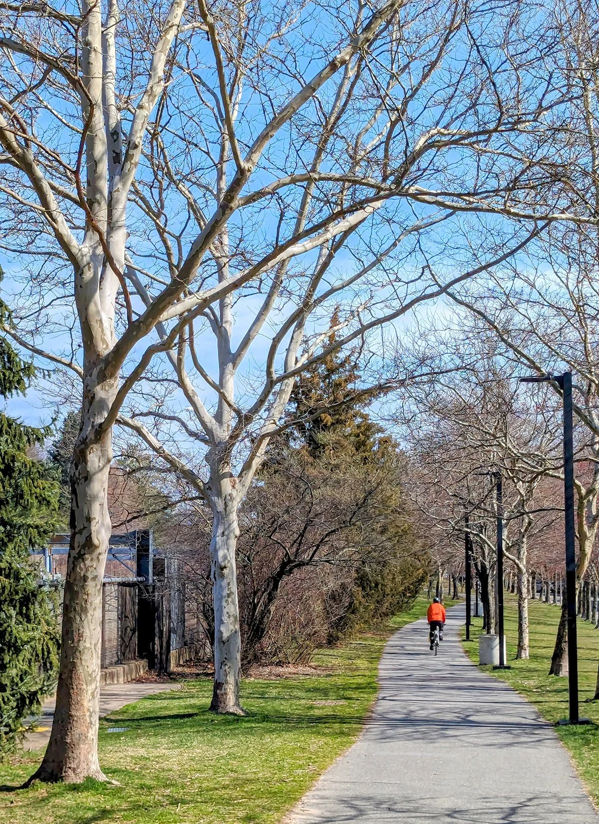
Charles Riverfront is arguably Boston’s most popular running destination, a multi-use path (Dr. Paul Dudley White Bike Path) spans miles along both banks of the Charles River, offering walkers, runners, and cyclists a picturesque route through Boston and its surrounding neighborhoods.
The path begins near the Museum of Science in the east and winds westward. Along the way, numerous bridges cross the river, creating countless loop combinations. The most heavily used segment typically includes one of three iconic crossings: the Longfellow Bridge, the Mass Ave Bridge, or the BU (Boston University) Bridge.
Beyond Boston University, the river narrows as the paths continue through Cambridge, past Harvard University, and into Allston, Brighton, and Watertown. Downtown Watertown marks the final stretch where paths run on both sides of the river. A classic loop from Boston to Watertown covers approximately 17 miles, making it a great option for long runs.
Lastly, a riverwalk that runs between Watertown and Waltham on the southern bank of river further extends the route to Newton.
The City Runner's Tips: Cambridge side of the path offers great views of Boston's skyline…Check out MIT's Great Dome and learn about the story of "Smoot" on Mass Ave Bridge…Run with local groups like @bricklayersunion, @metromoovin, @cambridgefridayrunclub to enjoy the riverfront with new friends…Refuel after the run at Tatte or Flour Bakery + Cafe (two of Boston's biggest local cafe chains ), or relax at Faro Café near Harvard.
Emerald Necklace
Boston Public Garden
Jamaica Pond
Arnold Arboretum
Distance: up to 15+ miles
Route: Strava (short), Strava (long)
Profile: multi-use path, mostly flat, partially shaded; some city streets and intersections.
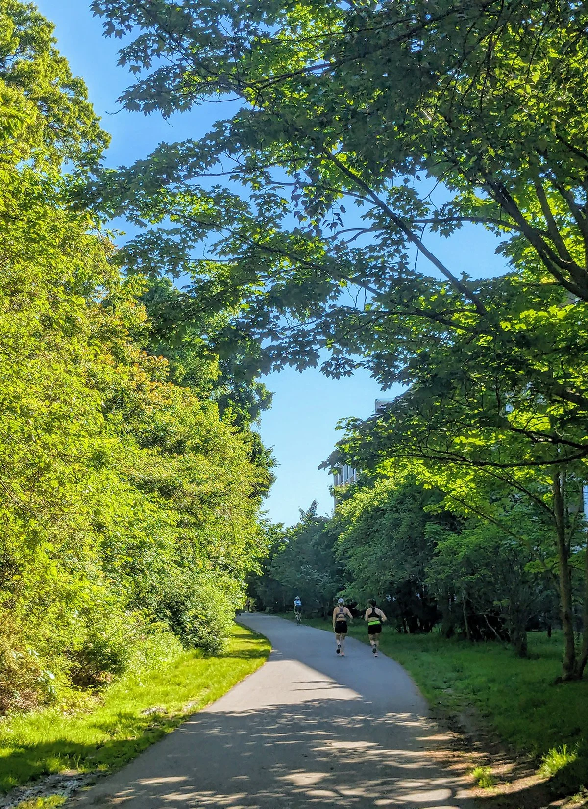
The Emerald Necklace is a chain of interconnected parks, parkways, and waterways designed by the renowned landscape architect Frederick Law Olmsted in the late 19th century. Winding through its lush landscapes are quiet, tree-lined multi-use paths that offer a peaceful escape from the urban bustle. Though often overlooked by casual visitors, the Emerald Necklace has long been a hidden gem for local runners, providing shaded, scenic routes perfect for everything from easy jogs to long training runs—all without leaving the heart of Boston. One way from Boston Common to Franklin Park is a little over 7 miles, and there are plenty of opportunities to add more along the way.
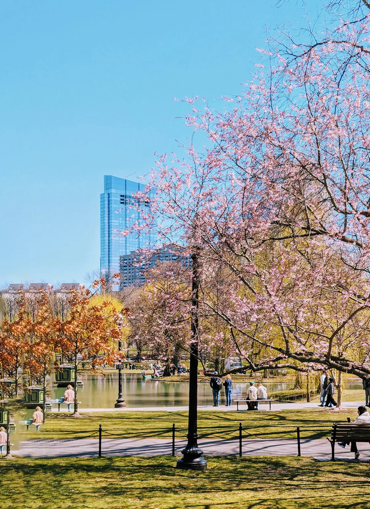
The Emerald Necklace starts at Boston Common in Downtown Boston. It is the oldest public park in the United States and a historic and recreational centerpiece of the city. The park features walking paths, green spaces, and monuments commemorating key moments in American history. Its outer loop is 1.1 miles long, including a 0.3-mile incline along Beacon Street that is popular for hill repeats.
Next to the Common is Boston Public Garden, the first public botanical garden in the United States, offering a beautifully landscaped setting with vibrant floral displays, winding pathways, ornamental fountains, and Swan Boats that have operated since 1877.
The route then takes the center walking path of Commonwealth Avenue Mall, often referred to as Comm Ave. This section of Commonwealth Avenue runs through the Back Bay neighborhood and features a grand, tree-lined promenade with wide pedestrian walkways and historic statues.
To get to the next section of the Emerald Necklace, take a left turn on Hereford, and then right on Boylston (exactly the opposite of the famous Boston Marathon slogan). After a few blocks on city streets, you are connected to Back Bay Fens, a green space near Fenway Park, featuring walking and running paths, a three-lane track, community gardens, and scenic views. In this section, paved paths and unpaved trails together create a 2.3-mile loop around the park.
Past Back Bay Fens, the Emerald Necklace turns south, continuing through The Riverway and Olmsted Park, two long, narrow parks that follow the course of the Muddy River. A multi-use path runs along the west edge of the parks, providing a scenic route for walking, running, and cycling. Additionally, there are soft-surface trails on the east side of the parks that wind through wooded areas and around tranquil ponds, and a well maintained track (Harry Downes) nearby Olmsted Park. A loop around both parks is 4 miles.
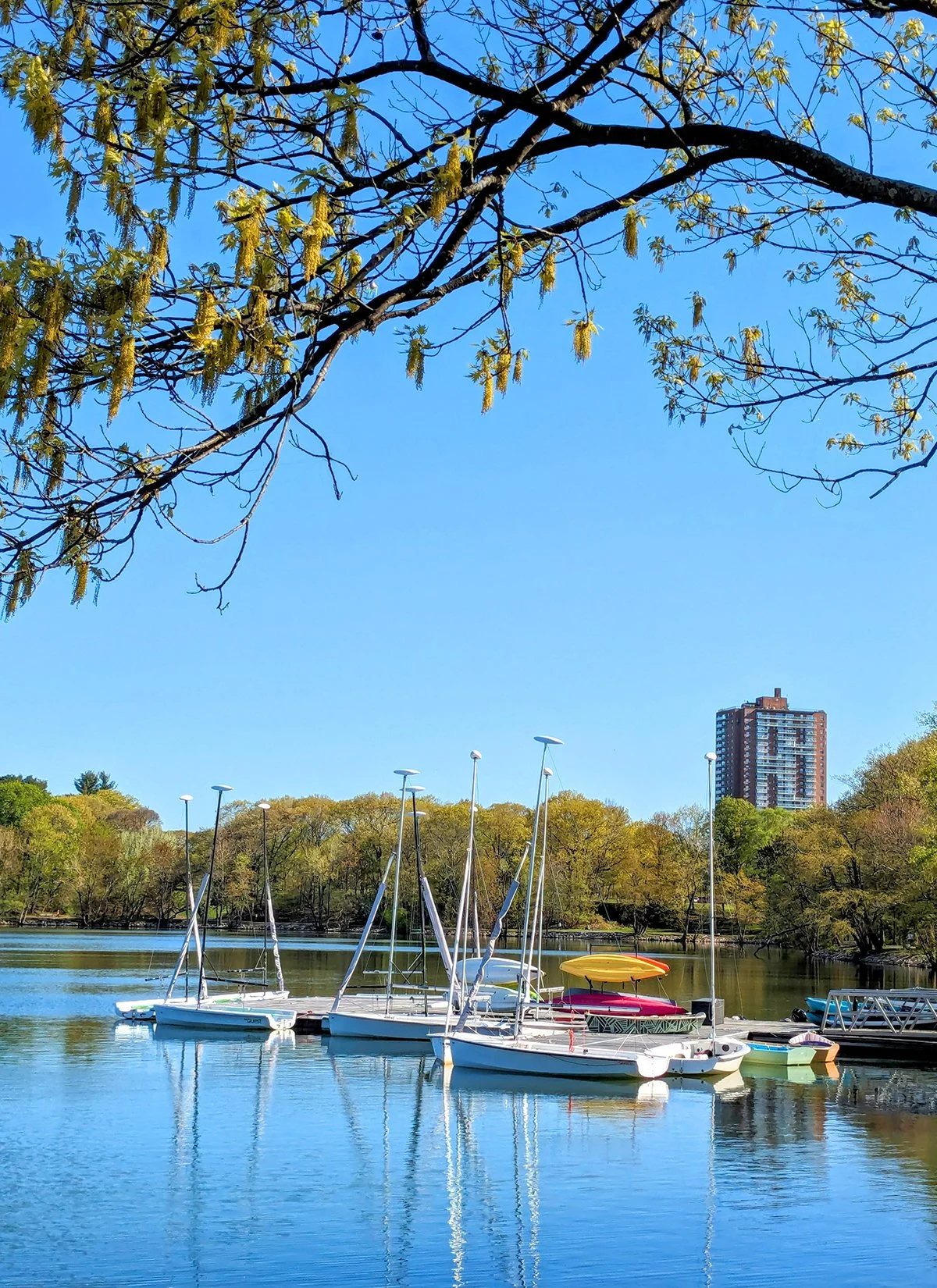
Located just south of Olmsted Park is the biggest pearl on the "necklace", Jamaica Pond, a scenic 68-acre pond that features a popular 1.5-mile paved loop for walking and running. The surrounding parkland offers open green spaces, shaded areas, and benches, making it a peaceful retreat within the city.
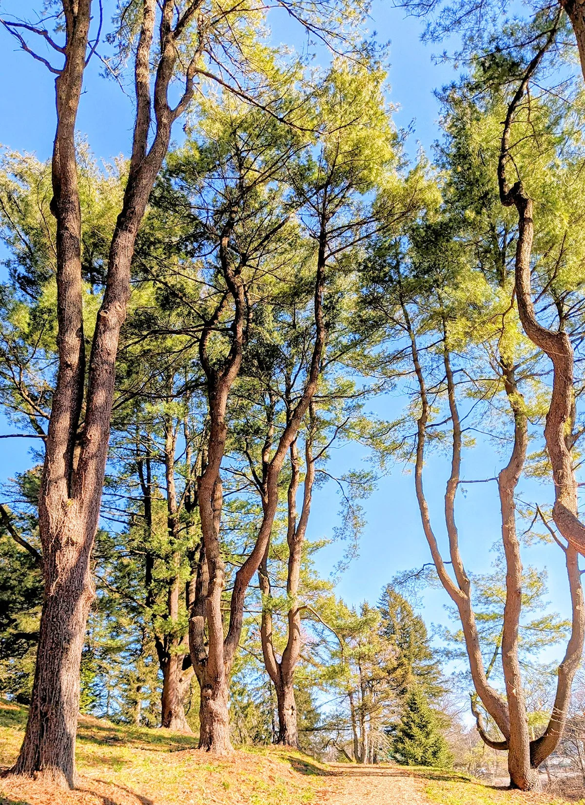
Leaving Jamaica Pond, the necklace follows The Arborway, the parkway that leads to Arnold Arboretum. The 281-acre botanical garden is operated by Harvard University, featuring a vast collection of trees, shrubs, and plants from around the world, making it a living museum of woody plants. The Arnold Arboretum is free and open to the public year-round, with its main entrances located along Arborway. Within the arboretum, paved roads intertwine with several connecting trails, offering plenty of routes to explore.
About one mile further on the Arborway, the Emerald Necklace reaches its last section, Franklin Park. Spanning 527 acres, Franklin Park is the largest green space in Boston, offering a mix of woodlands, meadows, and home to the Franklin Park Zoo. Its extensive trail system includes both paved and unpaved paths, with a 2.2-mile main loop, perfect for exploring nature without leaving the city.
More Routes: There are several public tracks along this route, Harry Downes Track by Olmsted Park is the best, Clemente Track in Back Bay Fens is also popular. Instead of looping back, runners can also take the Southwest Corridor to get back to the city center.
The City Runner's Tips: Check out the hills in Arbnold Arboretum, Bussey Hill is a great hill repeat location, while Peters Hill offers stunning panoramic views of the Boston skyline…The "T" Orange Line serves the Arboretum (Forest Hills Station), making a one-way run a convenient option…Along the Emerald Necklace, Back Bay and Fenway are packed with cafes, but the better-value options are in Jamaica Plain like Jadu.
Southwest Corridor
Distance: 4 miles
Route: Strava
Profile: multi-use path, mostly flat, partially shaded; many intersections.
Southwest Corridor
The Southwest Corridor is a linear park and multi-use path that stretches from Back Bay to Jamaica Plain in Boston. Following the route of the MBTA Orange Line, this greenway is easy to navigate and provides a scenic space for walking, running, and cycling. It connects several Boston neighborhoods, including Back Bay, South End, Roxbury, and Jamaica Plain.
While it may not be as popular the Emerald Necklace due to its lack of natural scenery and frequent intersections, the Southwest Corridor offers a practical alternative route linking Downtown Boston and Back Bay with Jamaica Plain. It is also a convenient route to reach the Reggie Lewis Track and Athletic Center, which features an indoor track that serves as the winter practice venue for Heartbreak Hill Running Co.'s weekly workouts.
The City Runner's Tips: Greystone Cafe in South End and Third Cliff Bakery in Jamaica Plain are two of the best pastry shops in Boston, both are close to the Southwest Corridor.
Downtown Harborwalk
Boston Harbor
Distance: 6.5 miles
Route: Strava
Profile: a mix of multi-use paths and city streets, mostly flat, some intersections.
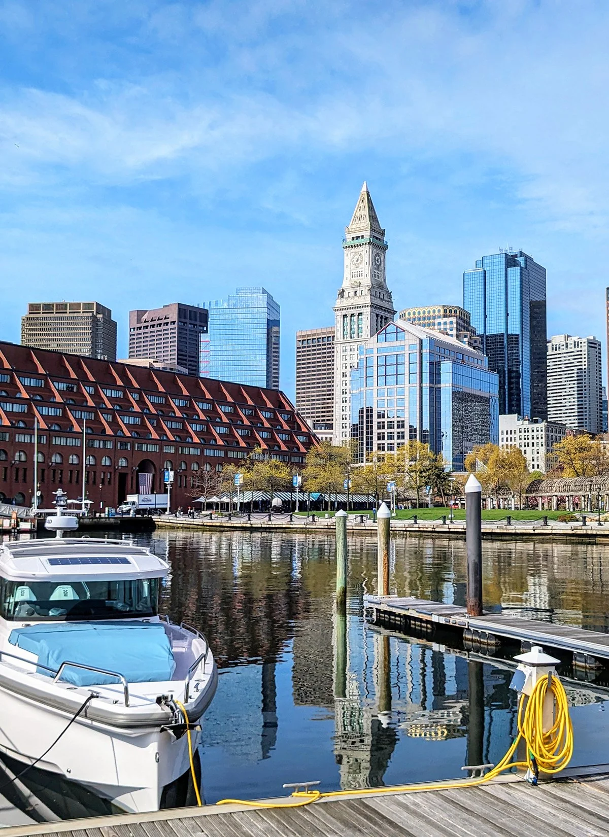
The Boston Harborwalk is a series of public waterfront pathways that stretch along Boston Harbor, weaving through neighborhoods, historic sites, parks, and working piers. The most iconic and popular sections run from Charlestown to Seaport through Downtown Boston, offering one of the city’s most compelling blends of maritime history, urban energy, and scenic waterfront design. This section is fully paved, mostly flat, and ideal for running, but its true magic lies in the landmarks and neighborhoods it connects.
The route begins in Charlestown, at the foot of Bunker Hill, site of the famous 1775 battle that galvanized the American Revolution. The Bunker Hill Monument, a 221-foot granite obelisk completed in 1843, stands as a solemn tribute to colonial resistance. The route runs through Charlestown Navy Yard, a beautifully preserved 19th-century shipyard and home to USS Constitution.
Crossing the Charlestown Bridge, the path skirts the edge of the North End, Boston’s oldest residential neighborhood and famed “Little Italy.” Though the official Harborwalk hugs the irregular downtown coastline, runners often follow Commercial Street, a lively waterfront road lined with historic wharves, cafes, and gelaterias. Continuing south, the walk enters Downtown at Christopher Columbus Waterfront Park, a palm-lined green space with fountains, performance areas, and front-row seats to harbor activity. Just beyond lies Long Wharf, once the busiest pier in America and now home to the New England Aquarium. The path then winds past Rowes Wharf, crowned by the grand Boston Harbor Hotel and its iconic archway leading to a private marina.
Crossing Fort Point Channel, the Harborwalk enters the Seaport District, a former industrial zone reborn as Boston’s innovation corridor. The path follows the shoreline behind contemporary buildings and plazas adorned with public art and harbor views, and ends near D Street Park.
The City Runner's Tips: ???
Harbor Walk (South boston)
South Boston
Castle Island
Distance: 1.85 miles loop
Route: Strava
Profile: flat, uninterrupted path
Harbor Walk (South Boston)
Distance: 4.75 miles
Route: Strava
Profile: multi-use path, flat, minimal intersections.
Castle Island
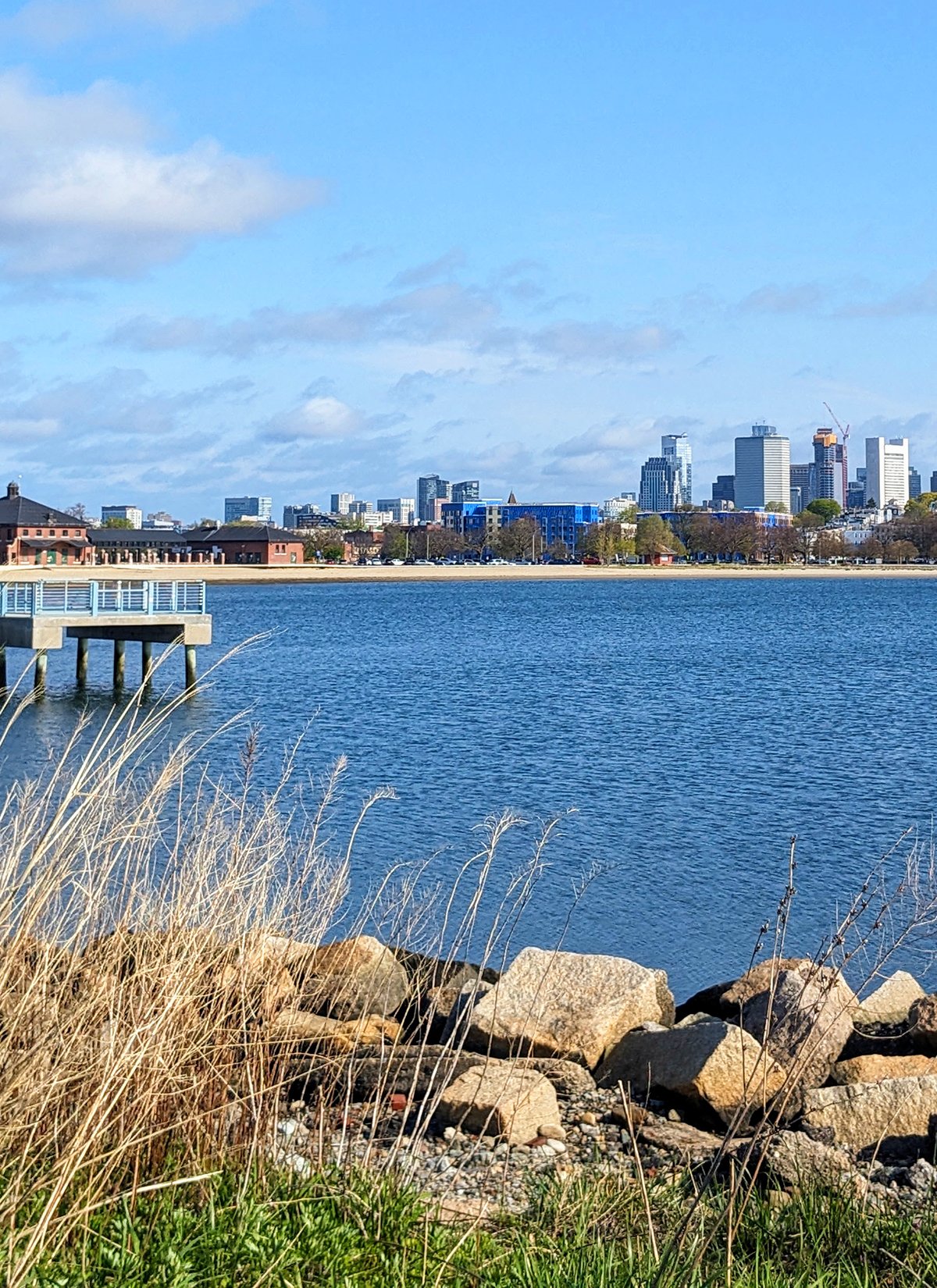
Castle Island is a historic landmark in South Boston. It is home to Fort Independence, a striking granite fort originally constructed in the 19th century. Though its name suggests otherwise, Castle Island is no longer an island; a causeway now connects it seamlessly to the mainland. For runners, “Castle Island” typically refers to the beloved 1.85-mile loop that winds around Pleasure Bay, offering sweeping views of Boston Harbor, the downtown skyline, and passing sailboats. Runners coming from downtown Boston usually take Summer St and E 1st St to reach the loop.
Harbor Walk (South Boston)
This is the southernmost stretch of the Boston Harborwalk. From Castle Island, the path traces a picturesque route along South Boston’s sandy shoreline, passing L Street Beach and Carson Beach. Continuing south, the Harborwalk winds through a series of interconnected linear parks around Columbia Point, home to the John F. Kennedy Presidential Library and Museum and the UMass Boston campus. Beyond the university, the trail follows the eastern edge of Morrissey Boulevard, offering open views of Dorchester Bay before concluding near the Southeast Expressway (I-93).
The City Runner's Tips: ???
Piers Park
East Boston
Harbor Walk (East Boston)
Distance: 1.9 miles
Route: Strava
Profile: a mix of multi-use path and city streets, flat, some intersections.
East Boston Greenway
Distance: 2.1 miles
Route: Strava
Profile: multi-use path, flat, some intersections.
Harbor Walk (East Boston)
The East Boston Harborwalk seamlessly blends urban energy with waterfront tranquility, offering a scenic and accessible route perfect for walking, jogging, or simply soaking in harbor views. Highlights include Piers Park, a beautifully terraced green space perched over the water and renowned for its postcard-perfect vistas of the Boston skyline; LoPresti Park, a lively community hub with sports fields, playgrounds, and picnic areas; and the Massport Harborwalk Park, near Logan Airport, where the striking Skyline Monument pays tribute to East Boston’s aviation heritage while framing dramatic views of planes, harbor, and cityscape alike.
East Boston Greenway
The East Boston Greenway, officially named the Mary Ellen Welch Greenway, is a vibrant, multi-use path that links East Boston’s waterfront at Piers Park to Constitution Beach. Winding through the heart of the neighborhood, it passes key community spaces such as Bremen Street Park and East Boston Memorial Park, offering a scenic, car-free corridor that’s ideal for walkers, runners, and cyclists alike.
East Boston’s running routes are relatively isolated from other Boston-area trails due to its location. However, runners seeking extended routes can explore scenic options by continuing to Revere Beach, Winthrop, or Chelsea.
The City Runner's Tips: ???
Somerville Community Parth
Distance: 4.0 miles
Route: Strava
Profile: multi-use path, flat, some intersections.
The Somerville Community Path is a paved, multi-use trail running through the heart of Somerville. It extends from East Cambridge near Lechmere Green Line Station to Alewife Station, creating a peaceful greenway ideal for walking, running, and cycling.
The eastern half, stretching between East Cambridge and Somerville Junction Park, is a narrower bike path that runs parallel to the MBTA Green Line, passing by warehouse areas along light rail tracks. This quiet section is often fenced and ideal for runners seeking to pick up speed. Beyond Somerville Junction Park, the trail widens and transitions into a more residential area. This portion is lined with greenery, offering multiple access points, and tends to be more populated with walkers, cyclists, and other trail users. Reducing speed in this segment is advisable due to the increased foot traffic.
For those exploring the area, Prospect Hill Park is worth visiting. This historic site is where General George Washington raised the Grand Union Flag in 1776, marking an important moment in U.S. history. The park today is a peaceful green space with a historic monument and great views of the surrounding area.
The City Runner's Tips: ???

Fresh Pond
Fresh Pond
Distance: 2.5 miles loop
Route: Strava
Profile: flat and uninterrupted
Watertown-Cambridge Greenway
Distance: 1.8 miles
Route: Strava
Profile: flat and uninterrupt
Fresh Pond
Fresh Pond is a peaceful pond encircled by a 155-acre reservation, part of Cambridge's reservoir system. A popular 2.5-mile paved loop winds around the pond, weaving through a blend of wooded areas, wetlands, and open meadows, offering scenic views of the water and lush greenery.
Watertown-Cambridge Greenway
The greenway follows the route of the former Boston & Maine Railroad, connecting Watertown with Cambridge (Fresh Pond). It offers a peaceful, scenic corridor within an urban setting, blending natural beauty with easy access for walkers, runners, and cyclists
The City Runner's Tips: ???
Alewife Brook
Alewife Brook Parkway
Distance:
Route: Strava
Profile:
Fitchburg Cutoff Path
Distance:
Route: Strava
Profile:
The Alewife Brook Greenway runs alongside Alewife Brook, linking several green spaces and bike paths in the region, with a convenient connection to the MBTA at Alewife Station.
The Fitchburg Cutoff Bikepath is a short multi-use trail between Brighton Street in Belmont and Alewife Station in Cambridge. The trail traverses the Alewife Reservation (P8), where a boardwalk offers opportunities to appreciate the area's marshlands and natural beauty.
The City Runner's Tips: ???
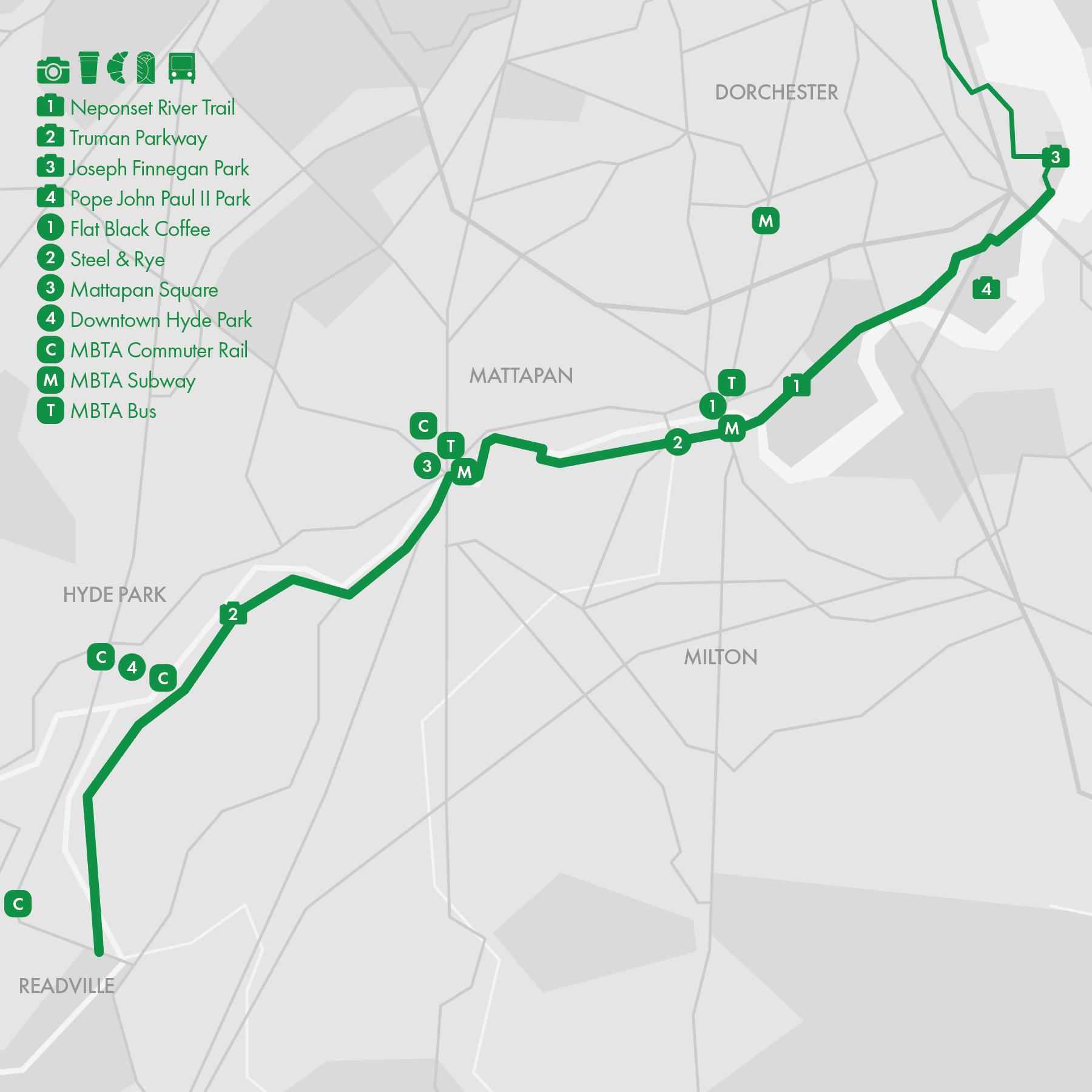
10. Neponset River Trail
• Start & Finish: Joseph Finnegan Park to Readville (Truman Pkwy at Neponset River Pkwy)
• Route Profile:6.9 miles one way, 156 ft+, paved path
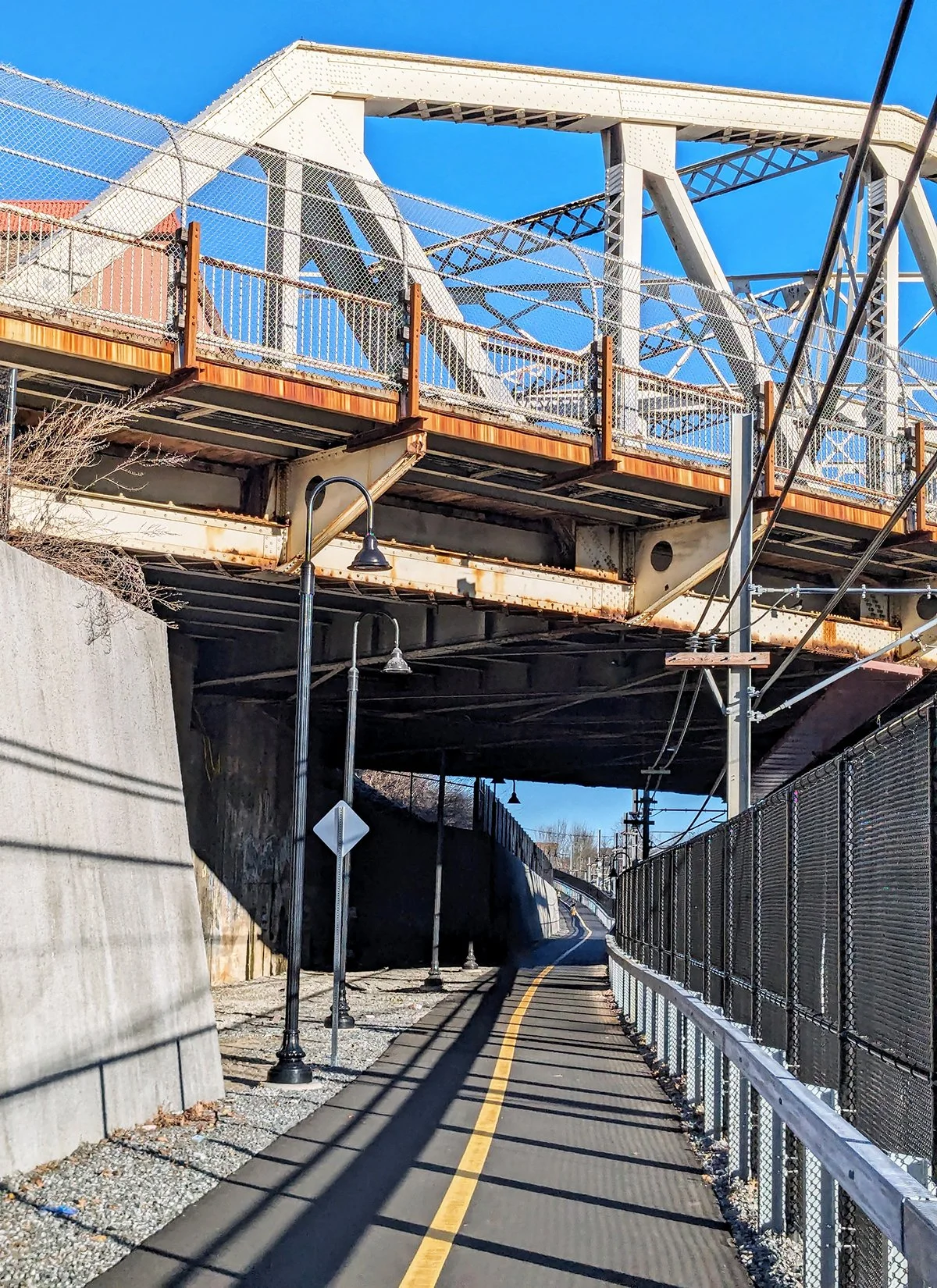
The Neponset River Trail is a scenic multi-use path running along the Neponset River, forming part of Boston's southern border. This pathway follows the historic route of the Old Colony Railroad, offering a peaceful green corridor for walking, running, and cycling, as well as opportunities to explore salt marsh ecosystems and observe local wildlife.
The eastern section of the trail meanders through several parks, including Joseph Finnegan Park and Pope John Paul II Park in Dorchester, providing scenic views of the river and add-on options. (0.5-mile loop in Joseph Finnegan Park and 1.35-mile loop in Pope John Paul II Park.) Heading west, the trail reaches Mattapan, largely paralleling the Mattapan Trolley, a branch of the MBTA Red Line. Although the official trail concludes in South Mattapan around the 4-mile mark, the route can be extended south by following the multi-use along Truman Parkway to Neponset River Parkway in Readville.
Cafe / The major clusters of cafes along the trail are located near the southern end of Dorchester Ave, around Mattapan Square, and in Downtown Hyde Park. These areas provide convenient spots for refreshments and relaxation during/after your run, as well as public transit access from/to the city center (see below).
Transit / In the northeastern section of the trail, it runs parallel to the Mattapan Trolley, part of the MBTA Red Line, with convenient access points at stations like Mattapan and Ashmont. Moving to the southwestern section, the trail passes near several MBTA Commuter Rail stations. Notably, Fairmont Station, located in Zone 1A, offers a much more cost-effective train fare from/to Boston compared to the nearby Hyde Park and Readville stations, which fall in Zones 1 and 2, respectively.
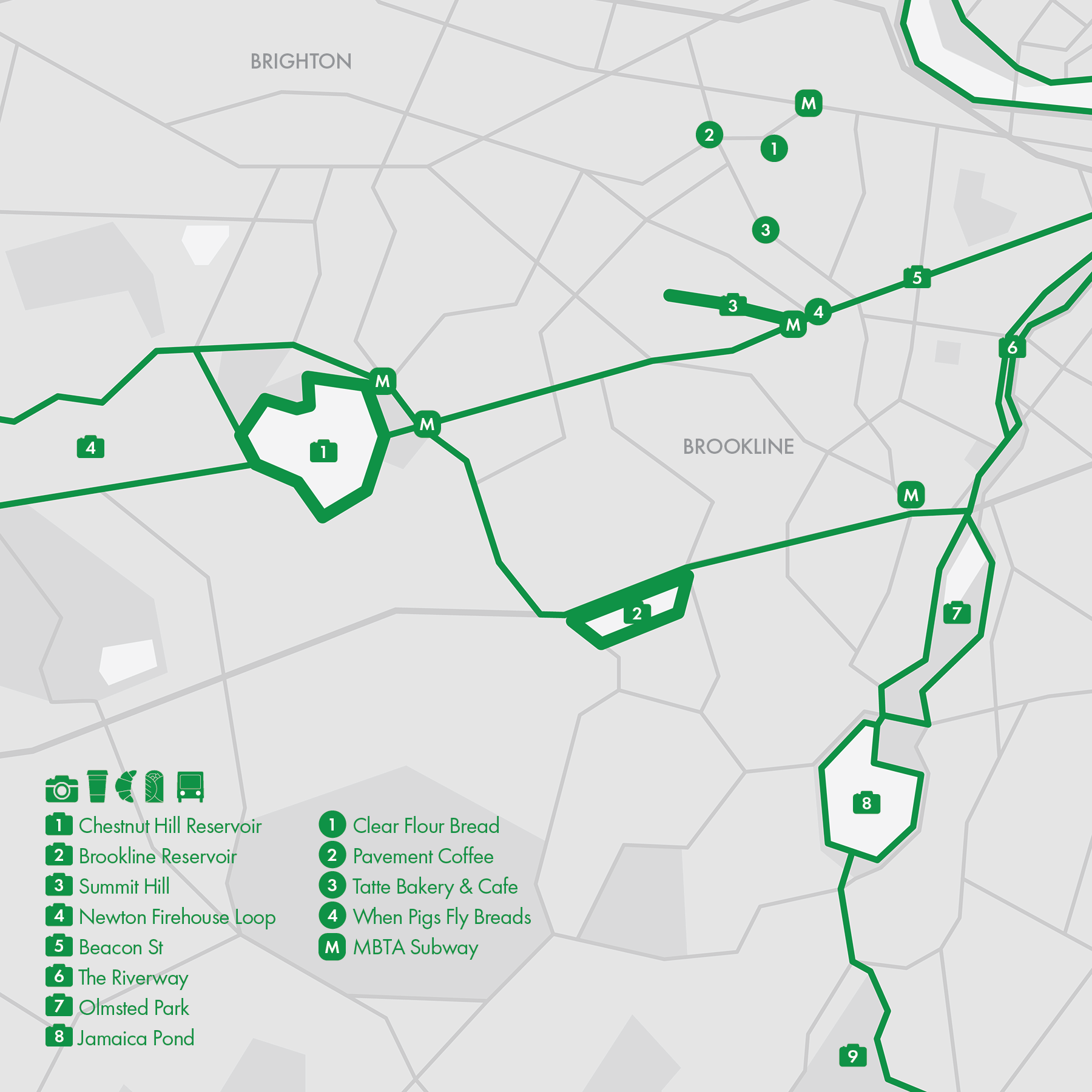
11. Brookline, MA

Brookline is a vibrant town located just west of Boston, known for its seamless blend of urban and suburban features. It combines historic charm, expansive green spaces, and a range of cultural attractions. The town is home to some excellent running routes, three of which will be highlighted in this post, with additional spots featured in the Emerald Necklace series.
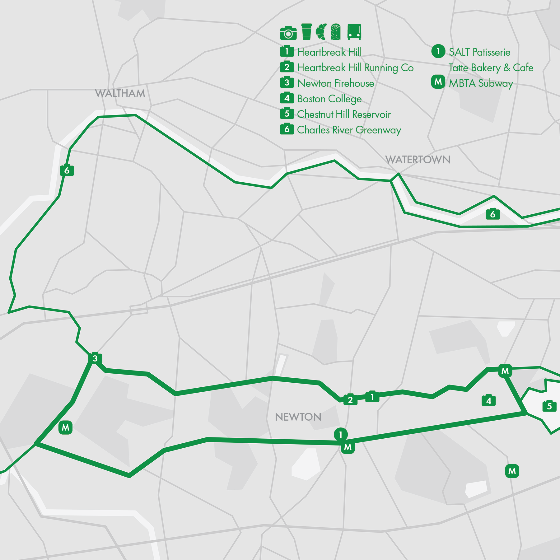
Chestnut Hill Reservoir
• Start & Finish: several access points along the loop
• Route Profile:1.5 mile loop, mostly flat
The Chestnut Hill Reservoir is a picturesque body of water encircled by a popular 1.5-mile path perfect for walking and running. The trail offers beautiful views of the reservoir, surrounding greenery, and nearby historic landmarks, including the impressive Romanesque-style water pumping stations.
Brookline Reservoir
• Start & Finish: Boylston St at Warren St
• Route Profile:1.0 mile loop, mostly flat
The Brookline Reservoir offers serene views of the water, surrounded by mature trees and parkland that create a peaceful atmosphere just minutes from the city. The one-mile loop around the reservoir is perfect for those looking for a scenic spot to walk, run, or simply unwind in a natural setting.
Summit Ave
• Start & Finish: Beacon St to Corey Hill Park
• Route Profile: 0.43 mile, 189 ft+, 8% grade
Summit Avenue features a short but challenging hill that is a favorite training spot for local runners. At the top, Corey Hill Park rewards those who tackle the incline with sweeping views of the Boston skyline, offering a picturesque and motivating scene.
Cafe / Coolidge Corner and Brookline Village are hubs for cafes and restaurants, offering a wide range of dining options. Just a short detour from Coolidge Corner is Clear Flour Bread, a local favorite for freshly baked goods. Nearby neighborhoods like Back Bay and Jamaica Plain also feature rich culinary and café scenes.
Transit / The Chestnut Hill Reservoir is easily accessible via MBTA Green Line's B, C, and D branches. Summit Ave Hill is between the B and C branches. The Brookline Reservoir is along Bus Route 60.
12. Newton, MA
Newton Firehouse Loop
• Start & Finish: Heartbreak Hill Running Company or Newton Centre
• Route Profile:10 miles loop, 479 ft+, sidewalks
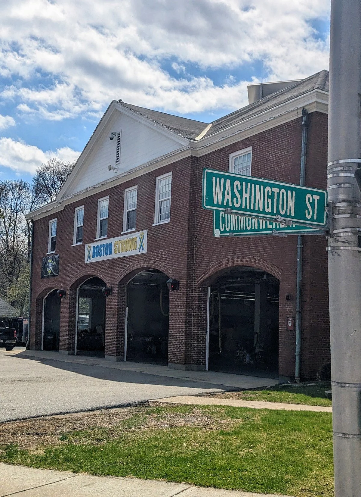
The Firehouse Loop, named for the Newton Firehouse located at mile 17.5 on the Boston Marathon course, is a popular 10-mile training route in Newton, a suburb southwest of Boston. Running clockwise, half of the loop (along Washington St and Commonwealth Ave) traces the Boston Marathon course from Mile 16.6 to Mile 21.6. The 10-mile loop can be easily shortened by using alternate connecting streets between Commonwealth Ave and Beacon St. the route can also be extended by adding on the 1.5-mile Chestnut Hill Reservoir Loop (Route 11).
Newton is known for its four consecutive hills along the Boston Marathon course, often referred to as the Newton Hills. The first of these hills takes place as runners leaving Wellesley and entering Newtown, shortly before the Newton Firehouse, and the Firehouse Loop incorporates the latter three hills, including Heartbreak Hill, the most famous hill located at Mile 20.5 of the marathon. Although Heartbreak Hill itself only ascends about 88 feet over 0.4 miles, it poses a unique mental and physical challenge due to its placement in the marathon.
At the base of Heartbreak Hill, you’ll find Heartbreak Hill Running Company (@heartbreak.bos) , a Boston-founded specialty running store. Heartbreak's Newton store organizes group runs on the Firehouse Loop, which also serves as their official 10 Mile time trial course. The group also does long runs along the Boston Marathon course especially during the months leading up to the marathon.
Cafe / At the center of the Firehouse Loop, Newton Centre offers a good selection of cafes, including SALT Patisserie and the popular local chain Tatte.
Transit / Newton Centre is on MBTA Green Line’s D Branch with a direct route to Downtown Boston. On the eastern side of the loop, the B, C, and D branches of the Green Line converge at Chestnut Hill Reservoir, although each branch has distinct station locations.
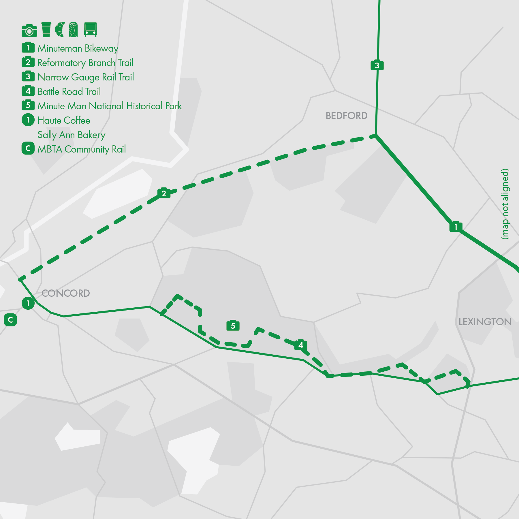
15. Minuteman Bikeway
Minuteman Bikeway
• Start & Finish: Alewife Station (Cambridge) to Bedford
• Route Profile: 10.1 miles one-way, 228 ft+, multi-use path
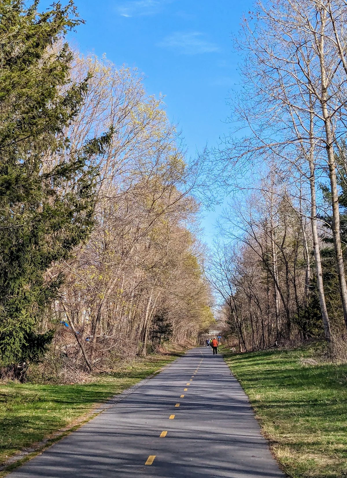
The Minuteman Bikeway is an rail trail between Cambridge and Bedford, with stops in Arlington and Lexington along the way. The trail follows part of the path taken by Paul Revere during his famous midnight ride in 1775, adding a historical element to its recreational appeal. The Bikeway is one of the most popular multi-use trails in Massachusetts, providing a scenic, car-free route for cyclists, runners, and walkers.
Runners can easily connect onto Minuteman Bikeway from Somerville Community Path (Route 13), Fresh Pond and Alewife Brook Greenway (Route 14), and Mystic River Greenway (Route 16).
Reformatory Branch Trail
• Start & Finish: Bedford to Concord
• Route Profile: 4.2 miles one-way, 39 ft+, crushed gravel and dirt trail
The Reformatory Branch Trail is a peaceful, unpaved, and wooded path stretching between Bedford, where it connects to the end of the Minuteman Bikeway, and Concord. It offers a scenic route ideal for hiking and mountain biking, passing near the Great Meadows National Wildlife Refuge,.
Battle Road Trail
• Start & Finish: Minute Man National Historical Park
• Route Profile: 4.5 miles one-way, 236 ft+, crushed gravel and dirt trail
The Battle Road Trail is a historically important path within Minute Man National Historical Park that traces the route taken by British soldiers and colonial militia on April 19, 1775, during the opening battles of the American Revolution. The trail covers approximately 5 miles between Lexington and Concord, offering visitors a scenic journey through fields, forests, and preserved 18th-century sites like Hartwell Tavern and Meriam's Corner.
Cafe / It won't be hard to find cafes in Downtown Arlington, Lexington, and Concord.
Transit / MBTA Bus Route 77 connects Arlington to Harvard Square station, Routes 62/76 connect Lexington to Alewife Station, both are on the subway Red Line. Concord is served by the MBTA Commuter Rail on the Fitchburg Line.
16. Mystic & Malden River Greenways

The M/ystic River and the Malden River are two interconnected waterways north of Boston. The Mystic River originates at the Mystic Lakes in Winchester and Arlington, flowing southeast through 7 miles and eventually emptying into Boston Harbor. The Malden River is a tributary of the Mystic River, running about 2.3 miles before joining the Mystic near the Encore Boston Harbor resort. Both rivers are encompassed by greenways featuring multi-use paths
- Malden River Greenway
• Start & Finish: Sullivan Square (Boston) to Malden Center
• Route Profile: 4.2 mile loop, 63 ft+, multi-use path and city street
This scenic route connects the Encore Riverwalk, Gateway Park, Wellington Greenway, and The Park at River's Edge, with an option to merge onto the Northern Strand (Route #17).
- Mystic River Greenway
• Start & Finish: Sullivan Square (Boston) to Arlington Center
• Route Profile: 7.35 mile one way, 121 ft+, multi-use path and city street
This route runs along the Mystic River banks, offering a peaceful green space within an urban setting. It stretches from the Assembly Row shopping center, passes through Medford Center, and continues to Arlington Center, providing a mix of riverfront views and urban amenities along the way.
- Mystic Lakes
• Route Profile: 5 mile loop, 130 ft+, dirt trail and city street
The loop offers beautiful views of the lakes and surrounding woodlands, with particularly scenic vistas from Shannon Beach along the Upper Mystic Lake. The western portion of the loop runs along city streets.
For longer runs, connect Mystic River Greenway with Somerville Community Path (Route #13), Alewife Brook Greenway (Route #14), or Minuteman Bike Path (Route #15).
Cafe / Refuel after your run at the city center of Malden, Medford, Arlington.
Transit / The MBTA Orange Line stations Sullivan Square and Wellington are located on the eastern side of the trail near the Malden River. On the western side, Medford and Arlington are connected by bus routes to Sullivan Square, Davis Square, and Harvard Square, all of which are served by the MBTA Subway.
17. Northern Strand
• Start & Finish: Trailhead off Encore Riverwalk to Lynn Beach
• Route Profile: 11.3 miles one-way, mostly flat, multi-use path for the first 10 miles
The Northern Strand Community Trail is a multi-use path that connects the cities of Everett, Malden, Revere, Saugus, and Lynn. It follows the former Saugus Branch of the Boston & Maine Railroad and is part of the larger East Coast Greenway, which aims to connect trails along the eastern seaboard from Maine to Florida. The trail is planned by Bike to the Sea, a non-profit cycling advocacy group in the area.
At its southern end, the Northern Strand connects to the Encore Riverwalk (Route #16), located at the meeting point of the Mystic and Malden Rivers, allowing runners to extend their route toward Boston or Wellington. On the northern end, the trail currently terminates abruptly in a residential area of Lynn (with a future extension plan to Lynn Beach), but a slight detour before the trail's endpoint offers access to Lynn Common, downtown Lynn, and Lynn Beach. Between these two end points, the trail is mostly off-road and peaceful, except for the stretch through Downtown Malden, about 2.5 miles in from the south, where runners can easily find shops, cafés, and other amenities.
Cafe / Refuel after your run at Gateway Center, Downtown Malden, or Lynn.
Transit / The MBTA Orange Line runs less than a mile east of the southern portion of the Northern Strand, with Malden Center and Wellington Stations offering the closest access points to the trail. The rest of the route lacks proximity to rail service, except at the northern end, where Lynn is served by the MBTA Commuter Rail on the Newburyport/Rockport Line.

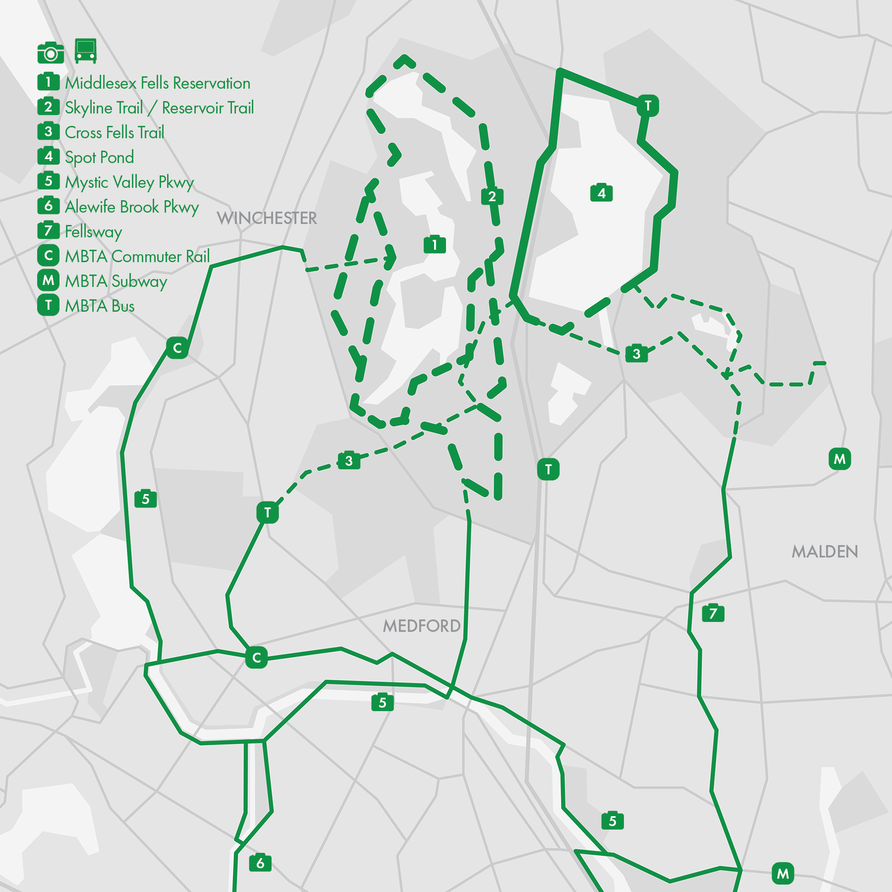
18. Middlesex Fells
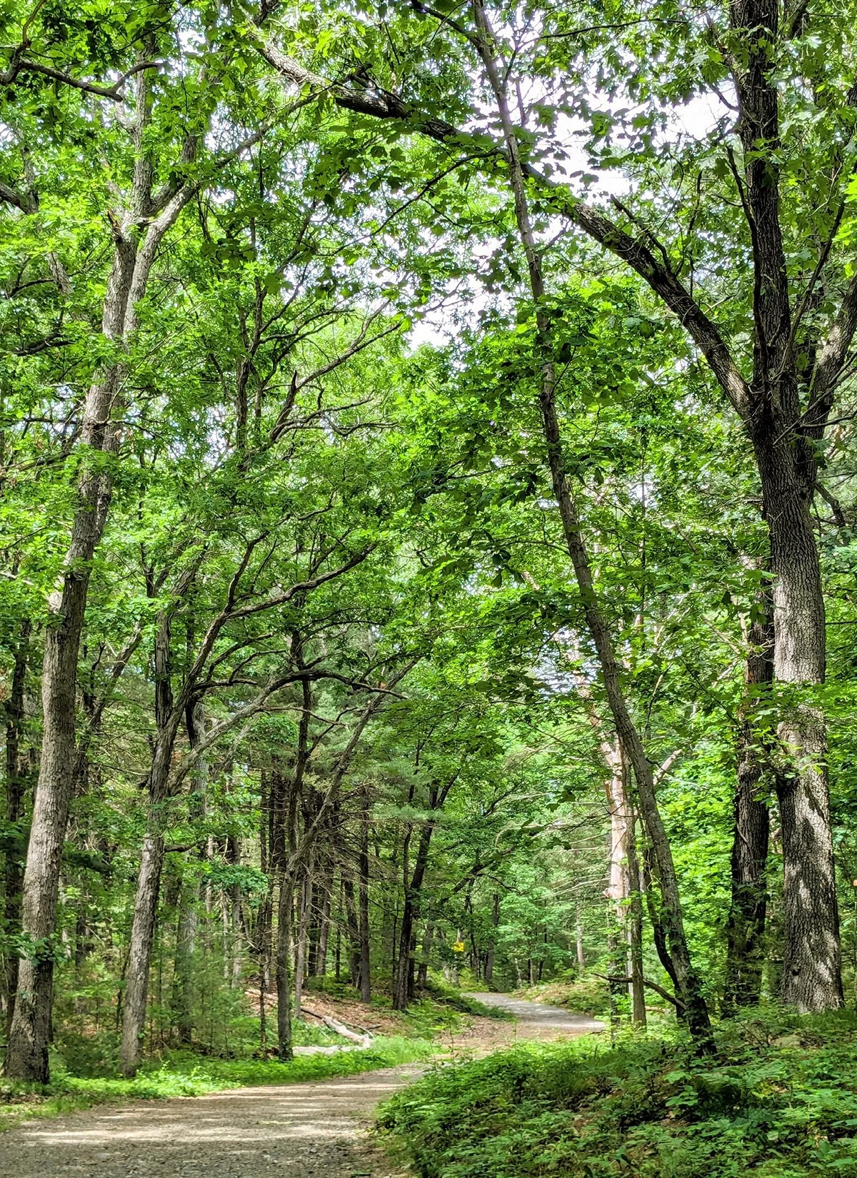
The Middlesex Fells is a large, 2,575-acre public park located just north of Boston. The reservation is a popular destination for outdoor enthusiasts, offering a mix of maintained trails, scenic ponds, and city views.
Interstate 93 cuts through the heart of the Middlesex Fells, dividing its western and eastern sections. On the west side, two of the most popular trails are the Skyline Trail and the Reservoir Trail. These dirt paths wind around three reservoirs, offering scenic views and more challenging terrain. There is also an MTB loop for mountain bikers.
On the east side of the Fells, visitors will find additional dirt trails, the beautiful Spot Pond and a popular, mostly paved loop around it.
Connecting both sides of the park is the Cross Fells Trail, a key passage that links trailheads in Winchester, Medford, and Melrose, making it accessible to runners and hikers coming on foot from Boston/Cambridge.
• Skyline Trail: 7.7 miles loop, 941 ft+, marked with white paint
• Reservoir Trail*: 6.0 miles loop, 456 ft+, orange paint
• MTB Loop*: 6.5 miles loop, 564 ft+, green paint
• Spot Pond loop: 3.8 miles loop, 136 ft+
• Cross Fells Trail: 9.1 miles one-way, 1069 ft+, blue paint
* Designated multi-use trail.
Cafe / Refuel after your run at Downtown Malden, Medford, or Winchester.
Transit / MBTA Orange Line Oak Grove station is the closest subway station to the Fells, with a couple of Commuter Rail stations (Wedgemere, West Medford) within running distance as well. MBTA Bus Routes 100, 132 and 134 connect Midddlesex Fells with Malden or Wellington Transit Center but frequency is low (about each hour).
Run Clubs
1. 1.5 Star Run Club
@runsouthie / Sat AM @ South Boston
2. Almosy Friday Run Club
@almostfridayrunclub_bos, Website / Thu AM @ South Boston
3. Boston Road Runners
@bostonroadrunners, Website / Tue PM, Sat AM @ Back Bay
4. Brick Layers Union
@bricklayersunion / Wed AM @ BU Bridge, Fri AM @ Downes Track
5. Brighton Bangers
@brightonbangers, Website / Wed PM, Sat AM @ Brighton
6. Castle Island Track Club
@castleislandtrackclub / various time from different locations
7. Davis Square Runners
@davissquarerunners, Website / Tue PM, Sun AM @ David Square
8. Dorchester Running Club
@dorchester_running_club, Website / Sat AM @ Dorchester
9. East Boston Run Club
@east_boston_run_club / Wed PM, Fri AM @ East Boston
10. Endorphins Running
@endorphinsrunning, Website / Mon AM, Wed PM @ West End
11. Forest Hills Runners
@fhrunners, Website / Mon PM, Thur PM, Sat AM @ Forest Hills
12. Friday Run Club
@cambridgefridayrunclub / Fri AM @ BU Bridge
13. Good Guys Running Clu
@goodguysrc / Tue AM @ Chestnut Hill Reservoir
14. Heartbreak Hill Running Company
@heartbreak.bos, Website / Tue AM, Thur PM, Sat AM LR @ various locations
15. Informal Running
@tmircebos, Website / Thu PM @ rotating locations
16. L Street Running Club
@lstreetrunning, Website / Tue PM, Thur PM @ South Boston
17. Marathon Sports
@marathonsports, Website / Various time from different store locations
18. Metro Moovin
@metromovinrc / Tue AM, Thu AM @ Mass Ave Bridge
19. Midnight Runners
@midnightrunnersboston, Website / Tue PM @ Downtown
20. Northeast Trail Crew
@northeasttrailcrew / Various trails
21. One Love Run Club
@one1ove_runclub_bos / Sat AM @ South Boston
22. Pioneer Run Crew
@pioneersrc / Wed PM @ Dorchester
23. Run Club of Malden
24. Somerville Road Runners
@somervilleroadrunners, Website / Various time @ different locations in Somervill, MA
25. South End Run Club
@southend_rc / Wed PM @ South End
26. Tracksmith
@tracksmithrunning, Website / Wed PM (WO), Fri AM, Sun AM (LR) @ Trackhouse
27. TrailblazHers Run Co
@trailblazhersrunco, Website / Mon PM @Location: Back Bay, Harvard
28. Viva Run Club
@viva.runclub / Tue PM @ South Boston
29. Waltham Trail Runners
@walthamtrailrunners / Various time from different locations
Membership Based
1. B.A.A. Running Club
2. Battle Road Track Club
@chicagoendurancesports, Website / Chicago
3. Boston Hares
@bostonhares, Website / Boston Area
4. Cambridge Running Club
@cambridgerunning, Website / Cambridge, MA
5. Central Mass Striders
@centralmassstriders, Website / Central Massachusetts
6. Dashing Whippets Boston
@dwrtboston, Website / Boston Area
7. Greater Boston Track Club
@gbtcrunning, Website / Boston Area
8. Notch Run Club
@metersforliters, Website / Brighton, MA and Salem, MA
9. Wicked Running Club
@wickedrunningclub, Website, Salem, MA
Run Clubs
1.5 Star Run Club
@runsouthie / Sat AM @ South Boston
Almosy Friday Run Club
@almostfridayrunclub_bos / Thu AM @ South Boston
Boston Road Runners
@bostonroadrunners / Tue PM, Sat AM @ Back Bay
Bricklayers Union
@bricklayersunion
Wed AM @ BU Bridge, Fri AM @ Harry, Downes Track, plus special runs
Often styled BLU, Bricklayers Union is a running collective that blends group runs, self-accoutable workouts, social vibes, and creative events. The structure is loose, but the synergy is high.
5. Brighton Bangers
@brightonbangers, Website / Wed PM, Sat AM @ Brighton
6. Castle Island Track Club
@castleislandtrackclub / various time from different locations
7. Davis Square Runners
@davissquarerunners, Website / Tue PM, Sun AM @ David Square
8. Dorchester Running Club
@dorchester_running_club, Website / Sat AM @ Dorchester
9. East Boston Run Club
@east_boston_run_club / Wed PM, Fri AM @ East Boston
10. Endorphins Running
@endorphinsrunning, Website / Mon AM, Wed PM @ West End
11. Forest Hills Runners
@fhrunners, Website / Mon PM, Thur PM, Sat AM @ Forest Hills
12. Friday Run Club
@cambridgefridayrunclub / Fri AM @ BU Bridge
13. Good Guys Running Clu
@goodguysrc / Tue AM @ Chestnut Hill Reservoir
Heartbreak Hill
Running Company
@heartbreak.bos
Tue AM, Thur PM at all three locations
Sat AM long run from the Newton store
15. Informal Running
@tmircebos, Website / Thu PM @ rotating locations
16. L Street Running Club
@lstreetrunning, Website / Tue PM, Thur PM @ South Boston
17. Marathon Sports
@marathonsports, Website / Various time from different store locations
Metro Movin’
@metromovinrc
Tue AM, Thu AM @ Mass Ave Bridge
Part of Boston's vibrant social running scene, Metro Movin’ is a community-based, fun-loving run club that meet and run regularly by the Charles River.
19. Midnight Runners
@midnightrunnersboston, Website / Tue PM @ Downtown
20. Northeast Trail Crew
@northeasttrailcrew / Various trails
21. One Love Run Club
@one1ove_runclub_bos / Sat AM @ South Boston
Pioneers Run Crew
@pioneersrc
Wed PM @ Dorchester
A community-focused, inclusive running group based in Dorchester, Boston. It is created to make running equitable and accessible, particularly for runners of color and anyone looking for a welcoming run crew.
23. Run Club of Malden
24. Somerville Road Runners
@somervilleroadrunners, Website / Various time @ different locations in Somervill, MA
25. South End Run Club
@southend_rc / Wed PM @ South End
Tracksmith
@tracksmithrunning
Wed PM workout, Fri AM, Sun AM long run
all from The Trackhouse
More Run Clubs
27. TrailblazHers Run Co
@trailblazhersrunco, Website / Mon PM @Location: Back Bay, Harvard
28. Viva Run Club
@viva.runclub / Tue PM @ South Boston
29. Waltham Trail Runners
@walthamtrailrunners / Various time from different locations
Membership Based
1. B.A.A. Running Club
2. Battle Road Track Club
@chicagoendurancesports, Website / Chicago
3. Boston Hares
@bostonhares, Website / Boston Area
4. Cambridge Running Club
@cambridgerunning, Website / Cambridge, MA
5. Central Mass Striders
@centralmassstriders, Website / Central Massachusetts
6. Dashing Whippets Boston
@dwrtboston, Website / Boston Area
7. Greater Boston Track Club
@gbtcrunning, Website / Boston Area
8. Notch Run Club
@metersforliters, Website / Brighton, MA and Salem, MA
9. Wicked Running Club
@wickedrunningclub, Website, Salem, MA
Stores
1. Heartbreak Hill Running Comapny
@heartbreak.run, Website / Three stores in Boston South End, Cambridge, Newton
2. Marathon Sports
@marathonsports, Website / 22 stores in the Greater Boston Area.
Brand House
1. HOKA
800 Boylston St, Boston, MA 02199
2. New Balance
Global Flagship: 140 Guest St, Boston, MA 02135
Newbury Store: 124 Newbury St, MA 02116
3. Nike
200 Newbury St, Boston, MA 02116
4. Tracksmith
285 Newbury St, Boston, MA 02115
Races
1. Boston Marathon
@bostonmarathon, Website / April / Boston / Marathon & B.A.A. 5K
2. B.A.A. 10K
Website / June / Boston / 10K
3. B.A.A. Half
Website / November / Boston / Half Marathon
4. Cambridge Half Marathon
@csraceseries, Website / Half Marathon & 5K / November, Cambridge, MA
5. New Bedford Half Marathon
Website / March / New Bedford, MA
6. Boston's Run To Remember
@bostons_runtoremember, Website / Half Marathon & 5 Mile / May, Boston
7. Baystate Marathon
@baystatemarathon, Website / Marathon & Half Marathon / October, Lowell, MA
8. 26.TRUE Marathon
@26.truemarathon / April / Boston
9. Harpoon 5 Mile
@harpoonbrewery, Website / May / Boston
10. Falmouth Road Race
@falmouthroadrace, Website / 7 Mile / August / Falmouth, MA
11. Beach to Beacon
@TdBeach2beacon, Website / 10K / August / Cape Elizabeth, ME
12. Mount Washington Road Race
Website / 7.6 Mile All-uphill / June / Gorham, NH
Coffee & Cafe
1. 1369 Coffee House
@1369coffeehouse / 1369 Cambridge St & 757 Massachusetts Ave, Cambridge, MA 02139
2. 3 Little Figs
@3littlefigscafe / 278B Highland Ave, Somerville, MA 02143
3. Bagelsaurus
@bagelsaurus13 / 1796 Massachusetts Ave, Cambridge, MA 02140
4. bōm dough
@bomdough_ / 1271 Cambridge St, Cambridge, MA 02139
5. Broadsheet Coffee Roasters
@broadsheetcoffee / 100 Kirkland St, Cambridge, MA 02138
6. Cicada Coffee Bar
@cicadacoffeebar / 106 Prospect St, Cambridge, MA 02139
7. Faro Cafe
@faro__cafe / 5 Arrow St, Cambridge, MA 02138
8. Flour Bakery + Cafe
@flourbakeryandcafe / ten locations in Boston and Cambridge
9. George Howell Coffee
@ghowellcoffee / two locations in Downtown Boston and one in Newtonville, MA
10. Gracenote Coffee
@gracenoteboston / 108 Lincoln St & 100 High St, Boston, MA 02111
11. Kickstand Cafe
@kickstandcafe / 594 Massachusetts Ave, Arlington, MA 02476
12. Kismet
@_imagine__________ / 358 Huron Av, Cambridge, MA 02138
13. Ogawa Coffee
@ogawacoffeeusa / 10 Milk St, Boston, MA 02108
14. Phinista Cafe
@phinista.cafe / 96 Peterborough St, Boston, MA 02215
15. Render Coffes
@rendercoffee / 563 Columbus Ave APT 2, Boston, MA 02118; 2 Drydock Ave, Boston, MA 02210
16. Revival Cafe + Kitchen
@revivalcafeandkitchen / five locations in Boston, Cambridge, Somerville, Lexington, Watertown.
17. Rita Tea & Espresso Bar
@rite.bos / 525 Western Ave, Boston, MA 02135
18. Tatte Bakery
@tattebakery / 20+ locations in Boston, Cambridge, Brookline.
Bread & Pastry
1. Bova’s Bakery
@bovasbakery / 134 Salem St, Boston, MA 02113
2. Butternut Bakehouse
@butternutbakehouse / 787 Massachusetts Ave, Arlington, MA 02476; 49 Leonard St, Belmont, MA 02478
3. Cafe Beatrice
@cafebeatricecx / 100 N First Street, Cambridge, MA 02141
4. Clear Flour Bread
@clearflourbread / 178 Thorndike St, Brookline, MA 02446
5. Colette Bakery
@colettebakery / three locations in Boston, Medford, and Melrose.
6. Forge Baking Company
@forgebakingco / 626 Somerville Ave, Somerville, MA 02143
7. Greystone Cafe
@greystone_southend / 123 Appleton St, Boston, MA 02116
8. Iggy’s Bread
@iggysbread / 130 Fawcett St, Cambridge, MA 02138
9. Japonaise Bakery
@japonaisebakery / 1020 Beacon St, Brookline, MA 02446
10. La Saison Bakery
@lasaisonbakery / 407 Concord Ave, Cambridge, MA 02138
11. Michette
michettebakery / 164 Broadway, Somerville, MA 02145
12. Mike's Pastry
@mikespastry / four locations in Boston, Cambridge, and Someville.
13. PRB Boulangerie
@prbboulangerie / three locations in Boston, Cambridge, Somerville
14. SALT Patisserie
@saltpatisserie / 792 Beacon St, Newton Center, MA 02459
15. Sofra Bakery & Cafe
@sofrabakery / 1 Belmont St, Cambridge, MA 02138
16. Third Cliff Bakery
@thirdcliffbakery / 3531 Washington St, Jamaica Plain, MA